Download
1 / 7
70 likes | 215 Views
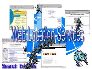
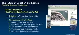
The Future of Location Intelligence From Web Services to the Enterprise. ESRI’s Perspective GeoWeb: the Spatial Fabric of the Web. Definition - Web services that provide location or utilize location Five elements of the GeoWeb Location “Dial Tone” service

E N D
The Future of Location Intelligence From Web Services to the Enterprise ESRI’s Perspective GeoWeb: the Spatial Fabric of the Web • Definition - Web services that provide location or utilize location • Five elements of the GeoWeb • Location “Dial Tone” service • Published base map and globe services • The presence of GIS web services • Syndicated, georeferenced events • Standards that enable consumption ESRI Presentation - Location Intelligence 2006
Managed Services Server Desktop SDK Mobile Internet • ArcWeb Managed Services • Oracle Spatial • DB2 Spatial Extender • ArcGIS Server • WEA LAS • MapInfo • ArcView • ArcEngine • MapXtreme • ArcPad • MS Smart Phones • Google Local Wireless • ArcWeb Services • Google Local / Earth • MS Live Local Location Intelligence Futures 1. Location “Dial Tone” Services spanning the Information Technology Spectrum Information Technology Spectrum Location Services ESRI Presentation - Location Intelligence 2006
Location Intelligence Futures 2. Publishing of base maps and globes • Key to basic visualization and exploration • Maps (2D) & Globes (3D) • Commercial • Microsoft Live Local • Google Local / Earth • Yahoo Maps • MapQuest • ESRI ArcWeb Services • Public • Geodata.gov • Federal, state, and local government • NGOs • Many exist today • Many more will be added in the future! ESRI Presentation - Location Intelligence 2006
Location Intelligence Futures 3. Presence of GIS web services • GIS web services • Providing the rich capabilities of GIS via open standards and the Internet • Implemented thru Standards • Examples • ESRI ArcWeb Services • Web services published by GIS organizations • DOE Plume Modeling Service • USGS Elevation Web & Inundation Services • Many others being published Geospatial One Stop – www.geodata.gov ESRI Presentation - Location Intelligence 2006
Location Intelligence Futures4. Syndicated, georeferenced events • Real time information • Sensor feeds • Data, audio, video…. • Standards • GeoRSS • Geo extension of RSS adding GML • Common Alerting Protocol (CAP) • Alert standards for events notification ESRI Presentation - Location Intelligence 2006
Location Intelligence Futures5. Interoperability through standards will drive adoption • GeoWeb Standards • Open LS • SOAP • WMS • GeoRSS • SVG • GML • Supporting Standards • RSS • CAP • WS-Security • SAML • Liberty Alliance • BPEL Open APIs / Free content & services are catalysts ESRI Presentation - Location Intelligence 2006
Location Intelligence Futures Result – A range of solutions built on the GeoWeb ESRI Presentation - Location Intelligence 2006