Download

1 / 47
470 likes | 683 Views
Asteroid Occultation Start to Finish. Predictions. Occult Watcher by Hristo Pavlov http://www.hristopavlov.net/OccultWatcher/OccultWatcher.html IOTA discussion group IOTAoccultations@yahoogroups.com Occult 4.0 http://www.lunar-occultations.com/iota/occult4.htm Derek Breit’s Google Maps

E N D
Predictions • Occult Watcher by Hristo Pavlov http://www.hristopavlov.net/OccultWatcher/OccultWatcher.html • IOTA discussion group IOTAoccultations@yahoogroups.com • Occult 4.0 http://www.lunar-occultations.com/iota/occult4.htm • Derek Breit’s Google Maps http://www.poyntsource.com/New/Global.htm • Steve Preston’s Maps http://www.asteroidoccultation.com/IndexAll.htm • Brad Timerson’s NA Ast. Occ. Program Site http://www.asteroidoccultation.com/observations/NA/
Planning my observing run • Gather pertinent data: • How bright is the target? (what is the effective intensity) • Mr (red magnitude) for video sensitivity • Is the magnitude brighter due to combined star-asteroid light? • What is the approximate atmospheric extinction factor due to elevation above horizon? targetmag + (1/sin(elevationdegrees) x 0.3)-0.3 • Use Guide 8 to determine twilight times (how soon can I deploy) • Where do I deploy? (Use Google maps, OW, Yahoo group to determine best weather chances, and best chord placement based on planned group effort) Predictions will dictate what level of difficulty, thus what equipment will be needed
The “Mighty Mini” If effective target intensity is > 9th magnitude FOV = 2.4 x 3.2 degree Limiting magnitude = 10.2 (using PC164CEX-2 & Owl FR)
Orion’s 80mm short tube refractor If effective target intensity is < 9th magnitude but >11th magnitude FOV = 1.1 x 1.5 degree Limiting magnitude = 11.8 (using PC164CEX-2 & Owl FR)
Orion’s 10” SkyQuest If effective target intensity is < 11th magnitude but >14th magnitude FOV = 23’ x 31’ Limiting magnitude = 13.8 (using PC164CEX-2 & Mogg FR) (currently working on a portable version)
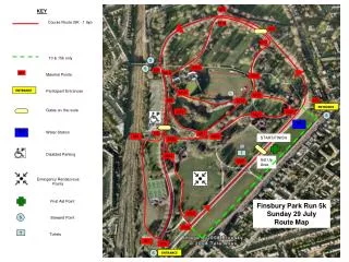
Site Selection I look for a straight stretch of road with Interstate access, good shoulders, preferably a low populated area, and (keeping star azimuth in mind) free of obstructions.
Sites posted in OW HWY 33 fills the bill for this event. Then, I declare my intentions in OW.
Long. & Lat. entered in Garmins’sMapSource and uploaded to GPS I enter my location data in MapSource to perform deployment statistical calculations.
Using my GPS as a “black box” I am able to do a statistical analysis of past multistation deployments to help plan and improve future deployments.
Bill Gray has added an automated method to Guide 8 to create prepoint charts. This method allows one to create a track of time through the sky representing the altitude and azimuth of the target star at event time.
Preferred Guide 8 charts • Target field at a Level 7 (2 degree FOV) with UT event center time and date listed on menu, the CCD frame of viewing instrument, and stars to just beyond the magnitude limit of instrument. I also like to make sure to put a note in the Caption as to what asteroid the event is for as well as the longitude the event time is for. (nothing worse than traveling 1000 miles for the Metis event and pulling out your Kleopatraprepoints that you mistakenly packed!) • Several very wide field Level 3 (45 degree FOV) finder charts for identifying major constellations near the prepoint track. These are also used to navigate my initial star hop to within the view of my main prepoint charts. • My main prepoint charts display either a half hour (Level 5: 10 degree FOV) or an hour (Level 4: 20 degree FOV) of the prepoint track. These charts go back in time far enough to either twilight or planned deployment time.
Equipment preperation • What DON’T I need?! (more on this at the end of presentation) • Allow enough time to recharge all battery packs before departure. • Should know your camera’s ppm error before the observation (but this can be done post event if needed) • Get an accurate forecast of event temperature. This way you will know whether you will need a hot or cold pack with the recorder and batteries (for temperature extremes). • Lay out all equipment and survey what you have at least a week (preferably 2 weeks) prior to departure to allow time to buy/repair/redo any deficient part. • A dress rehearsal including the prepoint constellation identification in twilight/moonlight, and equipment deployment proficiency can REALLY help identify the GOTCHAs before they GET ya’! This can help identify things like bad cables, charts, recorders, etc. • Don’t forget to fill up BEFORE you get remote! (I have to admit to making this mistake and nearly running out of gas after being caught up in the deployment moment!) • Good set of maps is a must, not only to know where to go, but how to get back! Don’t forget to pack the prepoint charts with a clip board to hold them steady.
Deployment • It is very important to take into account your travel time and method of travel to your deployment location. (I once planned an entire observation and then when I did the math I found out my travel time was so long I would arrive just about past event time!) • PACK SPARE CABLES and BATTERIES when possible!! • Starbucks Dark Chocolate Mocha and chocolate snacks! • Your favorite 70’s, 80’s, and 90’s Rock music or good Jazz CDs to play while driving. • Spare napkins and/or roll of paper towels (SAVED the Fortuna run, needed it to sop up dew!)
Stamp & Run • It helps for sites to be known or surveyed ahead of event. • Prior to end of twilight or start of deployment, as much equipment is assembled and laid out in order of their deployment in vehicle. • Prior to “Event Time – 122 minutes” record window, sites are prepointed to correct part of sky (but not recording) so that I finish deployment at Site #1 (closest to centerline, i.e. statistically most important data site). • At the “opening” of the RECORD window (longest record time available for my ZR at the moment is 124 minutes in LP mode): • Connect one “Y” of video camera to Canon ZR and start RECORD • Connect the KIWI Video Input to other “Y” of video camera • Press the yellow KIWI RESET button and record Long., Lat., Alt., UT date • Record about 10 seconds of UT time • WITHOUT STOPPING THE RECORDING I disconnect the KIWI from camera “Y” • R U N !!!! Make haste to the next site! • Continue Stamp & Run as far as you can go until event time or you have time stamped all your prepointed sites. • If event time hasn’t come and you have extra equipment you can drive further away from centerline and Deploy & Run….
Deploy & Run • Deploy & Run starts inside the “Event Time – 122 minutes” RECORD window. • In a Deploy & Run your sites may or may not be known • You show up at Site #1 (site closest to centerline, i.e. the statistically most significant data site). • Prepoint the station to the correct part of the sky. • Start RECORD on the Canon ZR camcorder. • Time stamp the recording using the Stamp & Run “Y” method. • RUN! Drive away from centerline to either your next predetermined site or drive for a predetermined amount of time and find the next suitable site area. • Deploy & Run. • Continue deploying sites in this manner until event time has passed or equipment is exhausted (or you are exhausted!!!)
Data Reduction • With Canon ZR I have three choices for digitizing my video for computer analysis: • Composite video through USB2 converter through Virtual Dub. • S-Video through USB2 converter through Virtual Dub. • DV, Firewire through IEEE-1394 via Windows Import Movie (came standard with my Vista system). • My method of preference is unfortunately the S-Video, as DV mode does not show the Canon ZR Time Code. • I need to know the ppm drift of the Quartz crystal in each of my cameras to convert the frame rate that my camcorder has counted to UT time.
UT time with ppm errorshows the dependence on temperature for accuracy.
Sample occultation LiMovie plotThe resulting CVS file used in Occular
Occular should be the tool of choice to “standardize” our reporting efforts.
Scotty’s follies…Why I chose my methods One name for me would be: MINIMALIST
The more correct adjective… I’M LAZY!!!
My personal priorities: • Never ever everever go straight to the target star, ALWAYS prepoint! • 9 times out of 10 the target star is faint and/or located in an awkward star hopping point in the sky. Prepointing allows you to pick the most convenient time to aim the scope AND to pick the brightest star near the most recognizable asterism (saves an INCREDIBLE amount of time, blood, sweat, tears, hair follicles, adds years to you life, takes years off your wife…. Yadayada you get the picture). • And starting at the target star means that you HAVE to stay on the target star, i.e. your polar aligning better be good (lotsa deployment time there), your motor drive better not have errors (lotsa $ there), and your batteries better last, even in the cold… (lotsa prayers there)! • Prepointing uses THE most accurate drive available to man… the Earth’s rotation. • LiMovie reduction with a prepointed target star drifting through at a steady rate is a BREEZE to accomplish using the “Drift” Tracking Method. • Use the widest FOV (field of view) instrument you have to attain the magnitude depth needed. • I have found statistically that doubling the FOV decreases prepoint time not by half, but by a quarter of the time! • WHAT DON’T I NEED!! • While those techno gadgets seem like a good idea for a successful observing run, they are a huge strain on your time budget. KISS works in this arena. • Holding a flashlight takes up one of my hands, roughly doubling the time needed to accomplish a task. I wear a headlight to free up both hands, and it also is always shining where my eyes are pointed. • Basic parts that I need: a video camera, a battery pack for the camera, a recording device (Canon ZR Models ZR10 through ZR300 work), an optical instrument with dew shield, the smallest tripod available for the optical instrument, a time keeping device (KIWI), charts & maps. That’s it. (I will concede here that I do use a GPS to navigate to/from sites, reduces time) How small and how light you can go with these determine how many stations you can carry/deploy. KISS
ms$The cost of accuracy for different portable recording methods
Battery of choice:9 pack of AA NiMHDuaracell 2650mAh PC164C voltage specs = 12VDC +/- 10% (i.e. 13.2 to 10.8VDC)
Taken before boarding my plane for (343) Ostara, 7 complete stations as a carryon!