Download
1 / 20
200 likes | 366 Views
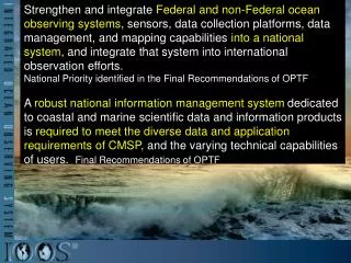
Strengthen and integrate Federal and non-Federal ocean observing systems , sensors, data collection platforms, data management, and mapping capabilities into a national system , and integrate that system into international observation efforts.

E N D
Strengthen and integrate Federal and non-Federal ocean observing systems, sensors, data collection platforms, data management, and mapping capabilities into a national system,and integrate that system into international observation efforts. National Priority identified in the Final Recommendations of OPTF A robust national information management system dedicated to coastal and marine scientific data and information products is required to meet the diverse data and application requirements of CMSP, and the varying technical capabilities of users. Final Recommendations of OPTF
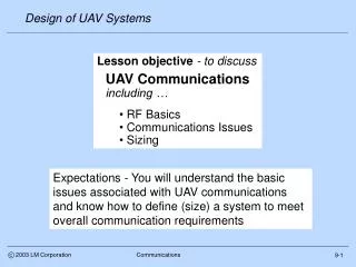
What is IOOS® ? On the National Front Delivering Benefits Linking and Leveraging Communications
An Integrated and Sustained Ocean and Coastal Observing and Prediction System. • A collaborative framework. • A network of many technologies • Contributes to the Global Ocean Observing System (GOOS) IOOS Refresher
What is IOOS®? On the National Front Delivering Benefits Linking and Leveraging Communications
What’s New Nationally • Formation of the Integrated Ocean Observing System Committee (IOOC) • National Ocean Policy • Ocean, Coastal, and Great Lakes Observations, Mapping, and Infrastructure • Framework for Coastal Marine Spatial Planning • CMSP National Information System • White House (OSTP) report to Congress: "Achieving and Sustaining Earth Observations: A Preliminary Plan Based on a Strategic Assessment by the U.S. Group on Earth Observations: US IOOS called out
Foundational Documents IOOS Blueprint Assessment Negotiations, Plans and Agreements Implementation 7 National Front - Blueprint Implementation
What is IOOS®? On the National Front Delivering Benefits Linking and Leveraging Communicaitons
IOOS® High Frequency Radar Surface Current Monitoring • Ingested & distributed by IOOS national HF radar data servers at Scripps & NOAA/NDBC • Collected by CODAR SeaSonde® HF radar systems Chronology 20 Apr 30 Apr 2 May 2 May – Cap of Oil Well 2006 2007 2 of 3 USM radars: not operational, scheduled maintenance HFR support to COSCO Busan Data received by IOOS National Servers & NOAA/OR&R/ERD HFR used daily for trajectory forecasting Safe Seas Exercise USM: radars restored
IOOS® Gliders Sub-surface Monitoring – New Technologies Slocum – Teledyne Webb Research SeaGlider- IRobot® Spray - Scripps • 9 Federal/Non-Federal gliders provided critical ocean state data & served as sentinels to evaluate cross-shelf transport of hydrocarbons - IOOS gliders (not counting Navy) collected 41,670 casts since 17 May 10. • MACOORA (Rutgers (2 gliders), U. Delaware); SECOORA (USF, Mote Marine Lab); GCOOS (USM/U. Washington) ; SCCOOS; US Navy (2) • MACOORA, AOOS, PacIOOS, NaNOOS, SECOORA, SCCOOS, CeNCOOS , and GLOS all have glider capacity
U.S. Data Management & Communications Other Third Party Users IOOS/GEOSS Data also returned to providers with processing. Data Management End Users (YOU!) National and Regional Observing Systems Modeling Feds States Industry Local Tribes Academia NGOs Data Providers Slide Courtesy of:
Data Integration – Support National and Regional Needs NANOOS Visualization System (NVS) for the Web Interactive Data Exhibits Assets on Google Map Sensor Data Values Trends and Forecasts
Delivering Benefits Across Many Sectors Marine Operations: Nationwide Search & Rescue Coastal and Marine Spatial Planning
Testbed Advisory Evaluation Group Follows recommendations from the IOOS Modeling and Analysis Steering Team • improve cyber infrastructure, • support development of community models, • ease the transition of models to operations. • Cyber Infrastructure • Estuarine Hypoxia • Shelf Hypoxia • Coastal Inundation
What is IOOS®? On the National Front Delivering Benefits Linking and Leveraging Communications
Board Representative USACE RA Participation Board Representative Identified RA Participant PacIOOS Todd Barnes, Chief Engineering and Construction Division POH Thomas Smith, Jessica Podoski AOOS Patricia Opheen, Chief Engineering Division POA Ken Eisses, Bruce Sexauer NANOOS Doris McKillip, Rod Moritz, David Michalsen NWS, NWP SCCOOS Richard Leifield, Chief Engineering Division SPL Arthur Shak GCOOS Jennifer Wozencraft, Director JALBTCX MVN, SAM, SAJ Jennifer Colee, Jay Ratcliff, Mathew Schrader, Jason Engle SECOORA Kaiser Edmond, Mathew Schrader, Jason Engle, Jeff Hanson SAD, SAJ, CHL MACOORA Roy Messaros NAN NERACOOS Roy Messaros, John Winkelman NAN, NAE GLOS James Selegean, Scott Thieme LRE
National Federation of Regional Associations 11 IOOS Regional Associations Interagency Partnerships CMSP Regional Planning Monitoring Water Quality Delaware River Basin NWQMN Pilot Study
What is IOOS®? On the National Front Delivering Benefits Linking and Leveraging Communications
US IOOS – A National Endeavor • IOOS is a comprehensive system and the regions are key partners that need to support both regional and national needs • Integration of data is critical, • IOOS is in place as the foundation for the National Ocean Policy www.ioos.gov