Download
1 / 23
230 likes | 333 Views
Learn about Hawaii's mapping and modeling status, activities of Hawaii State Earthquake Advisory Committee, NTHMP undertakings, and honed tsunami readiness initiatives post the devastating Honshu Earthquake in 2011.

E N D
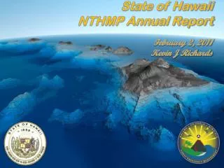
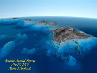
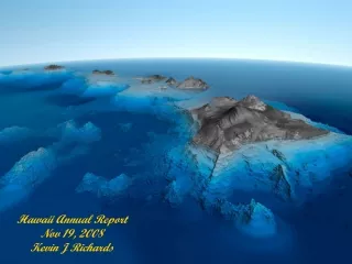
NTHMP Annual Meeting San Diego, Ca. February 6 - 10, 2012 Kevin J Richards
Hawaii’s Activities 2011 • Mapping & Modeling Status • Tsunami Advisory Group • Hawaii State Earthquake Advisory Committee • NTHMP Activities • TsunamiReady Activities • Special Projects • Exercises • Honshu Earthquake
1964 1957 1952 1946 Japan Cascadian Mariana Hawaii Kalapana on west shore Solomon Tonga 1960 Tsunami Inundation Mapping • First state to develop tsunami evacuation maps for emergency management (1991) • Cover 725 of 1500 km of Hawaii coastlines • Based on five most-destructive trans-Pacific tsunamis to Hawaii during the last century • Inferred from 1D modeling of recorded run-up • Update of Evacuation Maps: • In coordination with National Tsunami Hazard Mitigation Program • Latest topographic and land use data and 2D modeling techniques • Evaluation of hypothetical distant and regional tsunamis
Mapping Milestones • Oahu & Hawaii: • Mapped and Modeled • Tsunami Inundation Mapping – Review Panel • State Approved and Released Data to City and County Completed • City and County Developed Evacuation Map • Public Information Campaign and Publishing • Maui: • Mapped and Modeled • Tsunami Inundation Mapping – Review Panel Maui • Kauai: • Kickoff meeting scheduled for the first quarter 2012 • Greater then 9.+ From Alaska?
Tsunami Advisory Group (TAG) • New advisory group made up of representatives from • ITIC, PTWC, UH, Counties, and SCD and meet as needed • Activities: • 10/12 Post Tsunami Project • 10/14 Reauthorization of the Tsunami Warning • & Education Act (TWEA) • 10/24 Greater then a 9.+ from Alaska • 10/26 Pacific Islands Mapping Issues • 11/8 Post Tsunami Project • 12/1 Post Tsunami Project - Poster • 12/7 2012 Tsunami Awareness Week Activities
Hawaii State Earthquake Advisory Committee (HSEAC) • Activities: • 3/3 JMA (Fujinawa) - Earthquake Research and • Development Presentation • 3/4 HSEAC Meeting • 6/17 HSEAC Meeting • 7/5 ASCE, Sub-Committee Meeting • 9/9 HSEAC Meeting • 9/28 NASA, Early Warning Presentation • 12/16 HSEAC Meeting
NTHMP Activities • 2/3 Semi-Annual Meeting & Exec. Com. Meeting - Portland OR. • 2/28 Semi-Annual Report • 3/14 PRiMO – Pacific Partners Meeting & Workshop – Samoa • 6/14 NTHMP Program Presentation –Hilo • 6/15 NTHMP Program Presentation – Kauai • 6/20 NTHMP Program Presentation – Oahu • 6/21 NTHMP Program Presentation – Maui • 10/17 NOAA - West Coast Conference & MES-CC Workshop – • Seattle/Lynnwood, WA. • Note: • There were 13 Tele-conferences held in 2011 • covering a verity of issues
TsunamiReady Activities • Kapolei: • 9/26/11 Contact Made/Interested • North Shore: • 6/23/11 Contact Made/Interested • Maui: • 1/4/12 Contact Made/Interested • Kailua: • 4/5/11 Presented TsunamiReady Program • 1/9/12 Certified TsunamiReady • Marine Corp Base Hawaii: • 7/20/11 Presented TsunamiReady Program • 1/9/12 Certified TsunamiReady • Ewa Beach: 8/22/11 Presented TsunamiReady Program • United States Coast Guard: • 8/2/11 Presented TsunamiReady program • Pearl Harbor: • 9/11 Certified TsunamiReady • Kaneohe: 9/21/11 Presented TsunamiReady Program
Special Projects • Tsunami Awareness Kits • Menus Project • Evacuation Task Force • (ESF 17) • Oahu Tsunami Signs • KAHU Radio • Maui Train the Trainer • Hilo Airport/Keaukala • Mobile Tsunami • Display Unit
Exercises • 4/1 Kai Mamiki - Local Tsunami Exercise Statewide • 5/23 – 6/3 Makani Pahili 2011 – Hurricane Statewide • 8/17 DOE, Senor Leadership, Tsunami TTX • 9/7 Civil Defense Staff Tsunami Drill (Unannounced) • 9/15 Civil Defense Staff Tsunami Drill (Unannounced) • 9/29 Kailua Tsunami Exercise • 10/3 Kai Mimiki - Distant Tsunami Exercise
Kevin J Richards Desk: (808) 733-4300 ex: 561 Email: krichards@scd.hawaii.gov
HonshuEarthquake & Tsunami • Origin Time: 7:46 p.m. HST 3-10-11 • Tsunami Warning Issued: 9:31 p.m. (HST) • The Tsunami Advisory ended for the State of Hawaii at 11:26 a.m. (HST) 3-11-11 • Location: 80 miles off the east coast of Honshu, Japan, 6 miles deep • Coordinates: 38.3° N 142.4° E • Magnitude: 8.9 Moment • Wave Arrival: Nawiliwili: 3:07 a.m. HST
HonshuEarthquake & Tsunami • ARRIVAL TIMES AND MAX WATER LEVEL (INCLUDING TIDE)
HonshuEarthquake & Tsunami • Mar 11: Tsunami Impacts Hawaii • Mar 11 & Ongoing : State/Counties Conduct Damage Assessments • Mar 17 : SCD Requests JPDA of FEMA • Mar 22-23 : FEMA/State Conduct JPDA • Mar 25 : Gov. Requests Pres. Declaration • Apr 8 : Pres. Issues Major Disaster Declaration
HonshuEarthquake & Tsunami HONSHU EARTHQUAKE & TSUNAMI 3-10-11 SITUATION REPORT As of 8:00 a.m. HST March 14, 2011 • HAWAII: • Kealakekua Bay reports 7 homes and the church hall severely damaged. • ARC reported 28 homes received various levels of damages. One home was washed out into the ocean. • Debris cleared by county crews along Alii Drive, Kailua-Kona. • Kailua-Kona pier sustained major damage. • Hilo Harbor is now opened to commercial traffic. • MAUI: • Maalaea Boat Harbor sustained major damage to all docks and four boats. • ARC reports indicate 11 homes sustained some damage in Wailuku; 2 in Kihei; 8 in Spreckelsville; and 6 homes in Kamalo, Molokai. • Kahului Harbor is now opened to commercial traffic. • KAUAI: • County announced the All Clear status at 7:28 a.m. on 3-11-11. • No reports of public or private property damage. • EOC published a final PERDISREP and deactivated at 7:30 a.m. on 3-11-11. • No reports of private or public property damage.
Hawaii (Big Island)
Four Seasons Hotel Kailua-Kona King Kamehameha Hotel Kona Kona Village Kailua-Kona Keauhou Kona Yacht Club
Maui Molokai
HonshuEarthquake & Tsunami • OAHU: • All Clear Status as of 8:16 a.m. DEM-EOC was deactivated at 10:00 a.m. HST. • Non-essential county personnel were told not to report to work. • Keehi Lagoon closed for commercial traffic. • Haleiwa Harbor sustained extensive damage to main walkway so no access to at least 20 boats. Pier 300 is missing. Water line is broken and turned off. • Ala Wai Boat Harbor – confirmed one boat sank. Old piers are damaged and twisted; renovated piers are not damaged. • Keehi Lagoon – extensive damage to piers and boats. • Keehi Marine Center floating docks broke loose with 40-50 vessels still attached. Keehi Marine Center is working with DLNR to address the problems. • La Mariana Sail Boat Club sustained damages to piers and boats. • Sum total approximately 200 boats reported either damaged or sunk. Boats that were evacuated where permitted to dock at Kewalo Basin. • Honolulu Harbor is open but Keehi Lagoon is closed to tug and barge traffic. • Haleiwa Small Boat Harbor sustained major damages to piers and moorings. • MILITARY: • JTF-HD EOC was deactivated as of 12:05 p.m. HST 3-11-11.
Ke`ehi SBH O`ahu Hale`iwa SBH O`ahu Damaged Moorings at Hale`iwa SBH O`ahu
Kevin J Richards Desk: (808) 733-4300 ex: 561 Email: krichards@scd.hawaii.gov