Download
1 / 28
280 likes | 431 Views
This document explores the characteristics and map attributes of igneous rocks, focusing on textures related to cooling rates in both plutonic and volcanic environments. It covers magmatic processes such as partial melting, resulting in mafic and felsic magma formation. The mapping of volcanic rocks, including tuffs and agglomerates, and the distribution of volcanic deposits are detailed. Additionally, it discusses intrusive rock structures, the influences of gravity, and emplacement styles, providing a comprehensive overview of igneous geology.

E N D
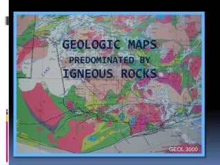
Geologic Maps Predominated by Igneous Rocks GEOL 3000
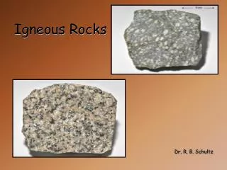
IGNEOUS ROCK TEXTURES f(rate of cooling = crustal environment) Plutonic---Volcanic 1 mm Degree of Undercooling 1 mm
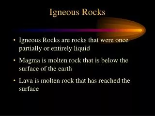
Magma Creation by Partial Melting Melting the mantle makes MAFIC Magma Melting the crust makes FELSIC Magma Igneous rocks crystallize over a range of temperatures
Map Attributes of Volcanic and Volcaniclastic Rocks Volcanic Rocks- crystallized from lava flows Volcaniclastic Rocks – air-fall accumulations of lava, ash and pre-existing volcanic rock ; Rock types: tuff, lahar, agglomerates) Areal distribution more limited than sedimentary units Map unit shapes controlled by gravity, landscape, volume of material erupted, explosiveness of eruption, proximity to vent, and fluidity (viscosity) of lava Tabular shapes – distal areas of volcaniclastic deposits, fluid lava flows Lensoid/Triangular/Fan/Irregular shapes – proximal areas of volcaniclastic deposits and lava flows, especially viscous lavas and low volume eruptions
Up Indicators in Volcanic and Volcaniclastic Rocks • Pillow structures • Vesicular/Amygdaloidal upper zones • Distinctive Flow Tops • Brecciation (AA) • Billowing, ropey tops (Pahoehoe) • Oxidation • Sediment infiltration Pipe vesicles/amygdules at base • Pipe vesicles/amygdules at base • Graded bedding in volcaniclastic deposits and clastic dikes
Pillowed Basalts Submarine Eruptions
BASALT FLOW SURFACES AA AA Pahoehoe HAWAII Pahoehoe NORTH SHORE
Other Up Indicators Pipe Amygdules Oxidized Pahoehoe surface Amygdule Cylinders
Graded bedding of tuff Bedded siltstone in a clastic dike
Map Attributes of Intrusive Rocks • Shape not controlled by gravity, but often by weaknesses and stresses in the crust • As such, may be discordant or locally concordant with structures in country rock • For large intrusions, will create a zone of thermal metamorphism (and local melting) in surrounding country rock • Commonly shows internal structure/zonation related to the shape of the magma chamber • Chilled margins • Layering* (phase, textural, modal, cryptic) • Igneous Foliation* (alignment of tabular minerals) • Jointing (orthogonal to the cooling surfaces or internal structure of the magma body) * These features are commonly controlled by gravity • Multiple (composite) intrusions are common because magmas are prone to reuse the same plumbing system
Intrusion Shapes Generally Concordant Sill Laccolith Lopolith Phacolith Generally Disconcordant Dike Dike Swarm (co-parallel or radial) Ring Dike/Cone Sheet Volcanic Neck Sheets Stock/Boss Batholith
Indicators of Style of Magma Emplacement • Shape of intrusion • Shape and distribution of Inclusions (Xenoliths) • Internal zoning and structure • Primary and secondary structures in the country rock • Large-scale structures in the intrusion (folds and faults) Emplacement Styles: Forceful – Magma forces entry by deforming and displacing the country rock Permissive – the country rock, under stress, dilates or moves apart as magma wells into the space Stoping – rising magma detaches blocks of country rock, which sinks into it Timing of Emplacement (relative to deformation): Pre-kinematic– Intrusion is deformed in the same way as the rocks it intrudes Syn-kinematic – Intrusion shape conforms to regional structures Post-kinematic – Intrusion shape is independent or cross cuts deformational fabric of country rock
Intrusions of Northern Minnesota Post-Kinematic Pre/Syn-Kinematic Post-Kinematic
Discriminating a Sill From a Flow ...... ......... .. ........... .... .... .. ....... .... ............ ..... .......... ........ ...... ......... .. ........... .... .... .. ....... .... ............ ..... .......... ........ • Upper amygdaloid zone • May be pillowed • May contain inclusions only of • footwall rocks • May cause weak contact • metamorphism of footwall rocks • May show zoning, but rarely • displays layering • Typically lacks amygdules • Never pillowed • May contain inclusions of • hanging wall and footwall rocks • Thermal metamorphism of hanging • wall and footwall rocks • Zoning &/or layering common, • especially in larger intrusions
Mafic Layered Intrusions Skaergaard Intrusion East Greenland Bushveld Complex South Africa
Internal Structure in the DLS Modal Layering Modal Layering Igneous Foliation
Lithostratigraphic Classification for Keweenawan Rocks of NE Minnesota Miller, Severson, and Green, 2002