Download
1 / 8
80 likes | 318 Views
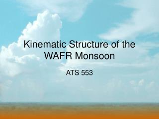
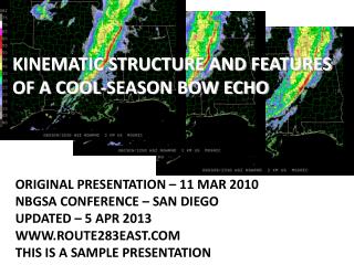
Kinematic Structure and Features of A Cool-Season Bow Echo. Original Presentation – 11 Mar 2010 NBGSA Conference – San Diego Updated – 5 Apr 2013 www.route283east.com This is a sample presentation. Table of Contents. Intro System Setup Storm Overview Kinematic Structure Findings

E N D
Kinematic Structure and Features of A Cool-Season Bow Echo Original Presentation – 11 Mar 2010NBGSA Conference – San DiegoUpdated – 5 Apr 2013www.route283east.comThis is a sample presentation
Table of Contents • Intro • System Setup • Storm Overview • Kinematic Structure • Findings • Conclusions
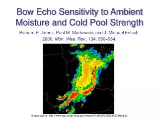
Bow Echo Characteristics • Bow Echoes are specialized Convective Weather Systems • Identifiable by curving section of thunderstorms on radar • Presence of bow echo indicates strong winds at surface • Can be born from squall lines, supercells or cell merger • 2 typical patterns: Warm Season (Great Plains/Great Lakes) & Cool Season (Southeast/Atlantic Coast) Bow Echo near Tuscaloosa, AL
Bow Echoes: Structure & Features • Strong mid-level winds move through cold dry air at 3-7 km AGL (Johns 1993) • When they encounter main downdraft, storm is strengthened at surface through increased evaporation and vertical momentum transport (Weisman 2001) • Combines with the downdraft outflow (gust front) to accelerate system, cause the bowing of line (Smull & Houze 1987b) • Behind the apex is the Rear Inflow Jet (RIJ) (Przybylinski 1983) • Bookend vorticies flank and amplify the RIJ (Weisman 1990) • Long-lived bow echoes can become derechoes (Heinrich 1888) Bow Echo evolution, from Fujita (1978); note “Bookend Vorticies”
Winds (U vs UR) U-winds (east/west winds) are primarily from the west in the strongest part of the storm. UR-winds: east/west winds RELATIVE to storm motion. Stronger winds embedded within the storm flow. Strong westerly winds alternate with weaker westerly winds.
Mesovortices • Storm motion, downdraft & RIJ account for much damage (especially at the bow apex) • Mesovortices along the line can enhance surface wind along the line • 9 March 2006 had one very strong mesovortex and other weaker ones • Vortex will ENHANCE ambient flow to the south and INHIBIT flow to the north, possible that wind is STRONGER than at apex • POSITIVE vorticity
Take-Home Points Squall lines can be as dangerous as more well known weather events (Tornadoes, etc) Dangerous winds can be from a combination of storm features Mesovortices are an important part of this storm’s dynamics More research needs to be done in the areas of: Cool-Season Severe Weather Severe Weather in the Southeast US Damaging windstorms in the Southeast US
Conclusion of sample presentation • Please contact us if you’d like to see this entire presentation: • info@route283east.com • 704.579.8700 • The complete presentation can be used for free by most educational interests and organizations. Please contact us if you’d like to use it. • See the website for more presentations! • www.route283east.com/resume/presentations • weather.route283east.com/presentations • education.route283east.com/presentations