Download
1 / 15
160 likes | 290 Views
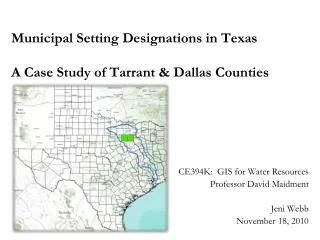
Municipal Setting Designations in Texas A Case Study of Tarrant & Dallas Counties. CE394K: GIS for Water Resources Professor David Maidment Jeni Webb November 18, 2010. Agenda. Background on HB 3152: Municipal Setting Designation (MSD) Literature – what are others saying about this law?

E N D
Municipal Setting Designations in TexasA Case Study of Tarrant & Dallas Counties CE394K: GIS for Water Resources Professor David Maidment Jeni Webb November 18, 2010
Agenda • Background on HB 3152: Municipal Setting Designation (MSD) • Literature – what are others saying about this law? • Research question • Methodology + Findings • Future work
The TCEQ regulates contaminated groundwater in Texas • Texas VCP provides incentives for property owners to remediate contaminated sites • Contaminated groundwater can be very difficult and expensive to clean • Creates conditions where property owners cannot afford to complete the VCP www.texaobserver.org http://www.fortworthgov.org/dem/info/default.aspx?id=8040
The Municipal Setting Designation (MSD) was passed in 2003 • Works in concert with the Texas VCP • Alleviates requirement to remediate contaminated groundwater to potable standards • Saves time & money, but has inherent environmental concerns • Designed to expedite Certificates of Completion http://www.fortworthgov.org/dem/info/default.aspx?id=8040
Since 2003, over 130 MSDs have been approved by the TCEQ • Over 75% of MSDs lie within the Dallas-Fort Worth MSA • Case study focuses on Tarrant & Dallas Counties • Some historical land uses led to groundwater contamination • Drinking water comes from surface reservoirs (e.g. Lake Ray Hubbard) http://trtdg.com/wp-content/uploads/2008/07/tx-hillsboro-old-corner-gulf.jpg
Literature – what are others saying about this law? Support Oppose Violates the “polluter pays” principle upon which CERCLA is founded Increases risk of vapor intrusion Risks spreading contamination through groundwater-surface water interaction MSD legislation does not stipulate an end point • Expedites VCP Certificates of Completion • Saves time & money • Promotes economic development • Increases property values • Expands the property tax base
Research Question: :Using ArcGIS to Examine Spatial Relationships • Can we identify areas of concern where contaminated sites risk polluting water resources?
Methodology • Collect raw GIS data • TWDB • TCEQ • NCTCOG • ArcGIS Online • Use ArcGIS tools to examine the spatial relationships between MSDs and water resources
ArcGIS identifies areas of concern for MSDs • MSDs are based on parcels with a specific address • Geo-coding, or “address matching” represents these addresses spatially • The Buffer tool establishes a distance threshold for comparing features (e.g. .5 miles)
ArcGIS helps identify sites for future MSDs • The Select by location tool helps examine spatial relationship between water resources and contamination • Enables land use planners to be proactive in identifying potential MSD sites
Findings • All existing MSDs are less than 200 feet below the ground surface • Woodbine and Trinity Aquifers are present in the case study area • 42 wells are within .5 miles of an MSD • Of those, none are less than 200 feet below
Findings • Risks contamination through existing wells • MSD law does not stipulate an end point for certificates of completion http://pubs.usgs.gov/circ/circ1171/html/gw_aquifer_old.htm
Future Work • Geo-code MSD point addresses that have been added since 2007 for inclusion in the study • Add NHD Flowline for surface water comparison • Use X-Tools Pro to convert the EPA’s Brownfields data from .kmz to .shp for comparison