Download
1 / 17
180 likes | 315 Views
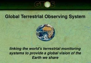
Global Terrestrial Observing System. linking the world’s terrestrial monitoring systems to provide a global vision of the Earth we share. GTOS Mission Statement.

E N D
Global Terrestrial Observing System linking the world’s terrestrial monitoring systems to provide a global vision of the Earth we share
GTOS Mission Statement To provide policy makers, resource managers and researchers with access to the data they need to detect, quantify, locate, understand and warn of changes (especially reductions) in the capacity of terrestrial ecosystems to support sustainable development.
Focuses on five issues of global concern: 1. Changes in land quality 2. Availability of freshwater resources 3. Loss of biodiversity 4. Effects of climate change 5. Impacts of pollution and toxicity
Global observing systems - convergence of interest IOC of UNESCO UNEP FAO WMO ICSU UNESCO Ocean services Biodiversity Atmosphere Land surface/ hydrology Pollution/ coastal zone Ocean & climate Pollution, toxicity Terrestrial ecosystem structure & function Marine living sources Cryosphere GTOS GCOS GOOS
GTOS Sponsors Food & Agriculture Organization (FAO) International Council of Science (ICSU) United Nations Environment Programme (UNEP) UN Educational, Scientific & Cultural Organization (UNESCO) World Meteorological Organization (WMO)
Key GTOS Partners Countries (Europe, Southern Africa, South Asia) Research institutes and universities Global change programmes (GCOS, GOOS, IGBP ... ) Space agencies and programmes Framework convention on climate change Convention on biodiversity
The global observation hierarchy 1. Large-area experiments 2. Long-term research centres 3. Field stations 4. Periodic, unstaffed sample sites 5. Frequent low resolution remote sensing
GTOS System of Networks:GT-Net • Objective: • to link existing terrestrial monitoring networks in order to study regional and global environmental change. • Key activities: • share and exchange environmental data; • define policies on data and information access; • develop standards for metadata and in situ data; • undertake demonstration projects • (e.g. Net primary productivity, carbon).
GTOS System of Networks:GT-Net • Objective: • to link existing terrestrial monitoring networks in order to study regional and global environmental change. • Key activities: • share and exchange environmental data; • define policies on data and information access; • develop standards for metadata and in situ data; • undertake demonstration projects • (e.g. Net primary productivity, carbon).
GTOS Secretariat Steering Committee (GTSC) GT-Net Panel Thematic Networks Regional / National Networks Ecology-Net Coastal-Net Glacier-Net Hydrology-Net Central Europe Southern Africa Southern Asia GT-Net Structure
GT-Net Ecology members • Arab Centre for the Studies of Arid Zones and Dry Lands (ACSAD) • Arctic Monitoring and Assessment Programme (AMAP) • Chinese Ecosystem Research Network (CERN) • Consultative Group on International Agricultural Research (CGIAR) • Fluxnet • International Cooperative Programme on Integrated Monitoring of Air Pollution Effects on Ecosystem (ICP IM) • Organismo Autonomo Parques Nationales • Réseau d’Observatoires de Surveillance Ecologique à Long Terme (ROSELT) • UK Environmental Change Network (ECN) • US Long-term Ecological Research Networks (LTER) • Worldwide Network of Biosphere Reserves (MAB-BR)
GT-Net demonstration project GT-Net undertakes projects which demonstrate the value of linking existing networks by generating data sets which are useful in studying global change. They serve as test beds for collaboration among networks and sites, including data sharing and exchange, and obtaining the experience needed for further development of GT-Net
The calculation of NPP requires input data which are valuable long-term observations in their own right: Land cover Leaf Area Index (LAI) Net primary productivity Soil water holding capacity and nitrogen content Temperature Rainfall Net Primary Productivity
GTOS-NPP Critical vegetation variables of LC, LAI and NPP are measured at local and regional scales and used to validate the global satellite-based estimates. NEP measurements provide a separate validation and translation of the carbon budget based NPP to estimate commodity yields (with local weather data if available).
Terrestrial Ecosystem Monitoring Sites meta-database • A global register of long-term terrestrial observation sites; • Information on more than 700 sites; • Searchable on the web: http://www.fao.org/gtos/ • Supporting GT-Net, the NPP project, the terrestrial carbon observation initiative.
Value-added through GTOS • Linked systems of terrestrial networks and sites; • Improved access to terrestrial data & information; • Better collaboration between ecological networks; • Filling gaps in key observations; • Stronger links between science and policy • Faster response to emerging issues • Harmonization of measurements & terminology