Download
1 / 14
150 likes | 286 Views
Presented by: Stan French , BLM Chief Cadastral Surveyor Idaho State Office, Boise, ID and Bob Dahl , BLM Cadastral Surveyor Division of Lands, Realty & Cadastral Survey Washington, D.C. Idaho Society of Professional Land Surveyors Annual Conference Boise, ID March 12, 2009.

E N D
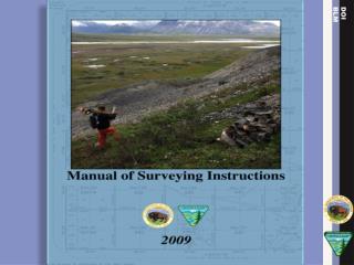
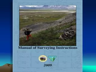
Presented by: Stan French, BLM Chief Cadastral Surveyor Idaho State Office, Boise, ID and Bob Dahl, BLM Cadastral Surveyor Division of Lands, Realty & Cadastral Survey Washington, D.C. Idaho Society of Professional Land Surveyors Annual Conference Boise, ID March 12, 2009 The Next Edition of theManual of Surveying Instructions
Handout Information from Bob Dahl on your DVD’s • Frequently Asked Questions Regarding the Development of the Next Edition Manual. • A Perspective of the Next Edition of the Dept. of the Interior Bureau of Land Management Publication Manual of Surveying Instructions. • State Laws, Regulations and Standards and the Next Edition of the BLM Manual of Surveying Instructions. • Common Grantor.
Agenda • “Process” for compiling the Next Edition • Chapter by Chapter “Crosswalk”: • 73 Manual Next Edition • Primary Areas of: • Change – Clarification - Additions
What is the Manual of Surveying Instructions? (Manual) Who/What is affected?
Chapter Crosswalk 1973 Manual Next Edition Ch. 1 - The General Plan Ch. 2 - Methods of Survey Ch. 3 - System of….. Ch. 4 - Monumentation Ch. 5 - Lost or Obliterated Corners Ch. 6 - Resurveys Ch. 7 - Special Surveys and Instructions Ch. 8 - Field Notes Ch. 9 - Plats Ch. 10 - Mineral Surveys Ch. 1 - The General Plan Ch. 2 - Methods of Survey Ch. 3 - System of….. Ch. 4 - Monumentation Ch. 5 - Principles of Resurveys Ch. 6 - Resurveys and Evidence Ch. 7 - Resurveys and Restoration Ch. 8 - Water Boundaries Ch. 9 - Special Instructions…….. Ch. 10 - Special Surveys and Mineral Surveys
Areas of: Change – Clarification - Addition • Water boundaries • Standard of evidence • Coordinates as collateral evidence • Technology • Mineral survey resurveys • Closing corners • Bona Fide Rights & Good Faith Location
Water BoundariesChapters III and VIII • Chapter III includes concepts and case studies of original surveys and water boundaries. • Chapter VIII includes concepts and case studies of resurveys and water boundaries. • Navigability determinations. • Submerged lands issues. • Ownership of unsurveyed islands in meandered nonnavigable waters.
Standard of Evidence • Interior Board of Land Appeals (IBLA) has altered the evidentiary standard for proof of a corner point. “beyond reasonable doubt” replaced with “substantial evidence” (More than a scintilla, but less than a preponderance) • Existent – Obliterated - Lost corner definitions use “substantial evidence” standard.
Coordinatesas Collateral Evidence • Repeatable coordinatesmay be the best available evidence for the position of an obliterated corner. • “…if the first surveyor documents how he or she obtained the coordinates so the second surveyor can, within an acceptable degree of confidence, determine the same point on the earth's surface (following in the computational footsteps) within an acceptable level of certainty, then coordinates may be the best available evidence of the corner position.”
Measurement TechnologyChange in Principal • The next edition is largely technology independent. • How the surveyor determines the relationship between point A and point B (measurement procedures; what instrumentation is used) will be determined for each survey from the best available technology to meet the purpose of that survey. • How to measure is better handled by special instructions.
Mineral Survey Resurveys • Expanded instructions for mineral survey resurveys, mineral leasing surveys, and mineral segregation surveys. • Incorporates much that is in the BLM publication “Mineral Survey Procedures Guide.”
Closing CornersPolicy Clarification For treatment of closing corners, the Manual will instruct the surveyor to determine how an existing closing corner was established. A corner, no matter what it has been called in the official record, (closing corner, junior corner, crossing closing corner, intersection point, or corner of minimum control) established during an obviously careful retracement of the intersected, senior, or existing line, can be accepted in place, and may be an angle point in the intersected, senior, or existing line.
Bona Fide RightsandGood Faith Location Before we get carried away with these doctrines: A landowner's bona fide belief concerning the boundary between his land and Federal interest land is not the same as a bona fide right that must be protected in a survey under 43 U.S.C. § 772. Although a person may have a bona fide belief, based on an understanding with a predecessor-in-interest that a fence marks a boundary, a bona fide right within the meaning of 43 U.S.C. § 772 is based on good faith reliance on evidence of the original survey. Tracy v. Rylee, 174 IBLA 239 (2008).
Next Edition Website http://www.blm.gov/wo/st/en/prog/more/cadastralsurvey/next_edition.html BLM Idaho PLSS Records: http://www.glorecords.blm.gov Federal Land Patents: http://www.glorecords.blm.gov