Download
1 / 11
110 likes | 250 Views
Data integration and dissemination in the MARsite project. John Douglas (WP10 leader ) j.douglas@brgm.fr. Diverse data types (examples). Final products (e.g. hazard maps). Geological maps. Bathymetry. Earthquake catalogues. Fault maps. Remote sensing images. Monitoring networks.

E N D
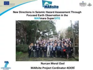
Data integration and dissemination in the MARsite project John Douglas (WP10 leader) j.douglas@brgm.fr
Diverse data types (examples) Final products (e.g. hazard maps) Geological maps Bathymetry Earthquake catalogues Fault maps Remote sensing images Monitoring networks
Data dissemination in MARsite • Classic approach: • Dissemination of (raw) data principally to researchers • Via KOERI server (TUBITAK back-up) (already installed) • Transfer of large quantities of data • Data downloaded and stored locally • Visualisation and analysis conducted locally • Modern approach (focus of today): • Dissemination of (processed) data to wider community • Via web services provided by data providers • Data remains with data providers • Visualisation (and basic analysis) via web portal • Facilitates combining information from different sources
Existing standards, models and formats Architecture & Data Committee GEOSS Broker MARSITE Information System Components Standards Recommendations Standards: WMS, WFS, CSW, Metadata SWE, O&M, SOS Data models QuakeML StationXML SensorML Data formats SEED, Rinex .shp, .kml .xls, .txt
GEOSS components AIP Baseline Main GEO Web Site GEOSS Common Infrastructure Registered Community Resources GEO Web Portal Client Tier Registries Community Portals Client Applications Components & Services Standards and Interoperability Discovery Broker Mediation Tier Best Practices Wiki Portrayal Servers Community Catalogues Workflow Management GEOSS Clearinghouse User Requirements User Management Processing Servers Access Brokers Test Facility Semantics Access Tier GEONETCast Data Servers Sensor Web Servers Model Web Servers
Proposed MARSite architecture Client layer • MARSite Registries: • Components • Standards • Best practices • Vocabularies • Objects dictionary • Portrayal rules • … MARSite Portal Process layer Catalogue Workflow management User management Existing Infrastrucutures to be connected Portrayal servers Processing servers Access brokers Access layer Data servers Sensor Web servers Model Web servers
Proposed MARSite architecture Many providers delivering various data types, sensors, formats, … Harmonisation layer for data, maps, sensors WP2: Long-term land-based data MARSITE Pilot Data WP3: Data from long-term continuous geodetic monitoring of crustal deformation Standard Web Services to view, access, process data Maps Discovery service WP4: Borehole data Catalogue of resources Sensor information WP5: Real-time data from seismological networks WP6: Data from sea-based instruments Resources described by their metadata Harmonisation should be made at the providers side (or for performance reasons in a central repository)
Easy web services • Survey of partners recently conducted • Very few (e.g. BRGM, ESA) have available web services • Few partners have IT capabilities to install them • Plan to use InGeoCloudS to facilitate their creationhttp://www.ingeoclouds.eu/ • Creates WMS and WFS from existing files (e.g. .shp) • Semi-automatic process but can be tailored by user
Benefits of modern approach • To use the ProMine WMS, click the button (Add external layers) And it is still possible to get information about a deposit Enter the WMS URL in the text box and click Submit: the system displays the list of available layers http://portal.onegeology.org/
Data integration and dissemination in the MARsite project • Your comments and ideas for collaboration between projects are most welcome, please email: John Douglas (j.douglas@brgm.fr). Thanks.