Download
1 / 23
240 likes | 372 Views
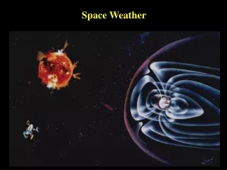
Towards Reducing the Space Weather Impacts on Vulnerable Infrastructure (ground technology) L. Trichtchenko, D.H. Boteler Geomagnetic Laboratory Natural Resources Canada presented by R. Pirjola FMI, Finland. OUTLINE OUR CONCERN: GROUND INFRASTRUCTURE. Introduction Cost of the problem

E N D
Towards Reducing the Space Weather Impacts on Vulnerable Infrastructure(ground technology) L. Trichtchenko, D.H. BotelerGeomagnetic LaboratoryNatural Resources Canadapresented byR. PirjolaFMI, Finland
OUTLINEOUR CONCERN: GROUND INFRASTRUCTURE Introduction Cost of the problem Questions Where the effect might occur? When it will happen? How large it might be? Answers Climatology Forecasts Case studies
INTRODUCTION $$$$$$$$ Directional Drilling, magnetic surveying Direct response to magnetic variations Airborne magnetic survey $100 per acre (~ 500 acres/day) http://www.estcp.org/Technology/MM-0031-VFS.cfm Directional drilling~ $60 to $300 per meter http://www.frtr.gov/matrix2/section4/4-36.html Power Systems: immediate response to GIC March 1989 storm: Direct costs Hydro-Quebec > 10 M$ PSE&G New Jersey ~ 8M$ http://www.magazine.noaa.gov/stories/mag131.htm Pipelines: Direct effect on pipeline testing 2-5M$/year http://ops.dot.gov/whatsnew/2002/ Gas_IMP_reg_eval_DRAFT_062102.htm cumulative response, enhanced corrosion Direct cost of corrosion rapture in one pipeline in North America ~100M$ http://www.corrosion-doctors.org/Pipeline/Introduction.htm
UK North America Europe 1.Where the effect might occur? Geographic location DMSP Images of aurora on 30 October 2003
3. When it will happen? BIG QUESTION Forecasts are mostly qualitative “in the next two-three days something can be expected…” SOMETIMES FORECASTS ARE BETTER (SEE BELOW FOR OCTOBER 2003), OTHER TIMES ARE FAR FROM BEING GOOD ?
3. How large it might be? Time, Location, System-dependent Case 2: Magnetic storm November 2004 Range 4000mV, Australian pipeline Case 1: Magnetic storm April 2001 Range 700 mV-1600mV Canadian pipeline INDUSTRY STANDARDS Potential of -0.850 V to –1.150 V at the pipe steel/earth interface Safe range 500 mV
Statistical (climatological) telluric hazard assessment for pipelines in Canada Need: request from industry and government
Steps • Part I geophysical • Statistics of geomagnetic variations • Establishment of activity levels for different locations • Local layered earth models/possible evaluation • Statistics of telluric variations • Telluric activity levels • Production of statistical maps • Part II industry-specific • Modelling the pipeline and corrosion protection system • Assessing the “weak points” of given pipeline • Part III complete assessment • Integrate pipeline and telluric assessments together
Part I geophysical • Statistics of geomagnetic variations • Establishment of activity levels for different locations • Local layered earth models/possible evaluation • Statistics of telluric variations • Telluric activity levels • Production of statistical maps
Geomagnetic Activity- Hourly Range Index used Annual HRX, Y,Z Auroral Zone Annual HRX,Y,Z Sub-Auroral Zone Activity Levels: Quiet level:chosen 40 nT (95% time in Ottawa) Unsettled: 300nT (95% in Yellowknife) Active: 600 nT Stormy: above 600 nT
Assessment of annual geomagnetic activity based on hourly range index
Area of interest: auroral zone (red circle) Only one magnetic observatory: YKC (Yellowknife)
Layered Earth models of area give surface impedances (plot below), Combined with geomagnetic data to model telluric activity Question: do these models give any difference in statistical evaluation of telluric activity
Telluric Activity: Hourly Standard Deviation (HSD) and Hourly Maximum Amplitude (HMA) Indices were established Quiet level chosen 20 mV\km (95% time in Ottawa) Unsettled 140 mV per km (95% in Yellowknife) Active 300 mV per km Stormy above 300 mV per km Hours of exceedance above certain levels Statistically Zone 4 and 5 are the same, Thus only two surface models (4,5) did not give significant differences.
Results of this work became part of Canadian Atlas of Hazards (together with landslides, floods, seismic activity) Geomagnetic activity map
Results of this work became part of Canadian Atlas of Hazards (together with landslides, floods, seismic activity) Telluric activity map
Results of this work became part of Canadian Atlas of Hazards (together with landslides, floods, seismic activity) Zoom-in option, major pipeline and power systems are also shown
Part II industry-specific • Modelling the pipeline and corrosion protection system • Assessing the “weak points” of given pipeline • Problem: • Specifications of pipeline and corrosion protection system are proprietary information • Generic results are shown.
DSTL model of pipeline applied Color-coded is pipe-to-soil potential difference (PSP) distribution along the pipeline increased where there is non-uniformity in pipeline electrical conductivity HIGH PSP LOW PSP N S Y - parallel admittance Z - series impedance E – driving electric field “GENERIC” PSP DISTRIBUTION ALONG PIPELINE
Part III complete assessment • Integrate pipeline and telluric assessments together
Part III complete assessment Integrate pipeline and telluric assessments together
Part III complete assessment Integrate pipeline and telluric assessments together
CONCLUSIONS Assessment of space weather hazards can be done in two stages 1. Space weather environment (general, using scientific, open data) 2. Assessment of infrastructure vulnerability (requires specific, proprietary information) References: P.Fernberg, L.Trichtchenko, D. Boteler and L. McKee, Telluric hazard assessment for northern pipelines. Paper 07654, NACE International, Houston, 2007 (open publication). D. Boteler, L. Trichtchenko, P. Fernberg, Report to private company, will be open to general public in 2008