Download
1 / 23
230 likes | 363 Views
The Idaho National Hydrography Dataset (NHD) announces key updates and new tools aimed at improving hydrography management. In early 2024, we expect the official release of new GeoEdit tools currently in beta testing. An ongoing moratorium on NHD and Watershed Boundary Dataset (WBD) check-outs is in effect as we prepare for these upgrades. Collaboration with Natural Resources Canada is underway for US-Canada-Mexico harmonization. Stakeholders are invited to provide feedback on tool functionality and areas for updates. Stay engaged for future developments and support.

E N D
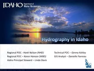
Hydrography in Idaho Regional POC - Hank Nelson (NHD) Technical POC – Genna Ashley Regional POC – Karen Hanson (WBD) GIS Analyst – Danielle Favreau Idaho Principal Steward – Linda Davis
National Hydrography Dataset News • New GeoEdit Tools • Beta Testing Now • Official Release – Feb/Mar (Tentative) • Current Moratorium on Check-outs
NHD GeoEditing Tools NHD Metadata Editing Form
National Hydrography Dataset News • New GeoEdit Tools • Beta Testing Now • Official Release – Feb/Mar (Tentative) • Current Moratorium on Check-outs • Additional Tools • Hydro Event Management Tools (HEM) • Conflation Tool • NHD Data Model Update • Version 2.1 • Com-id will be replaced by Permanent_Identifier • M-value fix • Goal is to simplify tools • US-Canada-Mexico Harmonization • Working with Natural Resources Canada (NRCan) • Available for Download for Idaho Subbasins • National Efforts • USGS National Water Information System (NWIS) Pilot • “Pour-point” Project • Fixing Linework Connectivity
Watershed Boundary Dataset News • WBD Tools • Version 2.1 – Beta Testing • USGS is taking over serving the Dataset from NRCS in • March (estimate) • Current Moratorium on check-outs
WBD Editing Tools WBD Metadata Editing Form
Watershed Boundary Dataset News • WBD Tools • Version 2.1 – Beta Testing • USGS is taking over serving the Dataset from NRCS in • March (estimate) • Current Moratorium on check-outs • Integration of WBD names/codes into GNIS (Gazetteer) • US-Canada-Mexico Harmonization
Watershed Boundary Dataset News • WBD Tools • Version 2.1 – Beta Testing • USGS is taking over serving the Dataset from NRCS in • March (estimate) • Current Moratorium on check-outs • Integration of WBD names/codes into GNIS (Gazetteer) • US-Canada-Mexico Harmonization • Finalized 8-digit are complete • 10 and 12-Digit Along Canada – BC review • 2011 Standards – Version 3.0 • Expanded modification field domain • Enhanced Definitions • Addressed inconsistencies, clarifies processes • Added 14 and 16-digit guidance • Added requirements for Metadata and Line Smoothing
How are you using the NHD and/or WBD? • What functionality do you need? • What areas would you like to have updated?
NHD/WBD 2011 Management Team Meeting Guidance for the Future Data Design Stewardship / Maintenance Events / Linear Referencing Network / Flow / Analysis Data Delivery NHDPlus / Hydro-Elevation Integration
2011 Projects • Update NHD in IDWR Critical Areas • Update Stream Classification in High Res NHD • NHDPlus Tools Test in Idaho • Develop an Internet Application for • Point and Line Events
Update NHD in IDWR Critical Areas • Managed Recharge • ESPA • Four Subbasins • 17040212 • 17040219 • 17040220 • 17040221
Update Stream Classifications in High Resolution NHD
NHDPlus Tools Test in Idaho 170103010502 Butte Gulch-Prichard Creek 5 Errors • Criteria: • One Mountainous • One Low-relief, Agricultural, Closed Basin • One Mix of Rural, Urban and Agricultural Uses 170402091104 Town of Kimama 20 Errors 170402091306 Snake River-Burley 67 Errors * 2 Severe
Develop an Internet Application that will allow Stakeholders to Provide Point and Line Event Edits To State Stewards 1 2 3
Develop an Internet Application that will allow Stakeholders to Provide Point and Line Event Edits To State Stewards
Edits to the NHD/WBD Need to go through the State Stewards • Different Levels of tools are available….. • Experienced GIS – Learn the GeoEdit Tools and perform the edits • Use if hydrography is part of your daily or weekly workflow. • Experienced GIS/Some GIS – Either GeoEdit Tools or IDWR Editing Tool • Use for an occasional project or update, no long-term • maintenance needed. • Little or No GIS – Use either the IDWR Editing Tool or the Online Editor • Edits are made and POC takes the info and incorporates it. • Can also use paper maps; IDWR can supply maps to cooperators.
Idaho NHD / WBD Contacts: Linda Davis, Principal Data Steward Linda.Davis@idwr.idaho.gov Genna Ashley, Technical Point of Contact Genna.Ashley@idwr.idaho.gov Danielle Favreau, GIS Analyst Danielle.Favreau@idwr.idaho.gov Scott Van Hoff, Geospatial Liaison svanhoff@usgs.gov Hank Nelson – USGS POC – Region 1 hpnelson@usgs.gov Karen Hanson – USGS WBD Coordinator khanson@usgs.gov
NHD.usgs.gov www.nrcs.usda.gov/wps/portal/nrcs/main/national/water/watersheds/dataset www.idwr.idaho.gov/GeographicInfo/NHD/default.htm