Download
1 / 19
190 likes | 292 Views
Promoting water quality monitoring and assessment through a common data repository for sustainable water resource management in the Piceance Basin region. Collaborative project involving various stakeholders and innovative strategies.

E N D
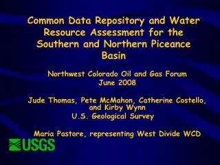
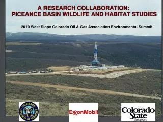
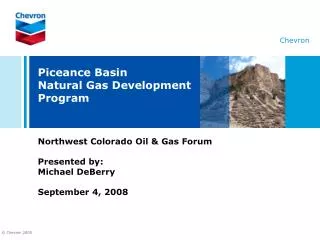
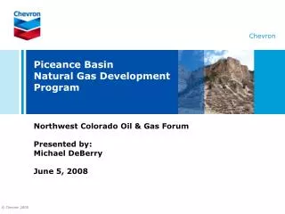
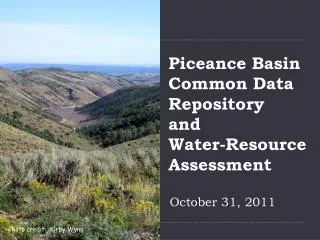
Piceance BasinCommon Data Repository and Water-Resource Assessment October 31, 2011 Photo credit: Kirby Wynn
PRESENTATION • Phase I • Data repository / Website / Screen snapshots • Phase II Vision
PROJECT NEED • Large-scale energy development in Piceance Basin • Identify potential impacts of natural and human factors affecting local water resources • Share water-quality data, make available to the public • Water quality monitoring and assessment is necessary to define baseline conditions for future monitoring, planning, conservation & management of water resources
PROJECT PARTICIPANTS • U.S. Geological Survey • Colorado DOLA grant, Northern & Southern Piceance • Bureau of Land Management • Colorado Oil & Gas Conservation Comm. • Shell Oil Company • Encana Oil & Gas (USA) Inc. • Williams Production • Chevron • Berry Petroleum • Petroleum Development Corp. • Genesis • American Shale Oil LLC • Marathon • West Divide Water Conservancy District • Colorado River Water Conservation District • Garfield County • Delta County • Rio Blanco County • City of Grand Junction • City of Rifle • Town of De Beque • Town of Carbondale • Town of Silt • Town of Rangely • Town of Palisade • Town of Parachute
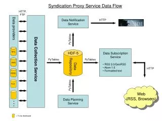
PROJECT OBJECTIVES • Develop web-accessible common data repository that provides energy operators, researchers, consultants, agencies, and interested stakeholders equal access to the latest information • Evaluate existing water-resources data for uniformity • Perform and publish a baseline assessment of available water-resources data • Develop regional monitoring strategies to more economically fill data gaps by reducing duplication of effort while still meeting regulatory requirements
PHASE I APPROACH • Assemble existing data from public and private sources • Create relational database, standardize data, and make database accessible via internet • Perform baseline assessment of available water resource data • Develop regional monitoring strategies
STUDY AREA • Northern and Southern Piceance Basin • Structural Basin/ Hydrologic / Political Boundaries define study area • Garfield, Delta, Mesa and Rio Blanco Counties
BENEFITS • Public Outreach • Education and Transparency • Management • Improved understanding will lead to better management tools and effective best-management practices • Inform monitoring programs • Economic • Internally consistent database • Reduce data compilation/manipulation time
PRODUCTS • Common Data Repository and Web Interface http://rmgsc.cr.usgs.gov/cwqdr/Piceance/index.shtml • Assessment reports of baseline hydrologic conditions • Groundwater Reports • Use of Diverse Geochemical Data Sets to Determine Sources and Sinks of Nitrate and Methane in Groundwater, Garfield County, Colorado, 2009. By P.B. McMahon, J.C. Thomas, and A.G. Hunt • Overview of Groundwater Quality for Select Constituents in the Piceance Study Area, 1946-2009, western Colorado. By J.C. Thomas and P.B. McMahon
PRODUCTS • Assessment reports of baseline hydrologic conditions • Surface water reports • Characterization and Data-Gap Analysis of Surface-Water-Quality in the Piceance Basin, Western Colorado, from 1959-2009 • Recommendations for regional monitoring for groundwater and surface water
PHASE II APPROACH • Continue to provide a publically accessible, useful and current water resource tool for the community • Phase II designed to be sustainable and cost-effective • Colorado River District fiscal agent • Employ Colorado Data Sharing Network (CDSN)
QUESTIONS Database and Web Interface completed August 2009 Accessible through the Project web site: http://rmgsc.cr.usgs.gov/cwqdr/Piceance/index.shtml