Download
1 / 15
150 likes | 282 Views
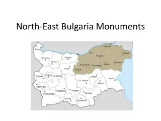
North-East Bulgaria Monuments. Balchik Botanical Garden.

E N D
Balchik Botanical Garden The Botanical Garden is the main attraction in town of Balchik. Its 10 hectares surround the small summer palace of the Romanian Queen Marie. The gardens are set on a steep hillside, and descend in 6 terraces to the sea - supposedly one for each of the Queen`s children. There are over 3000 varieties of shrubs, roses and flowers, set among streams, waterfalls, and ornamental channels. Location: Balchik ; Longtitude: 28.14824402 Latitude: 43.40392115
Madara Horseman The Madara Horseman (or The Madara Rider) is one of the symbols of Bulgaria. The site is located near village of Madara (several kilometers from town of Shumen in North-Eastern Bulgaria). It is an early medieval carved rock relief depicting the life-size forms of a horseman and an eagle, trailed by a running dog and a speared lion caught beneath the crushing hooves of the horse. The composition symbolizes the victory over the enemy and triumphant scenes are reminiscent of the ancient Thracian artistic traditions. Inscriptions in Greek on either side describe facts from the early history of the Bulgarian state. The monument is dated back to circa 710 AD and is related with regime of Khan Trevel. The object is included in the UNESCO World Heritage List since 1979 and in 2009 was declared a "National Symbol of Bulgaria“. Location: MadaraLongtitude:27.11882830 Latitude: 43.27814264
Monument Founders of the Bulgarian State Monument "Founders of the Bulgarian State" (aka "1300 years Bulgaria") was built in 1981 to celebrate the 1300th anniversary of the Bulgarian State. It is situated on a plateau above the town of Shumen and its silouette can be seen from a distance between 20 - 30 kilometres. Memorial recreates the important moments of Bulgarian history VII to X centuries. It is composed of 8 concrete elements, forming two semi-opened halls. - The 1st hall represents the pagan period. The statue I of Khan Asparuh. Here he is represented in the moment when he stuck his sword into the ground and said; "Here to be Bulgaria, under this sky, on this land`. Тhe 2nd hall is called the "Golden Age" and is related with the period when Bulgaria becomes 3-th country in Europe. There are three mosaics that develop the idea of the people`s contribution to the history. The first one (on the right side) represents a scene of victory - a Khan and his soldiers. The second one (in the middle) - the adoption of Christianity and the third reveals the educational mission of Cyril and Metodious who created the slavic alphabet. Location: Shoumen Longtitude: 26.92225456 Latitude: 43.26220620
VelikiPreslav The National Reserve of History and Architecture with a museum called "VelikiPreslav" is situated on the ruins of the Old Bulgarian capital VelikiPreslav (893-972) and it covers about 500 hectare of its area. VelikiPreslav was designed and built by its founders as one magnificent city worthy of being a competitor of the Byzantine capital Constantinople. Among them there are masterpieces like Saint Theodore`s icon, the Golden Treasure of Preslav, and the Ceramic Iconostasis of the Palace Monastery. The museum owns one collection of lead stamps which is unique by its character - it is the biggest in the world and was found during the excavations of the administrative building in the Palace Center. The collection of epigraphicalrecords is also extremely valuable - which is one indisputable proof of the high achievements and educational activity of the Preslav Literary School.
Shumen Fortress Rising three kilometers west of the city of Shumen is the Shumen Fortress which has existed more than 3200 years. During early and late middle ages the Shumen Fortress was Bulgarian maintained and played an important role in the history. During 1444, bout the time of the crusade march of Vladislav III Yagelo, the fortress was destroyed and burned down. The Fortress is one of the most explored archaeological sites in the country. The fortress and the cultural architecture, homes and thousands of movable monuments bear record of the diverse functions during the different periods, predominantly during the time of the second Bulgarian kingdom. Today the Shumen fortress is exhibited as an open-air museum.
Pobititekamani - Beloslav The natural attraction PobitiKamаni ("The Stone Forest" or "The Driven Stones") is located in the western part of Varna lowland between the town Beloslav and the villages Strashimirovo, Slunchevo, Banovo and Povelyanovo (a railway station near Devnya) and has a total area of 50 km2. The phenomenon consists of cylindrical stone columns fixed in a small desert. The stone columns have porous surface and rise to 5 - 6 meters in high and from 0.3 to 3 meters thick. They are built of limy sandstones, containing many fossils - mussels, snails. The majority have a smaller or bigger cavity, some are horizontally cracked. The site of PobititeKamani was declared natural landmark in 1937
Temple of Great Mother Goddess Cybele - Balchik The temple is next to Balchik and was active for 700 years. There are performed rituals even 100 years after accepting of the Christianity. Based on the found inscriptions, documents and coins it was defined that the temple of Cybele was built in the III-th century BC and is a part of the ancient city Dionysopolis, which was located in the borders of present town of Balchik About Cybele: The goddess Cybele is originally from Anatolia. She was a deification of the Earth Mother and has been worshipped since Neolithic times. Location: Balchik Longtitude: 28.16794750 Latitude: 43.40579190
AladjaMonsatry - Varna Aladja monastery is one of the few preserved and accessible rock monasteries in Bulgaria. It is located 14 km in north-east direction from the city of Varna, close to the Black Sea resort of Golden Sands. The monastery was established in XI-XII-th century when the hermits first inhabited it. Monastic cells and a small church have been dug into a 25-m high vertical carst cliff near the upper edge of the Franga plateau on several levels. The complex also includes two small nearby catacombs. The name of monastery originated from the Turkish word for colourful "aladjha" ("aladja"). Several brightly coloured 13th-14th century frescoes are still discernible on its walls. Location: Varna Longtitude: 28.01831200 Latitude: 43.27789300
Pliska The ancient Pliska was the capital of First Bulgarian state since foundation of Bulgaria in 681 by Khan Asparuh (according to the most popular version) till 893. After years of archaeological research, at an area of 23 km were discovered and restored the remains of an "external" and an "internal" town, a Throne Room, a small palace, pagan temple, palace church, water storage, bathrooms, industrial and residential buildings and an impressive cathedral (The Great Basilica - 1,5 km from the East Gate of the fortress). Location: Pliska Longtitude: 27.13449240 Latitude: 43.38749139
DineyaFortress The fortress of Dineya dates from the first half of IV century. It was a Roman road station between Abritus (Razgrad) and Martianopolis (Devnya), which gradually grew into an important fortress used to stop the frequent barbarian invasions from the north. Archaeological researches of region discovered that in III - V century the castle was repeatedly destroyed and ruined to the ground by Goths, Huns and Slavs. The Fortress Denneya was in an irregular pentagonal shape. There were 14 towers on the fortress walls shaped in harp and a semicircular. The second wall was at a distance of 3 to 9 meters from the north wall and was 1.8 meters thick. It is built of medium-sized blocks, bound with white mortar. Location: Voyvoda Longtitude: 27.14457750 Latitude: 43.46052777
Kaliakra Fortress The fortress Kaliakra is located at Cape Kaliakra at north coast of the Bulgarian Black Sea. The earliest finds were dated to the IV cent. B.C., when the cape was inhabited by the Thracian tribe "Tirizis", which gave the first name of the fortress - Tirizis. The period of greatest prosperity of Kaliakra is the second half of XIV century, when it is a capital of the principality Karvuna leaded by Bulgarian rulers Balik and Dobrotitsa. Kaliakra is one of the last Bulgarian lands fell under the Ottoman yoke. Location: Bulgarevo Longtitude: 28.46546888 Latitude: 43.36145972
Yailata The Archaeological Reserve Yailata covers an area of 300 000 m2 and is a large ledge near the sea, from which is separated by cliffs with a height of 50-60 meters. At the area of Yalata there are many interesting historical sites dating from different eras of human existence - from 6 millennium BC until the XI century – “the cave city" from 101 cave dwellings dated to the period around the 5th millennium BC, an Early Byzantine fortress from the V century, numerous caves used during the Middle Ages as a monastery complex, Thracian necropolis and others. Yalata area was declared an architectural reserve in 1989. Location: Kamen bryag Longtitude: 28.54813457 Latitude: 43.44025738
Petrich Fortress Fortress "Petrich Kale" (or "Petricha") was an important fortress in the defense system of the medieval Bulgarian state. It is located 4 km.north of the village of Avren and a 1 kilometer east of the the railway station of Razdelna on Varna-Sofia railway line. The castle dates from the V-th century but for a certain period was destroyed and rebuilt again in XI-XII century. In addition to Bulgarian, the "Petrich Kale" fortress is associated also with the Czech, Polish and Hungarian history. During the last crusade the United Christian armies under the leadership of the Polish-Hungarian king Vladislav III JagielloVarnenchik on November 7, 1444 the fortress was conquered and destroyed. Location: Razdelna Longtitude: 27.64356494 Latitude: 43.16309581
Krepcha Rock Monastery The Rock Monastery near village of Krepcha was founded in the Middle Ages, probably in X-th century during the reign of King Simeon the Great. It is located 2 km south-west of center of Krepcha, at the right side of the way to the village of GolyamoGradishte. The monastery complex includes a church, a church-tomb and monastic cells, built into the cliffs on three levels (terraces). On the walls of churches and cells was found carved Cyrillic and Hebrew letters and runic signs and drawings. For one of the inscriptions is presumed it is the oldest inscription in Cyrillic found on the Balkans. The rock monastery near the village of Krepcha is declared a monument of culture. Location: Krepcha Longitude: 26.10845625 Latitude: 43.46602161