Download

1 / 200
2.5k likes | 4.37k Views
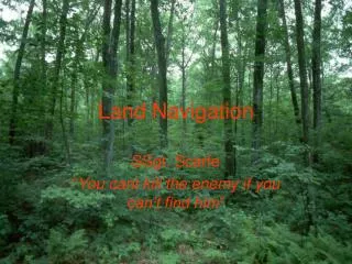
Land Navigation. WTT 12 & 13. Task : 071-329-1000 Identify Topographic Symbols on a Military Map Conditions: Given a standard 1:50,000-scale military map. Standards: Identify topographic symbols, colors, and marginal information on a military map with 100 percent accuracy. .

E N D
Land Navigation WTT 12 & 13
Task: 071-329-1000 Identify Topographic Symbols on a Military Map Conditions: Given a standard 1:50,000-scale military map. Standards: Identify topographic symbols, colors, and marginal information on a military map with 100 percent accuracy.
COLORS USED ON A MAP Black: Man-made features Blue: Water features Brown: Relief features and elevation on older or red-light readable maps Green: Vegetation Red: Man-made features Red-Brown: Cultural features and non-surveyed spot elevations Other: Occasionally other colors may be used to show special information and if used will be noted in the marginal information.
Check On Learning 1. What does the color red indicate on a military map? Major roads and built up areas 2. Where is the legend found on a military map? Lower left corner
Performance Measures 1. Identified the sheet name. 2. Identified the sheet number. 3. Identified the contour interval. 4. Identified the G-M angle (mils or degrees). 5. Identified the legend. 6. Identified the bar scales. 7. Identified the declination diagram. 8. Identified the grid reference box. 9. Identified the adjoining map sheets diagram. 10. Identified the elevation guide. 11. Identified 2 of 2 specific man-made features (shown in black on the map). 12. Identified 2 of 2 water features (blue on the map). 13. Identified 2 of 2 vegetation features (green on the map). 14. Identified 2 of 2 man-made features, for example, main roads or built-up areas (brown or red-brown on the map). 15. Identified 2 of 2 contour lines (brown or red-brown on the map).
Task: 071-329-1001 Identify Terrain Features on a Map Conditions: Given a standard 1:50,000-scale military map. Standards: Identify the five major and three minor features on the map.
Terrain Features Five Major • Ridge • Hill • Saddle • Valley • Depression Three Minor • Draw • Spur • Cliff Two Supplemental • Cut • Fill
Cut I
Check on Learning What are the five major terrain features? Ridge, Hill, Valley, Saddle, and Depression What are the three minor terrain features? Draw, Spur, and Cliff
Check on Learning Find all major and minor terrain features.
Performance Measures • Identified terrain features – GO / NO GO
Task: 071-329-1004 Determine the Elevation of a Point on the Ground Using a Map Conditions: Given a standard 1:50, 000 scale military map, a pencil, and a designated point on the map. Standards: Determine the elevation of the designated point to within half the value of the contour interval.
Contour Lines On a map these lines are brown.
Uniform, Gentle Slope Insert figure 10-6
Contour lines around a slope Insert figure 10-6