Download
1 / 26
260 likes | 348 Views
Explore the policy and technical aspects of GEOSS, a distributed system leveraging international cooperation for comprehensive, accurate Earth observation data. Discover the societal benefits and technical advancements of GEOSS in improving global observations.

E N D
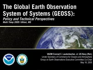
The Global Earth Observation System of Systems (GEOSS):Policy and Technical PerspectivesMulti Temp 2005 | Biloxi, MS VADM Conrad C. Lautenbacher, Jr. US Navy (Ret.) Under Secretary of Commerce for Oceans and Atmosphere Group on Earth Observations Executive Committee Co-Chair May 16, 2005
Presentation Outline • The Global Earth Observation System of Systems (GEOSS) Overview • Policy Perspectives • Technical Perspectives • Recent Events and the Way Forward
What is GEOSS?Technical Perspective An end-to-end system of existing systems (both in situ and remote sensing observation platforms) linked with new systems
What is GEOSS?Policy Perspective • GEOSS is a distributed system of systems built on current international cooperation efforts among existing Earth observing and processing systems • GEOSS is • Comprehensive—observations and products from all components • Coordinated—leverages contributing members resources • Sustained—by will and capacity of all members • GEOSS enables the collection and distribution of accurate, reliable Earth Observation data, information, products, and services to both suppliers and consumers worldwide—through an end-to-end process
Why GEOSS?Social, Economic, & Science Imperatives • The Ocean as an example: • Better observations—tide gauges, buoys, sensors—will allow us to forecast with more accuracy allowing us to get our coastal communities more effective warnings • More than half the world’s population lives within 60 km of the shoreline, & this could rise to 3/4 by the year 2020 • More than 90% of natural disaster-related deaths occur in developing countries • 25% of Earth’s biological productivity & an estimated 80-90% of global commercial fish catch is concentrated in coastal zones • Worldwide agricultural benefits of better El Niño forecasts are conservatively estimated at $450-$550M/year
Presentation Outline • The Global Earth Observation System of Systems (GEOSS) Overview • Policy Perspectives • Technical Perspectives • Recent Events and the Way Forward
Policy Challenges • Harnessing the political will of nearly 60 countries • Incorporating over 40 international organizations such as IOC, WMO, ISDR and UNEP • These organizations – even different U.N. agencies - don’t always talk to each other • GEO offers a mechanism for coordination
GEOSS Overview EOS I • EOS I • July 31, 2003, Washington, D.C. • 34 Countries + 20 International Organizations • EOS II • April 25, 2004, Tokyo, Japan • 43 Countries + EC + 26 International Organizations • EOS III • February 2005, Brussels • 60 Countries + EC + 34 International Organizations • 10-Year Implementation Plan • Commerce Secretary Gutierrez led the US delegation EOS II EOS III
GEO IGeneva, Switzerland • First meeting of new GEO at WMO headquarters on May 3-4 • Iceland recognized as newest member of growing effort • GEO agreed to 12 member Executive Committee • Africa (2), Americas (3), Asia and Oceania (3), Commonwealth of Independent States (1), Europe (3) • Co-Chairs: US, EC (developed); China, South Africa (developing) • Tsunami Update – IOC
3 1 3 2 3 Americas Europe Africa Asia/Oceania Brazil Honduras USA European Commission Italy Germany South Africa Morocco China Japan Thailand Commonwealth of Independent States GEO Executive Committee Russia
GEO ExCom Initial Meeting • Immediately after GEO I (June, Geneva) • Establish Functions and Roles • ExCom = Working Body / GEO = Decision Body • Set Up Committee Structure • S&T Mechanism • User Interface Mechanism • Architecture • Data Policy
Public Engagement is a Priority • Public Engagement Workshop—Continuing the Dialogue • Washington, DC, May 9-10 • +400 attendees from all sectors • Discussion of Societal Benefit Areas • Discussion of Near Term Opportunities Integration Frameworks • Data Management • Improved Observations for Disaster Warnings • Global Land Observing System • Sea Level Observing System • National Integrated Drought Information System • Air Quality Assessment and Forecast System
Presentation Outline • The Global Earth Observation System of Systems (GEOSS) Overview • Policy Perspectives • Technical Perspectives • Recent Events and the Way Forward
Technical Advancements…Geostationary Satellites CIMSS Much improved spatial and temporal coverage Current GOES Sounder coverage in one hour GOES-R: New generation of current U.S. geostationary operational environmental satellite (GOES) series GOES-R HES Sounder coverage in one hour
Technical Advancements…Polar Satellites • NPOESS: National Polar-Orbiting Operational Environmental Satellite System • Advanced imager offers near-constant resolution across scan • Additionally, VIIRS brings a great increase in multispectral channels OLS AVHRR VIIRS 2 6 22
… Bring Technical Challenges • Data Management Needs • New Systems mean 100-fold increase in data • Current systems already face challenges • Development of browser and visualization systems— underpinned by core geospatial technologies • Interoperability through protocols and standards
Architecture Needs • Support for a range of implementation options • Addressing planned, research and operational systems • Interfaced capabilities through interoperability specifications • Inclusion of metadata and quality indicators • Continuity of observations, and instigation of new observations • Building on existing systems and historical data • In U.S., focus on Federal Enterprise Architecture Framework
Architecture Targets: GEO • Within two years, GEOSS will: • Advocate formal commitments of contributions by GEO Members and Participating Organizations • Produce a publicly accessible, network-distributed catalogue • Establish and maintain a process for reaching interoperability arrangements • Advocate use of existing Spatial Data Infrastructure (SDI) components as institutional and technical precedents • Develop a cost-and-benefit-sharing mechanism(s) for observations
Presentation Outline • The Global Earth Observation System of Systems (GEOSS) Overview • Policy Perspectives • Technical Perspectives • Recent Events and the Way Forward
The Indian Ocean Tragedy Frequent Question: Why did it happen?
Why Observations Matter • After-the-fact data from research altimeter shows tsunami as it propagated in the Indian Ocean • Chart shows actual observation (in black) compared with model (in blue) • Models have much room for improvement
To Get Involved… • Alliance for Earth Observations • Serves as a communication link between the industrial, non-governmental, academic and governmental sectors; • Encourages broad participation in the development of a national strategy for Earth observations • http://www.strategies.org/alliance • For more information on on the U.S. Group on Earth Observations: • http://iwgeo.ssc.nasa.gov