Download
1 / 8
80 likes | 226 Views
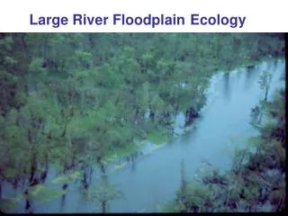
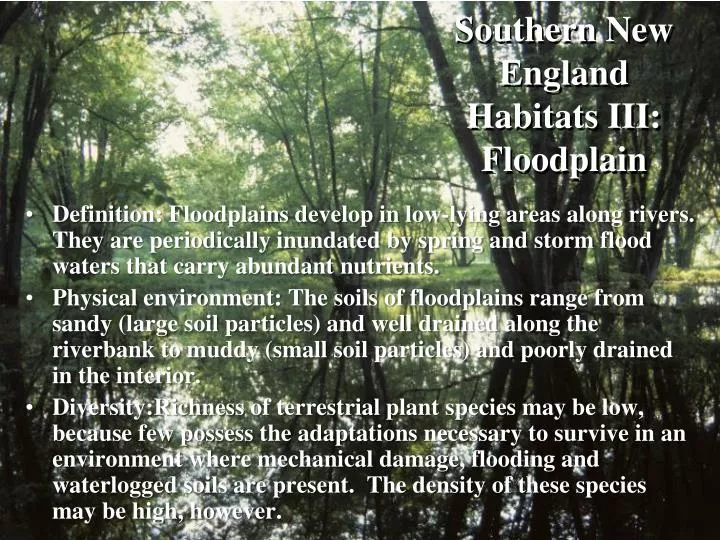
Southern New England Habitats III: Floodplain. Definition: Floodplains develop in low-lying areas along rivers. They are periodically inundated by spring and storm flood waters that carry abundant nutrients.

E N D
Southern New England Habitats III: Floodplain • Definition: Floodplains develop in low-lying areas along rivers. They are periodically inundated by spring and storm flood waters that carry abundant nutrients. • Physical environment: The soils of floodplains range from sandy (large soil particles) and well drained along the riverbank to muddy (small soil particles) and poorly drained in the interior. • Diversity:Richness of terrestrial plant species may be low, because few possess the adaptations necessary to survive in an environment where mechanical damage, flooding and waterlogged soils are present. The density of these species may be high, however.
Topography: the Riverbank and Levee The bank is where the river meets the land. Because river water is moving, it is a high energy environment. River water deposits larger soil particles along the bank, and floodwaters deposit sands in a mound several feet high, the levee, directly behind the bank and paralleling the river.
The Flat • Interior soils are generally high in nutrients but waterlogged and low in oxygen. • An impervious soil layer, a hardpan, may develop that keeps water near the soil’s surface. • Tree species capable of tolerating wet soils and spending weeks underwater predominate in this environment. • Shrubs are often sparse due to drowning and mechanical damage from flooding. Herbaceous plants can occur densely, however.
The Slough • In areas of lower microelevation, water may persist after other portions of the floodplain have drained of floodwaters. • Such areas typically show delayed development of herbaceous vegetation.
Floodplain Marshes • In more extensive regions of lower microelevation, permanent standing water may prevent most tree and shrub growth. • In these areas, a marsh community dominated by herbaceous plants develops. • Typical marsh plant species include river bulrush, water horsetail, tuckahoe (foreground), cattail (background) and bullhead lily.
Plant Diversity • The moist, rich, well-drained and sandy soils of the bank and levee are vegetated by tree species like eastern cottonwood, American sycamore (lower left), American linden, shagbark hickory, bitternut hickory, river birch and white ash (upper left). • The waterlogged clay and silt soils of the flat are dominated by species that tolerate these conditions like red maple, slippery elm, silver maple (upper right), green ash, pin oak (lower right) and swamp white oak.
Adaptations • Many tree species produce seeds in early spring so that they may be dispersed by floodwaters. • Trees often are multi-trunked and with shallow root systems, which help them to cope with floodplain conditions. • Herbaceous species may initiate growth late in the season to compensate for spring flooding of the habitat.