Download
1 / 41
410 likes | 553 Views
Asia Pacific Satellite Applications Training Seminar - 2002. WMO SATELLITE ACTIVITIES (WMOSA). Dr Donald E. Hinsman Senior Scientific Officer. World Meteorological Organization. WMO and UN - Historical Background. Aug 1853 First International Meteorological Congress

E N D
Asia Pacific Satellite Applications Training Seminar - 2002 WMO SATELLITE ACTIVITIES (WMOSA) Dr Donald E. Hinsman Senior Scientific Officer World Meteorological Organization
WMO and UN - Historical Background • Aug 1853 First International Meteorological Congress • Sept 1873 IMO created as a non-governmental body • Jun 1945 Creation of the United Nations • Feb 1946 Extraordinary Conference of Directors of NMSs • Sept 1947 Conference of Directors adopt WMO Convention • Mar 1950 Entry into force of WMO Convention • Dec 1951 Specialized Agency of UN Membership ( May 2002): 185 States and Territories
Purposes of WMO • To facilitate world-wide cooperation in the establishment of networks of stations for the making of meteorological observations as well as hydrological and other geophysical observations related to meteorology, and to promote the establishment and maintenance of centres charged with provision of meteorological and related services; • To promote the establishment and maintenance of systems for the rapid exchange of meteorological and related information; • To promote standardization of meteorological and related observations and to ensure the uniform publication of observations and statistics; • To further the application of meteorology to aviation, shipping, water problems, agriculture and other human activities; • To promote activities in operational hydrology and to further close cooperation between Meteorological and Hydrological Services; • To encourage research and training in meteorology and, as appropriate, in related fields, and to assist in coordinating international aspects of such research and training.
Organizational Structure • Congress, supreme body, determines the future policy (meets every 4 years) • Executive Council, 36 Directors of Meteorological or Hydrometeorological Services. They act in their individual capacities (meets annually) • Regional Associations (6) - Address regional concerns • Technical Commissions (8) - Technical experts make recommendations on scientific or technical issues within the purposes of WMO • Secretariat with Regional (3) and subregional (4) Offices
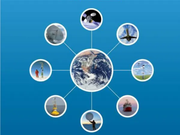
Monitoring and Predicting the Atmosphere(Weather and Climate) • World Weather Watch • 1961 UN Res. 1721(XVI) - International Co-operation in the Peaceful Uses of Outer Space • WMO to assume leadership in use of satellites for atmospheric monitoring • Operational networks for monitoring of weather and climate system and provision of related forecasts and warnings • Free and unrestricted exchange of related data/products
WMOSA Main long-term objectives (i) Participate in the development of the Global Observing System (GOS) as a composite system, particularly for upper-air observing based on an optimal mix of observing components, including ground-based remote-sensing, mobile observing platforms, satellite and Global Position System-Meteorology (GPS-MET). GOS support to meeting GCOS requirements for climate monitoring and prediction will also be a priority goal; (ii) Assist Members in the transition of the low-resolution imagery satellite services from analogue to digital under complex operational conditions; (iii) Promote satellite-related high quality continuing education to keep the knowledge and skill of Members operational and scientific staff up-to-date with the latest technological innovations, and to provide the competence and skills needed in related fields, such as communication with users; (iv) Provide information, advice and guidance to Members on satellite-related technological developments as well as on changes in relevant existing meteorological and hydrological operation systems to enable them to develop plans for objective and wise investment actions.
Global System of Geostationary Satellites
Global System of Polar Orbiting Satellites
Status of implementation and operation of the space-based component of the GOS • Meteorological Satellites: 40 Years of Service • Status of the Space Based GOS
Pioneers in modern atmospheric science helped pave the way • V2 Rocket photographic montage • J. Bjerknes performed synoptic analyses using pictures such as this in 1948: likely the first serious attempt to analyze the atmosphere from “space” • (WMO formed in 1950)
On April 1, 1960 the first U.S. • weather satellite was • launched from • Cape Canaveral, FL • SATELLITES AND THE WWW • UN Resolution No. 1721 for “international co-operation in the peaceful uses of outer space” approved 20 December 1961 • Advent of satellites offered substantial opportunities for improvements in meteorological services • Called on WMO to lead a study and report on recommendations of the UN Resolution • Report delivered in June 1962 • “First report on the advancement of atmospheric sciences and their application in the light of developments in outer space” • Birth of World Weather Watch
On April 1, 1960 the first U.S. • weather satellite was • launched from • Cape Canaveral, FL • First TIROS television vidicon pictures presented several challenges • Image rectification • Navigation • Cloud type identification • Calibration
40 Years Later • Meteorological satellites provide essential data for weather forecasting to national weather services across the globe • APT – free and open direct broadcast sharing of data and science • Satellite data are high resolution digital renderings from a variety of spectral bands whereby both qualitative and quantitative information about the atmosphere, clouds, and land and sea surface properties are deduced
40 Years Later • Observations are provided by both low earth orbiting (mainly polar for global observing) and geostationary satellites (maximizing the temporal domain) • We utilize many portions of the electromagnetic spectrum • Ultraviolet – Ozone profiling and monitoring • Visible and Infrared - Observing various atmospheric, oceanic and land related properties • Microwave – active and passive observations of sea state, land properties, precipitation, and diagnosing atmospheric thermodynamic structure
Deep appreciation for the continued contribution made by satellite operators in providing valuable data, products and services from the space-based Global Observing System EUMETSAT Japan People’s Republic of China (PRC) Russian Federation United States of America Operational Highlights Geostationary EUMETSAT satellite over the data-sparse Indian Ocean @ 63E PRC’s FY-2B @ 105E Polar PRC’s FY-1C direct broadcast of 10 channel MVISR, FY-1D launched 14 May 2002 United States of America’s NOAA-15 & NOAA-16 with Advanced Microwave Sounding Unit as part of ATOVS (NOAA-M in June 2002) Status of implementation and operation of the Space-based component of the GOS
Geostationary EUMETSAT Meteosat-7 at 0° Meteosat-5 at 63°E Russian Federation GOMS-1 at 76°E People's Republic of China FY-2B at 105°E Japan GMS-5 at 140°E United States of America GOES-10 at 135°W GOES-8 at 75°W Polar Orbiting People's Republic of China FY-1C, FY-1D Russian Federation METEOR-2 and 3 series United States of America NOAA-15 NOAA-16 NOAA-M Status of implementation and operation of the space-based component of the GOS
Approved plans for geostationary orbit Future Geostationary Satellites
Approved plans for polar orbit Future Polar-Orbiting Satellites
The Space Based Global Observing System, 2002A Combination of Geostationary and Polar Orbiting Satellites Unparalleled international cooperation has been achieved in satellite activities* *5th WMO Long Term Plan
Typical Polar Orbiting Sounder Coverage for Global NWPAssimilated Microwave from NOAA-14 MSU (Ch 3, blue) and NOAA-15 AMSU (Ch 7, red) for 00Z, Feb. 22, 1999
Coverge provided by GOES mid and upper level high density winds from May 2, 1998
Assimilated HIRS Ch 7 Observations @ 00Z, Nov. 17, 1998NOAA-11 (red), NOAA-14 (blue) (Ch 7 effected by surface and clouds) Need to improve use of satellite sounding data over land!!!
Satellite data are an integral part of our environmental monitoring system, and must be fully exploited We should expect great strides forward with improvements in global space based observing systems The advancement to improved microwave sensors and hyper-spectral imaging and sounding is a natural progression, and provides exciting new opportunities and challenges with truly adaptive observing systems The explosion in satellite data volume and sophistication expected over the next decade requires maximum efforts in data assimilation and NWP
WWW Implementation GoalsPercentage of Members with at least one polar-orbiting and one geostationary receiver % %
The New Research and Development Constellation • NASA’s • Aqua • Terra • NPP • TRMM • GPM • QuickScat • ESA’s • ENVISAT (Brochure) • More expected (NASDA, RSA)
WMO Satellite Activities Web Sitehttp://www.wmo.ch/hinsman/satsun.html Goals, objectives and publicationsSatellite operator status reports Global Observing System (GOS) status reportsOther satellite related organizationsOnline database informationAPT/WEFAX to LRPT/LRIT transitionOnline satellite imagery sites Working documents for Upcoming Meetings Education and Training Materials
Strategy to Improve Satellite System Utilization • Strategic Goal • To improve systematically the utilization of the GOS space-based sub-systems capabilities with emphasis on improving utilization of satellite data and services in developing countries • Major Objectives • To focus on the needs of developing countries • To improve the use of satellite data through increased capabilities in its applications by direct involvement of existing WMO Member expertise • To improve the access to satellite data through increased effectiveness in the distribution of satellite system data and products at major hubs- in particular those maintained by satellite operators, WMO WMC’s RSMC and other entities as appropriate
Strategy to Improve Satellite System Utilization Proposed Action Topics by Projects 1) Improve benefits, mainly through promotion Foster improved promotion of systems use at User Forum Favour multiagency strategy promoting satellite system benefits Focus on improved warning and monitoring of environmental hazards such as severe weather, volcanic ash, air and ocean pollution etc.
Strategy to Improve Satellite System Utilization • Proposed Action Topics by Projects 2) Data processing and development of new methodologiesStudy the concept of specialised centres and networks to assist NMHSs in the use of satellite data, e.g. new applications, NWP products • Promote better transfer from research to operational applications • Focus in high identified priority user requirements for satellite applications • Assure closer operational development links with PIsImplement operational distributed database system • Study specifications for improved WMC/RSMC satellite products
Strategy to Improve Satellite System Utilization • Proposed Action Topics by Projects 3) Education and Training • Favour the implementation of specific satellite E&T programmesin RMTC’s and organisation of other relevant WMO trainingactivitiesExpand US-based virtual lab network in RA III & IV Focus on better use of polar -orbiting data and products • (Menzel’s Notes)
Strategy to Improve Satellite System Utilization • Proposed Action Topics by Projects 4) Infrastructure, including receiving stations • Evaluate the status of aid projects (Swiss, Italian...)Seek CGMS help for assuring the continuity of Indian Ocean/RA II satellite coveragePropose major WMO project on low-cost satellite workstationPromote the expansion of EUMETSAT MDD system use in RA I &IIFocus on effective use of LRIT in RA II & V (with MTSAT-1)Focus on a smooth transition from WEFAX/APT to LRIT/LRPTFocus initial funding on work station and networkingExpand use of DCP/DRS for agriculture and HydrologyPursue improved performance of the MTN and GTS toaccommodate increasing flows of satellite dataPromote a better use of Internet and systems such as VSAT
Strategy to Improve Satellite System Utilization • Proposed Action Topics by Projects 5) Continuous review and monitoring activities • Continuously perform critical review process of satellite dataavailability and use linking monitoring to action plansReview WMO requirements for new Earth Observation Satellite data
What Awaits Us New remote sensing capabilities higher spatial resolution higher temporal resolution more spectral bands higher spectral resolution better science Opportunities to be realized new approaches international partnerships early involvement in science teams and associated field programs Distinction shrinking between polar and geostationary sensors research and operational sensors international sensor capability