Download
1 / 16
160 likes | 295 Views
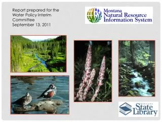
Report prepared for the Water Policy Interim Committee September 13, 2011. Natural Heritage Program. Water Information System. Geographic Information System. Water Quality Climate Surface Water Ground Water Water Rights. Maps GIS Data Analytical Services Technical Assistance Metadata.

E N D
Report prepared for the Water Policy Interim Committee September 13, 2011
Natural Heritage Program Water Information System Geographic Information System Water Quality Climate Surface Water Ground Water Water Rights Maps GIS Data Analytical Services Technical Assistance Metadata Plant & Animal Data Natural Communities Rare, Threatened, or Endangered Species Online Field Guides
http://nris.mt.gov/drought/default.asp Water Information System Water-related topic guides with relevant links, maps and information.
NRIS Maintains a dataset of surface water features based on the USGS Topographic Quadrangle maps. This dataset contains lakes, ponds, rivers, streams, irrigation ditches and other water features for the entire state. This dataset is one of 14 priority data layers in the Montana Spatial Data Infrastructure (MSDI) The goal is to get input from water users across the state to help develop a common layer that will meet their business needs. NRIS’ work on this layer is funded through partnerships with the USGS and the Montana Land Information Council
http://nris.mt.gov/Flathead_2009/ http://nris.mt.gov/yellowstone/
http://www.mbmg.mtech.edu/gwip/gwip.asp http://nris.mt.gov/wis/mtgwres.asp
http://cwaic.mt.gov/ http://nris.mt.gov/wis/swap/swapquery.asp http://maps2.nris.mt.gov/mapper/Corp404/CorpMain.asp http://nris.mt.gov/Apps/WQProject/watermain.asp