Download

1 / 23
230 likes | 314 Views
U.S. 31 at CR 400 South Roundabout Information Meeting December 18, 2013 Clifty Creek Elementary Columbus, Indiana. Meeting Agenda. Welcome Presentations Formal Public Statements or Comments for the Record Adjourn

E N D
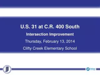
U.S. 31 at CR 400 South Roundabout Information Meeting December 18, 2013 Clifty Creek Elementary Columbus, Indiana
Meeting Agenda • Welcome • Presentations • Formal Public Statements or Comments for the Record • Adjourn • Please join our project team with your specific questions in the Display Area
Project History Environmental Document released for public involvement on October 2009 • Presented as a Corridor project consisting of road rehabilitation with bridge rehab/replacements on US 31 from US 50 to CR 50 in Jackson and Bartholomew Counties. • INDOT identified areas to address as independent projects.
Project History continued • The intersection at US 31 and CR 400 was identified an important improvement along the corridor and was identified as one of those independent projects. • Initiated an Additional Information (AI) to determine if any additional impacts as a result of the new project design. • Update and inform the public of the design change.
Project Purpose & Need The Purpose of the project is to provide an intersection with improved safety and improved traffic flow. The Need for the project is due to safety and traffic flow concerns.
What is a Roundabout? • A roundabout is a circular intersection in which traffic enters or exits only through right turns and proceeds in a counter-clockwise direction. • When approaching a roundabout – Slow Down - incoming traffic always yields to the circulating traffic.
Environmental Impacts Existing land use is agricultural and residential. Historic farm east of the intersection and south of CR 400 is eligible for National Register of Historic Places. No right-of-way will be cquired from acquired from this farm.
Brochure Federal Highway Administration Conflict Diagram Why a Roundabout?
Reduced conflict points All vehicles slow to enter roundabout Reduced number of injury (76%) and (35%) reduction in all accidents More than 90% reduction in fatalities Roundabout Safety
Provides efficient traffic flow Reduces noise and air pollution Less fuel consumption Lower operation and maintenance costs Other Benefits
Proposed • Single lane roundabout • 18’ Circulatory travel lane • 10’ Concrete truck apron • 95’ Green center island • Curb and gutter • 15 mph Speed
Proposed • Approaches • 12’ travel lanes • 17’ entry width • Outside curb and gutter • Concrete splitter islands • Visual queue • Separates entering and exiting vehicles • Aligns driver for correct entry • Deters wrong way movements
CR 400 S • East leg • Replace structure just east of US 31 • Extend existing structure east of drive • West leg • Driveway relocation in SW Quadrant • Field drive removal in NW Quadrant • Replace structure just west of US 31
Drainage • Will remain basically as the existing • Changes • Curb and gutter on approaches • Curb turnouts draining back into open ditches
Phase 1 One travel lane in each direction Construct temporary pavement on east side of US 31 Close east leg of CR 400 S Access will be maintained to all properties Construction zone speed limit 35 mph Maintenance of Traffic (MOT)
Phase 2 One travel lane in each direction East leg of CR 400 S will remain closed Close west leg of CR 400 S Access will be maintained to all properties Construction zone speed limit 35 mph Maintenance of Traffic (MOT)
Phase 3 One shared travel lane controlled by temporary signals Both east and west legs of CR 400 S will remain closed Access will be maintained to all properties Construction zone speed limit 35 mph Maintenance of Traffic (MOT)
Phase 4 One travel lane in each direction Both legs of CR 400 S open Weekend closures of intersection to complete the center island and remaining work Construction zone speed limit 35 mph Maintenance of Traffic (MOT)
Phase 5 Open new roundabout Finish grading of side ditches Construction zone speed limit 35 mph Maintenance of Traffic (MOT)
Project Schedule • Public Information Meeting – December 2013 • Design Plan Refinement • Real Estate Acquisition Activities • http://www.fhwa.dot.gov/realestate/realprop/index.html • Appraising • Negotiations/Buying • Utilities Coordination/Relocation • Project Let for contractor bidding • Construction – Tentative Spring/Summer 2015
Public Comments • Indiana Department of Transportation Seymour District Office 185 Agrico lane Seymour, IN 47274 • E-mail: secommunications@indot.in.gov • Phone: 1-877-305-7611 • INDOT respectfully requests comments postmarked by Friday, January 10, 2014 All comments will be reviewed and evaluated and given full consideration during the final design process.