Download
1 / 40
400 likes | 761 Views
Water in California: Self-induced Scarcity . Waterscape International Group. Perceptions. Do you think California is a drought prone state? Why? What is the most pressing water quality or quantity dilemma? What scales of analysis are useful for understanding water in California?

E N D
Water in California: Self-induced Scarcity Waterscape International Group
Perceptions • Do you think California is a drought prone state? Why? • What is the most pressing water quality or quantity dilemma? • What scales of analysis are useful for understanding water in California? • How can we measure the effect of water diversions on ecosystems? • What groups should have the burden of meeting water needs? • What technological fixes might help reduce scarcity?
Objective • California is well-endowed with water, yet faces shortages. • Why? • How can this be remedied? • How does this relate to environmental science?
Overview • Natural Setting of California • Water Use in the State • Water Distribution (Central Valley and State Water Projects) • Roots of Scarcity • Quality Intermingled • Options for the Future
Part 1 The Natural Setting
Part 2 Water Use in California
Agricultural and Urban Water Use Statistics • Domestic consumption of groundwater & surface water = 3 MAF and 3 MAF, respectively. • Agricultural consumption of groundwater & surface water = 12.2 MAF and 19.5 MAF, respectively.
Central Valley Project Facts • 400 miles, from the Cascade Mountains near Redding to the Tehachapi Mountains near Bakersfield • 20 dams and reservoirs, 11 powerplants, and 500 miles of major canals • 9 million acre-feet of water annually managed • Annually delivers about 7 million acre-feet • 5 million acre-feet for farms • 600,000 acre-feet for municipal use • 5.6 billion kilowatt hours of electricity (~2 million people) • 800,000 acre-feet per year to fish and wildlife and their habitat and 410,00 acre-feet to State and Federal wildlife refuges and wetlands (CVPIA, 1992)
State Water Project Facts • 1973-Store water and distribute it to 29 urban and agricultural water suppliers in Northern California, the San Francisco Bay Area, the San Joaquin Valley, and Southern California. • Water quality in the Delta, control Feather River flood waters, provide recreation, and enhance fish and wildlife. • 32 storage facilities, reservoirs and lakes; 17 pumping plants; 3 pumping-generating plants; 5 hydroelectric power plants; and about 660 miles of open canals and pipelines. • Supplemental water to approximately 20 million Californians and about 660,000 acres of irrigated farmland.
Consequences • What are some of the consequences for the environment of this distribution system?
Part 3 Factors complicating the allocation of water among agricultural, domestic, and environmental uses
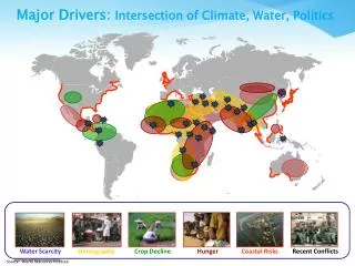
The Problem: 7 Reasons to Worry • Water allocation system is inflexible • Population Growth • Federal Endangered Species Act • Federal Clean Water Act • Colorado River 4.4 MAF • Normal Climate Variability • Long-term Climate Variability
Water Allocation • California Doctrine (Appropriation and Riparian Rights) • Permits to surface water • Permits to groundwater
Federal Regulations • Clean Water Act • Section 303(d): Total Maximum Daily Loads for “impaired waters” • Source Water Protection • Endangered Species Act • Critical habitat protections • Salmon
Climate Variability • Normal climate variability • Anthropogenic climate forcing
The Result • Need more water for regulatory purposes • Difficult to adjust allocations • Groundwater is not permitted or even accounted • Et increased due to irrigationflow decreasedreduced assimilative capacity
Part 4 Case Study: Selenium Toxicity at Kesterson Reservoir
Part 5 Options
Improve Allocation • Demand side • Water Transfers (land retirement) • Efficiency • Supply • Surface water storage • Groundwater storage (conjunctive use) • Desalinization
Water quality • Real-time monitoringassimilative capacity • Irrigation changes • Drain
Closing Thoughts • Other topics-Quality • Water-rich landscape • Integrated system • Hydrology-ecology interface • SW-GW interactions • Quality and quality connections • Increasing demands • Longer-term planning
References • Department of Water Resources (1998). California Water Plan: 160-98. • Letey, J (1986). An Agricultural Dilemma: Drainage Disposal in the San Joaquin Valley.