Download
1 / 5
50 likes | 152 Views
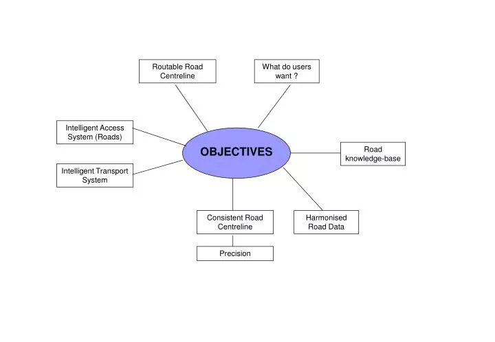
Routable Road Centreline. What do users want ?. Intelligent Access System (Roads). OBJECTIVES. Road knowledge-base. Intelligent Transport System. Consistent Road Centreline. Harmonised Road Data. Precision. STEPS. Compatibility Issues between Datasets. Road Study. Gap Analysis.

E N D
Routable Road Centreline What do users want ? Intelligent Access System (Roads) OBJECTIVES Road knowledge-base Intelligent Transport System Consistent Road Centreline Harmonised Road Data Precision
STEPS Compatibility Issues between Datasets Road Study Gap Analysis Identify User Requirements Identify Possible Solutions Tactical VS Strategic Road Group Presentations Map Business Processes Develop Term of Reference for Roads Group Agency Relationships Business Case Workflows Funding for Business Case $25,000 for comparison of MRWA & LG data ?
ISSUES Geometry Flow Direction Events Feature Characteristics Road Direction Speed Limit Direct Editing Crowd Sourcing Naming Data Road Updates Incremental Update Address Creation Model Feature ID join Address Ranges Trickle Fees Landgate Funding MRWA Data Road Centrelines Precision WALIS Geometry MetaData Data Use IP Capture Standards Budget Maintenance Priorities Commercialisation Which dataset to evolve into RRCN Digitising Standards for capture
AGENCY REQUIREMENTS Other ? WA Police Anomaly Feedback to Landgate FESA Address Range Capture Speed Limit Need Tracks PTA Roads in DEC estate Road Width DEC Bus Routes Spatial Accuracy Route Analysis Road names Landgate Context to other Topo Data Names Database Thematic Mapping (Spatial) Local Government Grants Commission Asset Management (Attributes) Main Roads WA Curb Subset of Roads Data Events Management (SLK) Sealed / Unsealed Area Info Funding Model for new infrastructure Flow Direction
AGENCY Relationship FESA WAPOL DEC LANDGATE PTA MRWA LGA