Download

1 / 53
530 likes | 726 Views
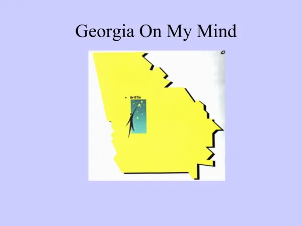
Georgia on my mind. N. W. Georgia’s location. Georgia -- Western & Northern hemispheres. In other words, located west of zero degrees longitude (the “ prime meridian ”)& north of equator . In U. S., GA part of 2 major geog. regions: S, SE. S. SE. Georgia’s location.

E N D
N W Georgia’s location Georgia -- Western & Northern hemispheres. In other words, located west of zero degrees longitude (the “prime meridian”)& north of equator. In U. S., GA part of 2 major geog. regions: S, SE S SE
Georgia’s location GA located in the ______ and ______ hemispheres. In other words, we are located west of zero degrees longitude (the “_____ meridian” which passes through Great Britain) and north of the ________. Within the U. S., we are a part of two major geographic regions: the ______, the _____east
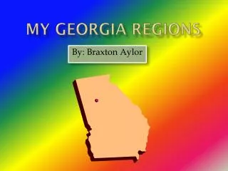
Within Georgia there are five geographic regions. Georgia’s five geographic regions are: 1. COASTAL PLAIN 2. PIEDMONT 3. BLUE RIDGE 4. RIDGE AND VALLEY 5. PLATEAU
Coastal Plain: 60% ofstate, once covered by A. Ocean. Relatively flat land , known for sedimentary deposits – sand, limestone. 3 P’s: peanuts, peaches, and pecans. Cotton grows well, especially near Fall Line.Key features:Okefenokee Swamp, Barrier Islands, estuaries, continental shelf, Fall Line, Savannah and Chattahoochee Rivers
The Coastal Plain, covers about __%of the state, once entirely covered by _____ Ocean. Relatively flat , it’s known for sed_________ deposits like ____ and ______. It is relatively flat and famous for the 3 P’s: p_____, p_______, and p______. C____ also grows well in much of the region. Key features: Okefenokee Swamp, Barrier Islands, estuaries, continental shelf, Fall Line, Savannah and Chattahoochee Rivers
Okefenokee Swamp FACTS: * largest wetland in GA * approximately 700 square miles * primary industry here from 1910 to 1937: logging * In 1937 (during Great Depression) Pres. Franklin Roosevelt makes Okeefenokee a wildlife refuge.
Barrier Islands: just off coast, provide barrier b/n mainland and ocean. Protects fishing boats, pleasure craft, and shippers from winds, waves and currents as they travel Atlantic Intracoastal Waterway. Estuaries(semi enclosed bodies of water where salt and fresh water mix) contain 70% of GA’s recreationally & commercially important fish. Estuaries located in and among Barrier islands.
Barrier Islands: Some developed, connected to mainland by bridges/causeways: (Jekyll {a state park}, St. Simons, Tybee). Tourism is important to these islands. Some are wildlife refuges (Blackbeard, Wassaw, Wolf) Some are privately owned.
B___ Islands: . Islands just off coast earn name by providing b____ between mainland and ocean. This barrier protects fishing boats, pleasure craft, and shippers from winds, waves and currents as they travel along the A____ I_______ Waterway. E_____(semi enclosed bodies of water where salt and f____ water mix) contain 70% of GA’s recreationally and commercially important fishes. These e_______ are located in and among the B______ islands. Some developed, to the mainland by bridges/causeways: (Jekyll {a state park}, St. Simons, Tybee). Tourism is important to these islands. Some are wildlife refuges (Blackbeard, Wassaw, Wolf) Some are privately owned.
FALL LINE: ** located on former shoreline of A. Ocean. ** 20 mile wide drop off in elevation **boundary b/n Piedmont & Coastal Plain regions. **The Fall Line affected: 1. early commercial transportation (offloading b4, back on river after); 2. provided water power resulting in development of cities along Line (Columbus, Macon, Augusta – “CMA Awards”)
F____ LINE: ** It’s located on the former s______ of the A_____ Ocean. ** It is a ____mile wide drop off in eleva- tion that forms the boundary between the P_____ and C_____ Plain regions. **The Fall Line affected early commercial transportation(____ b4, back on after) & provided ___ power resulting in the development of cities along the Line (C_____, M______, A______).
1828: Georgia’s General Assembly (our legislative branch of gov’t) created the town of Columbus. Why?
History and the Fall Line Late 1830s: Fall line used for industrial power source (water power)for textile mills & gristmills. These mills were important to the Confederacy during Civil War (1861 – 1865). For that reason, Union troops focused on destruction of factories and mills of cities on Fall Line.
History and the Fall Line 1828: Georgia’s General Assembly (our legislative branch of gov’t) creates the town of C_____. Why? Late 1830s: Fall line used for industrial p____ source (w____power)for t___ mills & gristmills. These mills were important to the Confederacy during Civil War (1861 – 1865). For that reason, Union troops focused on destruction of factories and mills of cities on Fall Line.
REMINDER: `The Coastal Plain region is famous for growing the 3 P’s: , PEACHES, and PECANS These grow well in the western section of the Coastal Plain. Near the Fall Line, peaches grow well. The soil is too sandy in the eastern Coastal Plain which is known for its pine barrens.
** Georgia “red clay” (result of iron in soil) **Part of the larger Piedmont (100 to 300 mi. wide) that stretches from mid Atlantic States down through SE. **2nd largest region of GA (30% of GA), terrain: rolling hills & valleys
** Georgia “r___ c___” (result of i___ in soil) **Part of the larger Piedmont (100 to 300 mi. wide) that stretches from mid Atlantic States down through SE. **___ largest region of GA (30% of GA), terrain: r___ h__ & v___.
** large areas of solid rock (bedrock): marble , granite (Stone Mtn. is granite), & slate deposits; “Granite capital of world” = Elbert County, GA ** Piedmont known for cotton, soybeans. Beef cattle, dairy cattle, hogs, and chickens (Gainesville: “Chicken Capital”)
** large areas of solid rock (b____): marble , granite (S___ Mtn. is granite), & slate deposits; “Granite capital of world” = E___ County, GA ** Piedmont known for cotton, soybeans. Beef cattle, dairy cattle, hogs, and chickens (Gainesville: “C_____ Capital”)
** Southern border of Piedmont = Fall Line. ** Most of GA’s population lives in Piedmont. ** Contains Atlanta: GA’s largest city and its capital (and Canton) . FACTOID: Most of Ga’s Peach crop is grown in counties along the Fall Line.
** Southern border of Piedmont = F___ Line. ** Most of GA’s p____ lives in Piedmont. ** Contains A_____, GA’s largest city & its c_____ (and Canton) . FACTOID: Most of Ga’s Peach crop is grown in counties along the Fall Line.
Historical Factoids of Piedmont Region: **1540: de Soto again—passes through this region as well **Through the 1700s on into the 1800s, cotton plantations developed in the lower Piedmont subsistence farming in northern Piedmont, later replaced by poultry and hog farming.
* ** **the Blue Ridge Region consists of southernmost Appalachian Mtns. ** B. R.--Borders Ga’s Piedmont Region to south and Ridge & Valley region to west. **Heavy rainfall in B. R. contributes significantly to GA’s water supply ** B. R. --spectacular waterfalls. *
** Both the Chattahoochee and Savannah Rivers have source (begin) in B. R. Region ** Apple orchards. ** Brasstown Bald, highest point in Ga (4,784 ft. above sea level) is in B. R. Region. *
** Region consists of southernmost_______ Mtns. ** Borders Ga’s Piedmont Region to the south and Ridge & Valley region to the west. **Heavy r_____ in the Blue Ridge region contributes significantly to GA’s water supply ** Contains spectacular waterfalls. ** Both the C____and S_____ Rivers begin in the Blue Ridge Region ** A____ orchards thrive. ** Br_____ Bald, the ______ point in Ga, is located here. (4,784 ft. above sea level) *
Blue Ridge Historical factoids **Many historians believe Cherokees arrived in 1400s. **First European: conquistador Hernando de Soto (1540) **Gold discovered in late 1820s; Gold rush in 1830s; spells end for Cherokees in GA. Why?
Historical factoids cont’d **During the American Civil War this region was divided. A significant number of the people living here opposed secession. One reason: there were very few slaves. Why?
**most of NW GA; part of a larger U. S. Ridge and Valley region stretching from N. York southward.**Consists of long parallel ridges (long hills or mtns.) overlooking wide, rolling valleys.**Valleys used for pasture and farmland.** series of natural gaps provided natural landscape for road and railroad construction. Gaps strongly influenced colonial migration-- 1700s; Union invasion of South-- Civil War (1861-1865).
**Covers most of NW GA; is part of a larger U. S. Ridge and Valley region stretching from New York southward.**Consists of long parallel r_____ (a long hill or mtn.) overlooking wide, rolling v_______.**a series of natural g____ running from Cartersville through Calhoun, Dalton, and Ringgold provided natural landscape for r_____ and r________ construction. This route strongly influenced colonial migration in the 1700s and Union invasion of the South during the Civil War (1861-1865).**Valleys used for p____ and f______.
**part of the national Plateau -- from New York to Alabama. GA’s smallest region ; extreme NW GA **Only known area of GA containing coal deposits. **Land primarily used for hardwood harvesting and pasture.
**GA region that is part of the national Appalachian Plateau stretching from New York to Alabama. GA’s s___ region in extreme NW GA **Only known area of GA containing c___ deposits. **Land primarily used for h____ harvesting and p_____.
Significance of GA Rivers 4. In the 1800s, these rivers were important lines of travel and transport. 5. Both purposes vital to the Confederacy during Civil War. Union ships blockaded Savannah River during the war (1861-1865). 6. After WWI (1914 – 1918), roles reduced due to advances in railroad development and motorized vehicles (trucks, cars, busses). 7. Today these rivers provide vital water supply for drinking. Dams on the rivers provide reservoirs and hydroelectric power. 8. Savannah River forms most of GA’s border with S. Carolina; Chattahoochee forms major portion of border with Alabama.
Georgia’s CLIMATE has contributed to its historically agricultural roots. Climate has provided for long growing season. • Georgia’s moderate CLIMATE has also attracted business in 20th and 21st centuries.
Georgia’s C_______ has contributed to its historically a______ roots. The climate of the state has provided for a long g______ season. • Georgia’s m______ C______ has also attracted b____ to the area in the 20th and 21st centuries.
Early Native American Periods in GA Paleo Indians first appeared along Savannah River ~10,000 B.C.(“Native Americans” migrated from Asia into North America across land bridge known as Beringia that connected the two continents at that time.) The 4 early Native American periods found in GA from earliest to most recent were: Paleo->Archaic->Woodland->Mississippian (“PAWM”). .
Early Native American Periods in GA P_____Indiansfirst appeared along Savannah River ~10,000 B.C.(“Native Americans” migrated from A___ into N_____ A_______ across a land bridge known as B_____ that connected the two continents at that time.) The 4 early Native American periods found in GA from earliest to most recent were: P____->Ar_____>W_______->M_______(“PAWM”). .
ASSIGNMENT:Do progress/development graphic organizer (flip chart) showing how progress led to greater survival rate of each Native American period.
Paleo Pd.: nomadic hunters of large game (mammoths, mastodons, etc.) from which they got food, clothing, tools; also gathered fruits & vegetables they found. Major development: may have developed atlatl (spear launching device).
P____ Pd.: n____ hunters of large game (mammoths, mastodons, etc.) from which they got food, clothing, tools; also gathered fruits & vegetables they found. Major development: may have developed a___ (spear launching device).
Archaic: nomadic in early years; dependent on hunting, fishing, gathering (fruits, veggies) widespread use of atlatl, Major Developments: pottery, allowing them to become more settled WHY?
Archaic: n____ in early years,; dependent on hunting, fishing, gathering (fruits, veggies) widespread use of atlatl, Major Developments: p____, allowing them to become more settled WHY?
Woodland Pd.: built burial and ceremonial mounds (Rock Eagle; Kolomoki). Major developments: Agriculture: led to formation of tribes & villages--WHY? Bow & Arrowimproved survival rate;