Download
1 / 12
140 likes | 357 Views
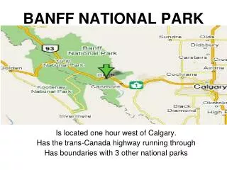
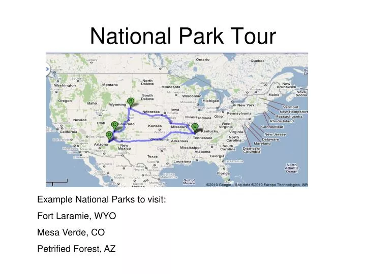
National Park Tour. Example National Parks to visit: Fort Laramie, WYO Mesa Verde, CO Petrified Forest, AZ. National park project.

E N D
National Park Tour Example National Parks to visit: Fort Laramie, WYO Mesa Verde, CO Petrified Forest, AZ
National park project • 11 power point slides—Intro slide (three parks your are visiting and your name), 3 on each of the three parks (total of 9), and a final slide that summarizes your entire trip with mileage and hours. • Select 3 national parks from the lower 48 states using the National Parks website, www.nps.gov site • For each park create three slides: • Slide 1-when was park established, where/what it is and why you should visit it (be specific) • Slide 2- at least 2 pictures that best represent the park • Slide 3-map of a route to the park from GCHS (1107 Housman Street, Mayfield, KY 42066 for the first park, from that park to the next park, from that park to the next park, and from the final park back to GCHS (from google maps)
Open up a blank power point make 11 slides • Open up google then go to google maps • Open up http://www.nps.gov/findapark/index.htm
Google Maps: Click get directionsthen put in GCHS address1107 Housman street, Mayfield, KY 42066
Click add destination to add parks Put in GCHS address first
This is what you should put on slide 3 1066 miles 18hrs 9min from GCHS to Ft. Laramie Right click bring up the picture tool bar, select the trim icon two plus signs
You are starting at GCHS then going to park 1, then put in your next park address, and recording the distance from park 1 to park 2-NOT GCHS
To copy the screen where the map is on google hit printscreen at the top of your keyboard, then right click and copy and paste to your power point slide
Go back to nps.gov/findapark site • Select another state and park • Do the same thing as you did for park 1 • Your address should be in destination C • Your distance from park 1 to park 2 is located down toward the bottom of the directions
Getting final directions: On the left side is where you put in the addresses of the parks. You will start with GCHS address 1107 Housman street, Mayfield, KY 42066 and then add destination for each park and finally put the GCHS address in last. The route will turn by turn underneath after you hit directions. Copy the total distance to each park.
See at the end it shows the distance and estimated driving time. Then it will head out to the next destination.
Slide 11 (Last slide) should show complete route and miles/hrs 1,067 mi – about 18 hours 16 mins to Fort Laramie National Historic Site from GCHS. Then 600 mi – about 11 hours 24 mins to MESA VERDE, CO 81330 from Ft. Laramie Then 253 mi – about 5 hours 16 mins to the Petrified Forest from MESA VERDE, Then 1,346 mi – about 22 hours 2 mins back to GCHS 1107 Housman St 3,267 miles total round trip