Download
1 / 19
190 likes | 411 Views
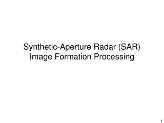
Guest Scientist: Jeffrey Weissel Originally presented 8 May 2004 . Using Synthetic Aperture Radar (SAR) to Map Natural Hazards and Disasters. Remote Sensing of Our Planet.

E N D
Guest Scientist: Jeffrey Weissel Originally presented 8 May 2004 Using Synthetic Aperture Radar (SAR) to Map Natural Hazards and Disasters
Remote Sensing of Our Planet • During the last three or four decades, great advances have been made in technologies to study our planet from vantage points high above the surface • Monitors aboard aircraft and satellites reveal much that cannot be discovered through surface-based techniques
Remote Sensing & E2C • Christopher Small has shared examples of cutting-edge investigations using remote sensing over the years in E2C programs • Some examples can be found at http://www.earth2class.org/workshops/ws5.htm http://www.earth2class.org/k12/w2_f2002/template.htm
One of the best print resources about remote sensing is Claire L. Parkinson’s Earth from Above: Using Color-Coded Satellite Images to Examine the Global Environment University Science Books, Sausalito CA ISBN 0-935702-41-5
Today’s Topic: Synthetic Aperture Radar (SAR) is one of the most useful of the remote sensing strategies used by research scientists and operation specialists in a variety of fields. Death Valley, CA http://www.jpl.nasa.gov/radar/sircxsar/
What’s “SAR” and How Can It Help Map Natural Disasters and Hazards? • Synthetic Aperture Radar is a space or airborne technology that provides high-resolution monitoring for environmental and military purposes in all weather or day/night conditions • With SAR it is possible to obtain detailed information quickly that may be of great use in combating such natural disasters as wildfires, oil spills, ice and seas, etc.
How Does SAR Work? • Details are complex, but in a simplified version, we can say that SAR operates by sending out energy pulses at microwave wavelengths and measuring the precise time of the returning echo from a surface • What makes SAR different is that it creates an extremely sharp beam over a wide area that enables high-resolution imaging • The next slide represents the process.
Here is an example of a SAR image of a natural environmental hazard http://www.sandia.gov/radar/images/oilslick.jpg
SAR is one type of “imaging radar” • Many types of optical as well as radar remote sensing systems have been developed in the past few decades that have yielded vast amounts of data about our planet • All radar systems basically transmit a pulse in the radio frequency part of the EM spectrum and capture part of the returning echo, as shown in the next slide
Imaging radars produce an image in the flight direction and for a distance on one side of the flight path http://southport.jpl.nasa.gov/
SAR involves combining signals along the flight path to synthesize a very long antenna, thus improving resolution http://southport.jpl.nasa.gov/
SAR and related technologies have been used for a wide variety of studies • As long ago as 1978, imagers aboard SeaSAT were used to obtain unprecedented views of the upper ocean and sea ice • Many of the Shuttle missions obtained SAR and other images to reveal new discoveries about our planet • NASA’s Jet Propulsion Laboratory has had a lead role in much of this work http://southport.jpl.nasa.gov/
The US Geological Survey has also utilized remote sensing for a wide variety of purposes • Interferometric SAR (InSAR) can detect surface displacements on the order of centimeters associated with changes in groundwater levels, which has been very useful in drought and water resource studies http://ca.water.usgs.gov/program/desert/insar/
As aquifers are depleted, surface subsidence occurs. InSAR can identify even millimeter-scale differences over time. http://ca.water.usgs.gov/program/desert/insar/ex_santaclara/
Wildfires in the Western US • Inevitable part of the environment • Expansion of human communities into forested areas increase risks • Landslides and flooding in burned-out areas are major post-fire threats • Need new technologies to identify potential as effectively as possible http://landslides.usgs.gov/html_files/wildfires/index.html
Debris flow over I-70 in Colorado after 1994 South Canyon fire. Partially dammed Colorado River. http://landslides.usgs.gov/html_files/wildfires/index.html
With this background introduction, we will take a break and get ready for our guest scientist, Dr. Jeffrey Weissel. He will discuss some of his research that has utilized SAR to shed new insight about various natural hazards and disasters.