Download
1 / 22
220 likes | 299 Views
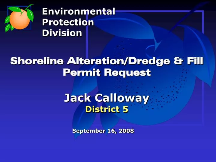
Environmental Protection Division. Shoreline Alteration/Dredge & Fill Permit Request Jack Calloway District 5. September 16, 2008. Location Map. Aerial Location Map. Site Plan. Plan/View. Site Plan. Site Plan. Side View. Site Photograph. Site Photograph. Site Photograph.

E N D
Environmental Protection Division Shoreline Alteration/Dredge & Fill Permit RequestJack CallowayDistrict 5 September 16, 2008
Site Plan Plan/View
Site Plan Site Plan Side View
Existing seawalls Approximate location of proposed seawall Lake Martha
Alternatives Heavy Planting Rip-Rap Geo-Tube Envirolok
Action Requested ACTION REQUESTED: Denial of Shoreline Alteration/Dredge and Fill Permit Application
Environmental Protection Division 800 Mercy Drive Orlando, Florida 32808 407.836.1400 FAX 407.836.1499
Conditions of Approval • 1A. If an alternative shoreline stabilization method is approved by the • Board of County Commissioners , the Applicant must provide EPD with • a new planting plan, cross-section, site plan (as applicable), signed and • sealed by a licensed engineer in the State of Florida, for review and • final approval. • OR • 1B. Construction activities shall be completed in accordance with the • plan submitted by Structural Plan Service, Inc., dated as received on • March 14, 2008 by the Environmental Protection Division (EPD). • The permitted work must be commenced within six months and • completed within one year from the date of issuance of the permit. In • the event that project has not commenced within 6 months or • completed within a year this permit is void.
Conditions of Approval • Native vegetation, including but not limited to, Sagittaria latifolia, • Sagittaria lancifolia, Pontederia cordata, and Juncus effusus may not • be removed from the shoreline outside of the specified access corridor, • specific to project. • The permittee is hereby authorized to perform or cause to be • performed the impacts shown on the application and approved • drawings, plans, and other documents attached hereto or on file with • the EPD. The permittee binds itself and its successors to comply with • the provisions and conditions of this permit. If the EPD determines at • any time that activities are not in accordance with the conditions of the • permit, work shall cease and the permit may be revoked. • At least 48-hours prior to commencement of activity authorized by • this permit, the permittee shall submit to the EPD, a "Construction • Notice" (form CN-001-04) indicating the actual start date and expected • completion date.
Conditions of Approval • Prior to construction, the permittee must clearly designate the • limits of construction on-site. The permittee must advise the contractor • that any work outside the limits of construction, including clearing, • may be a violation of this permit. • The permittee must require the contractor to maintain a copy of • this permit, complete with all approved drawings, plans, conditions, • attachments, exhibits, and modifications in good condition at the • construction site. The permittee must require the contractor to review • the permit prior to commencement of the activity authorized by this • permit. The complete permit must be available upon request by Orange • County staff.
Conditions of Approval • Issuance of this permit does not warrant in any way that the • permittee has riparian or property rights to construct any structure • permitted herein and any such construction is done at the sole risk of • the permittee. In the event that any part of the structure(s) permitted • herein is determined by a final adjudication issued by a court of • competent jurisdiction to encroach on or interfere with adjacent • property owner's riparian or other property rights, permittee agrees to • either obtain written consent or to remove the offending structure from • the affected owner or to remove the interference or encroachment • within sixty days from the date of the adjudication. Failure to comply • shall constitute a material breach of this permit and shall be grounds • for its immediate termination. • This permit does not release the permittee from complying with all • other Federal, State, and Local rules and regulations. If these permit • conditions conflict with those of any other regulatory agency the • permittee must comply with the most stringent conditions.
Conditions of Approval • Should any other regulatory agency require changes to the • permitted system, the permittee shall provide written notification to the • Division of the change prior to implementation so that a determination • can be made whether a permit modification is required. • The EPD must have final construction plan approval to ensure that • no modification has been made during the construction plan process. • The permittee shall immediately notify the EPD, in writing, of any • previously submitted information that is later discovered to be • inaccurate. • The permittee shall notify the EPD, in writing, within thirty days of • any sale, conveyance, or other transfer of ownership or control of the • permitted system or the real property at which the permitted system is • located, during the permit period. The permittee transferring the permit • shall remain liable for any corrective actions that may be required as a • result of any permit violations prior to such sale.
Conditions of Approval • EPD staff, with proper identification, shall have permission • to enter, inspect, sample and test the system to ensure • conformity with the plans and specifications approved by the • permit at any reasonable time. • The permittee shall hold and save the County harmless • from any and all damages, claims or liabilities, which may arise • by reason of the activities authorized by the permit. • No failure or successive failures, on the part of the EPD to • enforce any portion of this permit shall impair the right of the • EPD to enforce the same in the event of subsequent breach. • All costs, including attorney's fees, incurred by the County • in enforcing the terms and conditions of this permit may be • required to be paid by the permittee. The Environmental • Protection Officer shall make this determination.
Conditions of Approval • Permittee agrees that any dispute arising from matters relating • to this permit shall be governed by the laws of Florida, and initiated • only in Orange County. • Turbidity and sediments must be controlled to prevent • violations of water quality pursuant to Rule 62-302.500, 62- • 302.530(70) and 62-4.242 Florida Administrative Code (FAC). Best • Management Practices, as specified in the Florida Stormwater, • Erosion, and Sedimentation Control Inspector's Manual, shall be • installed and maintained at all locations where the possibility of • transferring suspended solids into wetlands and/or surface waters • due to the permitted activity. If site-specific conditions require • additional measures, then the permittee shall implement them as • necessary to prevent adverse impacts to wetlands and/or surface • waters.
Conditions of Approval • The existing ambient water quality within Outstanding Florida • Waters shall not be lowered as a result of the proposed activity, • except as authorized by the Florida Department of Environmental • Protection under Rule 62-4.242(2) FAC. • All excess lumber, scrap wood, trash, garbage, etc shall be • removed from the project area and/or surface waters immediately. • The permittee shall restore any unauthorized wetland and/or • littoral zone impacts within thirty days of completion of the project. • The restoration will be done to the satisfaction of the EPD. • A copy of this permit, along with EPD stamped, approved • drawings should be taken to the Zoning Division for approval in • order to obtain a building permit.
Conditions of Approval • A certified site plan will be required to obtain a building permit. • For further information, please contact the Zoning Division at (407) • 836-5525 or the Division of Building Safety at (407) 836-5550. • This permit will expire one year from issuance date. • Operation of the facility shall not become effective until the • permittee has complied with the requirements of this permit. • The material used as fill shall be clean material and shall not • contaminated with vegetation, hazardous, toxic waste or other • materials that are not suitable within waters of the State.
Conditions of Approval • The permittee may maintain a clear access corridor below the • Normal High Water Elevation (NHWE), not to exceed 30 feet in width, • of sufficient length waterward from the shoreline, to allow access to • open water. Any structures such as a boat dock or ramp must be • located within this corridor. The remaining shoreline shall be • naturally vegetated. • Prior to any filling within the 100-year flood zone a Flood Plain • Permit must be obtained from the Orange County Stormwater • Management authorizing the fill. • The permit holder must provide an as-built drawing on a final • survey, signed and sealed by an appropriate professional licensed • by the State of Florida, with the notice of completion. The signed • and sealed as-built survey shall consist of an aerial view of the • project site with the Normal High Water Elevation (NHWE), • topographic elevations and cross sections with elevation data.