Download
1 / 21
220 likes | 402 Views
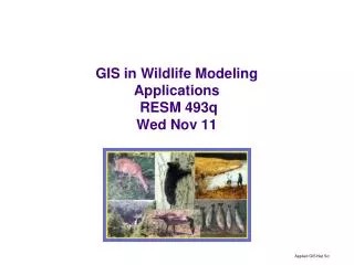
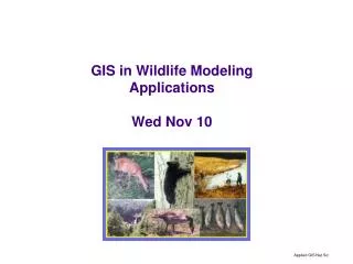
http://www.cnr.uidaho.edu/rsgis/nr504.htm. NR505 GIS Applications in Wildlife Sciences. Mondays and Wednesdays 9:30 – 11:20 CNR GIS lab Room 26 Home Range Resource Selection Wildlife Habitat Models + Accuracy Assessment Fragmentation Analysis in Fragstats

E N D
http://www.cnr.uidaho.edu/rsgis/nr504.htm NR505 GIS Applications in Wildlife Sciences Mondays and Wednesdays 9:30 – 11:20 CNR GIS lab Room 26 Home Range Resource Selection Wildlife Habitat Models + Accuracy Assessment Fragmentation Analysis in Fragstats Distance Measurements and Least Cost Path Analysis Functional Connectivity Introductory Remote Sensing + separability testing Grading: Attendance & Participation 60 % Final Project Presentation 40%
Home Range and GIS Eva Strand CNR Remote Sensing and GIS Lab
What is Home Range? The description of an animals space use The home range is believed to contain the essential requirements such as food, water and cover Wildlife Techniques Manual
Home range characteristics • Home ranges often overlap (as opposed to territories) • Home range size has been correlated to body size • Can help explain an animals biological patterns • Can help improve understanding of ecological relationships
Telemetry data or GPS collar Tabular data in Excel (2003) .dbf or .txt format can be directly imported to ArcGIS or ArcView
Home Range Methods Minimum Convex Polygon Harmonic Mean Kernal Jennrich-Turner
Minimum Convex Polygon Minimum Convex Polygon (MCP) is defined as the polygon drawn around the outermost points
Fixed kernel home range is currently recommended Contours The size of the kernel home range is sensitive to the bandwidth value (h) used!
Kernel Density Functions n – number of locations h – smoothing parameter d – distance from the location x, y
….a few assumptions • Locations are independent • Large enough sample size • Smoothing parameter (kernel estimators)
Bandwidth, h-factor, smoothing parameter • Least Squares Cross Validation (LSCV) • Currently recommended • Tendency to undersmooth, creates multiple local minima • High variability • Likelihood Cross Validation (CV) • Novel method (Horne and Garton 2006) • Performs better for smaller sample sizes (< 50) • Better fit and less variability • Normal or Reference method (href) • Scaled-REF (href is multiplied by a fixed proportion) Gitzen et al. 2006 Horne and Garton 2006
Home Range Spatial Tools Hawth’s Tools http://www.spatialecology.com/ Home Range Tool http://blue.lakeheadu.ca/hre/ Animal Movement http://www.absc.usgs.gov/glba/gistools/ Likelihood Cross Validation Tool (Jon Horne) http://www.cnr.uidaho.edu/population_ecology/animal_space_use.htm
Hawth’s Tools ArcGIS extension www.spatialecology.com
Home Range Tool • Free downloadhttp://blue.lakeheadu.ca/hre/ • Developed by Art Rodgers, Ontario • Extension to ArcGIS 9 • Kernel Tool • MCP Tool • Display Travel • Calculate travel times • Great User’s Manual and Tutorial Guide!!
AnimalMovement Extension • Will utilize any type of point data that can be brought into ArcView • Works in any projection* • Works on any selected subset of data* • Produces Coverages, Grids, or Tables i.e. all output is compatible with ArcView *Except Gin= Gout2 G = Garbage U.S. Department of Interior U.S. Geological Survey Alaska Biological Science Center Glacier Bay Field Station
Changes to ArcView Buttons Tools Menus
Readings – home range • Bookhout TA (editor) 1994. Research and Mangement Techniques for Wildlife and Habitats pp.394-403, The Wildlife Society, Bethesda , Maryland . • Horne JS and EO Garton 2006. Likelihood cross-validation versus least squares cross-validation for choosing the smoothing parameter in kernel home-range analysis, Journal of Wildlife Management 70(3):641-648. • Gitzen RA, JJ Millspaugh, and BJ Kernohan, 2006. Bandwidth selection for fixed-kernel analysis of animal utilization distributions, Journal of Wildlife Management 70(5):1334-1344. • Home Range Tool User’s Manual