Download
1 / 15
170 likes | 327 Views
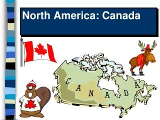
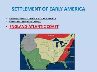
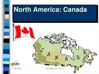
World Geography Unit 04, Lesson 01. Regions of North America: Canada. Canada. Made up of ten provinces and three Territories. 2 nd largest country in land area. Largest block of population settled in the southeast near the valley of the St. Lawrence Seaway.

E N D
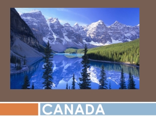
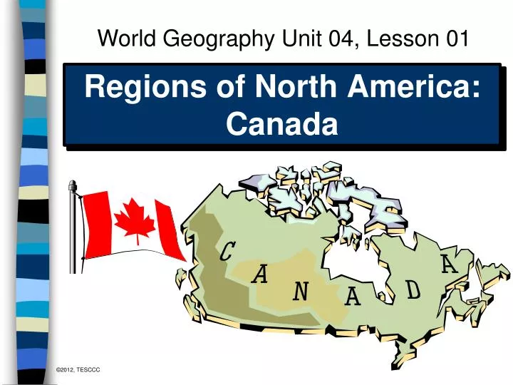
World Geography Unit 04, Lesson 01 Regions of NorthAmerica: Canada
Canada • Made up of ten provinces and three Territories. • 2nd largest country in land area. • Largest block of population settled in the southeast near the valley of the St. Lawrence Seaway. • Shares more than 5,000 miles (8,050 km) of border with the US, which is generally open and allows easy cultural and economic connections between the populations on both sides of the boundary.
Canada Satellite view of Canada, Alaska
Regions of Canada • Maritime Atlantic Provinces- Nova Scotia, New Brunswick, Prince Edwards Island, and Newfoundland. • Core – Quebec and Ontario (Includes French Canada • Prairie Provinces – Manitoba, Saskatchewan, and Alberta • Western Province- British Columbia • Northern Frontier- Nunavut, Northwest Territory, Yukon
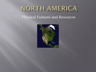
Physical Geography What physical features of Canada are shared with the U.S.? • Physical Features: • Canadian Shield • Arctic Coastal Plain • Central Lowlands • Great Plains • Rocky Mountains • Intermontane Basins • Coastal Ranges
Canadian Shield What is the Canadian Shield? The Canadian Shield is the largest region in Canada. The Canadian Shield covers most of the Northwest Territories This region is shaped like a saucer. The area covers 1.8 million square miles. The Canadian Shield has many natural resources. Under most of this tree covered land is the oldest rock in the world which contains many minerals such as copper, zinc, iron, gold, silver, uranium, diamonds and lead. Water is also one of the most important natural resources in this area. Many Canadian river systems flow through this region emptying into the Arctic Ocean or into the Hudson's Bay. The main rivers on the Canadian Shield are the Mackenzie and Nelson. World Geography, Unit 3, Lesson 2
Climate Descriptions • Humid Continental (short summers) along the southern border of Canada warm to hot (and often humid) summers and cold (sometimes severely cold) winters. • Steppe climate in the Prairie Provinces intermediates between desert climates (BW) and humid climates • Highland climate in the Rockies (cold, average temps of about 50*, also known as Alpine climate • Marine West Coast (along British Columbia) warm, but not hot summers and cool, but not cold winters • Subarctic (interior north of Canada) (cold and mild) • Tundra- Northern fringes (permafrost- permanently frozen soil, very cold)
Population Geography of Canada • About ninety percent of Canada’s population lives within 100 miles (161 km) of the US-Canadian border. • One-third of Canada’s population lives in Toronto, Montreal and Vancouver. • Chief trading partner of the US (source of US energy imports)
Population Density About 90% of Canada’s population lives within 100min of the US-Canadian border. 1/3 of Canada’s population lives in Toronto, Montreal and Vancouver.
Maritime or Atlantic Provinces • Atlantic Canada - consists of the provinces of Newfoundland, New Brunswick, Nova Scotia, and Prince Edward Island • Cod fishing - mainstay of its economy ever since earliest settlement • The Grand Banks - east of this region, have long been a rich source of fish harvest because of the mixing of warm waters from the south and cold from the north. • Recently, the Banks have become so over-fished that they have lost their capacity to support the region's fishing population.
Core Provinces • Ontario and Quebec - the two provinces which make up the core of Canadian settlement and political influence. • Two-thirds of Canada's population lives in this region. • The margins of the St. Lawrence River and the Great Lakes make up the areas of primary settlement and industrial activity. • Ontario- strongly British, and Quebec is powerfully French in its cultural flavor, with 80% of the Quebec population of French origin.
Prairie Provinces • Prairie region - made up of Manitoba, Saskatchewan, and Alberta. • Wheat, petroleum, and coal - major economic resources • Major urban centers include Edmonton, Calgary, and Winnipeg. These centers provide linkage east and west with other major Canadian regions and also to the North.
Western Province • Western Frontier - centered in Vancouver, British Columbia, at the mouth of the Fraser River. • More than one-half of the province's population lives in the Vancouver area, which is the region's main industrial, administrative, financial, and cultural center. • Vancouver is home to the second largest Chinatown in North America. • Shares many of the same characteristics at the Pacific Northwest of the U.S.
Northern Frontier: Territories • Canadian North – sparsely populated • Nickel, copper, and uranium are the major resource metals mined and exported from the area. • Forestry, pulp manufacture, and hydroelectricity - additional economic resources • Nunavut is the newest political unit. (1999) a unit of territory defined by boundaries set by political authority and usu. having a separate political organization