Download
1 / 17
170 likes | 270 Views
PipeGIS is a comprehensive geographical information system designed for pipeline operators. It integrates technical documentation, SCADA, inspection reports, and more to enhance oil and gas pipeline management with modern technology. By bringing all data together and turning it into new information, this system offers operational support, risk analysis, emergency response planning, and integration of existing systems such as SAP R3. PipeGIS helps visualize risk, assess damages, and streamline pipeline operations, ultimately saving costs and improving efficiency.

E N D
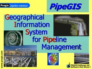
PipeGIS Geographical Information System for Pipeline Management
The Pipeline information system for pipeline operators The efficient way to manage oil & gas pipelines with modern technology!
Technical Documentation • Operation Reports • SCADA • Document Archive • Inspection Reports • Video Archive Field Inspection In-Line Inspection • Operational status • Geological Maps • Aerial Images • Land Survey • Pipe Map Key Objective Bring all DATA together and turn them into new INFORMATION An Open System bringing IT all together
Chemical Laboratory Video Inspection SCADA middleware Electronic Archive PipeGIS CMMS MIS Economical System Integration of existing systems: e.g. SAP R3
PipeGIS - main modules • Map and Data archive • Operational support • Maintenance support • Risk analysis • Emergency response plan
Map and Data Graphical data Attribute data Technical data
orthophoto images demographic map general vector map pipeline maps geological map plant maps cadastral map schemes Map and data - Graphical data Display only Information and Details relevant to the task
technical report inspection control form cadastral data report of armature shaft demographical data attribute of pipeline report of cathodic prot. report of interconnection Map and data-Attribute data
Pigging ultrasonic data pipebook data Pigging magnetic control SCADA data air video control Chemical analysis data Map and data-technical data
Operational Support – use • provides technical information about objects • visual displays operational status of pipeline • cumulative values of transferred medium • operational pressures on objects of pumping stations • chemical and physical properties of medium • concentration of danger vapors • increased levels of medium in armature shafts
ASME B31.G RSTRENGTH DNV-RP-F101 ... Analysis of Inspection Spatial Analysis Spatial Overlays Distance ... Risk Analysis • Risks associated with the Pipe • Corrosion • Dents • Stress • Risks associated with the Environment • Geology • Water • Terrain / Bathymetry • Risk associated with Third party • Minimum Depth of Cover • Activity Level • Weighted Risk – Probability Analysis • Scenarios • Visualize Risk Types/Classes in Thematic Maps
Risk Evaluation • Corrosion • Buried Metal Corrosion (cathodic protection, coating condition, soil corrosivity, age of system, etc.) • Internal Corrosion (Product Corrosivity, Internal Protection) • Third Party • Minimum Depth of cover • Aboveground Facilities • Activity Level • Right-of-way Condition • Patrol Frequency • Incorrect Operations • Design (Safety system, MAOP Potential, Hazard identification) • Construction (Inspection, Material, Coating, Joining, Backfill) • Operation (Procedures, SCADA, Surveys, Training) • Maintenance (Procedures, Schedule, Documentation)
Risk Analysis Inspection Result So what ?
Water Sources Urban area Road Crossing AC Power Line Soil corrosivity PipeGIS- Risk Assessment Transform Risk data... in Risk Information!!! Other Risk impact factors
Key Benefits • Whatever Data exist about a Pipe • Find them • Show them • Relate them • Relate Pipe Information to other sources • Environment • Reports • Archive • Visualize Areas of Management Interest • Inconsistencies • Risks • Save Operation Costs • Administration • Reporting • Expandable – Adaptable – Customizable • Open System • Interface • Database