Download
1 / 24
290 likes | 1.71k Views
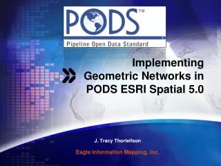
Geometric Networks in ArcGIS. Sewer, water, roads, etc. Types of Networks. Networks are of two types Directed flow (geometric networks) utility networks such as sewer and water systems; rivers and streams

E N D
Geometric Networks in ArcGIS Sewer, water, roads, etc.. GISC 6382 UT-Dallas Briggs
Types of Networks Networks are of two types • Directed flow (geometric networks) • utility networks such as sewer and water systems; rivers and streams • Elements on the network have no choice in travel decision. Flow direction is determined by the network characteristics alone. • Referred to as geometric or utility networks by ESRI • Available with ArcEditor level of ArcGIS • Undirected flow • Transportation networks such as streets • Elements on the network make their own travel decisions. Flow direction not determined solely by network. • Available thru Network Analyst extension GISC 6382 UT-Dallas Briggs
Geometric Networks and Network Topology Geometric Networks can also be useful for checking network topology • provide an alternative approach to applying topology rules • checking editing on a line file for connectivity and overlaps • Linking points and lines into a topological structure • Network Topology • a procedure for ensuring the integrity of data • applying topology rules for points and lines feature classes • examined in av9edit_topo.doc • Geometric (Utility) Network • a procedure for modeling flows thru a network • However, can also be helpful in editing network data and ensuing its integrity My guess is that each was developed by separate teams with different primary goals, with overlap occurring in the process Note 1: If a Topology relationship class exists in a feature dataset, you cannot build a geometric network. Note 2: ArcEditor is required for either.
Creating a Network in ArcCatalog • Geometric networks are created in ArcCatalog and stored as a relationshipclass within a geodatabase feature dataset • Right click on a feature dataset and select New/Geometric network to start the wizard for creating the network • The network (a relationship class) and its junctions (a point feature class) are listed along with the feature classes • Multiple point and line feature classes can participate in a network but they must all be in the same feature dataset • However, not all line or point feature classes in the feature dataset have to participate • The features within participating feature classes • May be moved if snapping is allowed • Have one or two new attribute fields: Enabled and Ancillary Role (if Source/Sink) • A feature class can only participate in one network • If desired, you can create a network with empty feature classes, and populate by editing in ArcMap, or loading data GISC 6382 UT-Dallas Briggs
source Analyze Network in ArcMapwhat you can do with a network sink • relate lines and points together so that when a move is performed in editing all points and lines move together • Establish flow direction in network using sources and sinks downthe network to a sinkor down the network from a source • Intended for tracing paths through network • Also useful to find errors in edited files (lines not snapped together, etc..) • Sources and sinks are identified in the AncillaryRole field in the point feature class(es). A junction is either: source, sink, none, Usually have only sources or sinks • Restrict flow via barriers, and observe effect on trace(pipe clog, pipe break, etc..) • Temporary barriers applied to junction or edge with Barrier tool in map document (e.g pipe break now) • Semi-permanent barriers applied through the Enabled field in point or line feature classes in database (e.g pipe segment under construction) • Perform network analyses (e.g. find common ancestor, find connected segments) • Junction or edgeFlagsare the starting point for these various trace operations All are implemented with the Utility Network Analyst toolbar GISC 6382 UT-Dallas Briggs
edges junctions Simple edge Complex edge Key Concepts • Networks are made up of: • Edges (derived from Line feature classes) • These have distance and direction • Junctions (derived from Point feature classes) • All edges end at a junction • Junctions may be end point of a line or intersections between lines • If a point from a point feature class is not available to serve as a junction, a point, called an orphan junction, is created in the junction feature class • Edges and Junctions may be simple or complex • Simple edges/junctions consist of a single feature • Complex edges allows edges to connect without separate segments • Complex junctions represent multiple features • A pump station complex junction may itself consist of multiple water lines (edges) and valves (junctions) • Weights may be associated with both edges and junctions • They represent the cost of traveling over that feature • They are calculated based upon an attribute of the feature (e.g. length of a pipe segment) GISC 6382 UT-Dallas Briggs
Type of network flow • Uninitialized • Flow has not yet been set for this part of the network • Determined • Flow has been set for this part of the network • Undetermined • Flow cannot be determined for this part of the network given the sources and sinks that are established • Acts the same as uninitialized flow • Same symbol used as default,but can be changed via options GISC 6382 UT-Dallas Briggs
Building and Using the Geometric Network Reference detail GISC 6382 UT-Dallas Briggs
Building the network • Select a feature dataset • Name your network • Select feature classes to participate • Set snapping • Tolerance distance • Feature classes to snap to • Identify complex edge feature classes • Define Sources and Sinks • Set weights GISC 6382 UT-Dallas Briggs
Define Source and Sinks GISC 6382 UT-Dallas Briggs
Establishing flow with sources and sinks • Flow goes from source to sinks • AncillaryRole field of junctions • A domain defines the available values • None • Source • Sink • Recalculate flow after editing and before analysis with tool • Display flow arrows via Flow/Display Arrows GISC 6382 UT-Dallas Briggs
Network Weights Cost to traverse an edge or junction • Based on numeric field values • Lower numbers = lower resistance • Can be bidirectional (two way) by using two fields • Negative values are barriers • block flow down that segment • Define when the network is created • Name the weight • Apply it to a field in one or more feature classes (process similar to using a domain: “define” then “apply”) GISC 6382 UT-Dallas Briggs
Add Weights to a network GISC 6382 UT-Dallas Briggs
Add complex edges and Define feature to be snapped GISC 6382 UT-Dallas Briggs
Network Analysis • Network Traces • Tracing upstream and downstream • Finding path • Finding common ancestor • Find connected • Flags are use to define locations for tracing: 3 step process • Place the flags • Choose a trace task • Solve the trace GISC 6382 UT-Dallas Briggs
Tracing upstream and downstream • Upstream trace • Downstream trace GISC 6382 UT-Dallas Briggs
Finding Path • Find the best path between two flags • Upstream, downstream, connected • From first flag to second flag • Flags are placed on any feature GISC 6382 UT-Dallas Briggs
Finding common ancestor • Piece of upstream network common to all flags • Which electric line is common to all house? GISC 6382 UT-Dallas Briggs
Finding connected features • Finding features connected to a flag • Commonly used for isolating features • Disable layer(s) (e.g. Valves) • Set Trace to Ends Property • Place a flag on the feature you want to isolate • Trace back to the disable layer GISC 6382 UT-Dallas Briggs
Finding Indeterminate Flow • Use the Find Loops analysis No Cycle (switch open) Cycle (switch closed) GISC 6382 UT-Dallas Briggs
Connectivity Rules for Networks • similar to domains for geodatabases • Domains control the values that variables can assume • Can apply at subtype level and also set default values • Connectivity rules allow you to control: • which edges may connect together • what junctions (points) must be used to connect these edges • Can apply at subtype level and also set default values • Two types • Edge to junction rules • Edge to edge rules • Cardinality • The number of features that can connect • Number of edges a junction can connect to • Number of junctions an edge can connect
Setting Connectivity Rules • Connectivity rules are network versions of domains • “business rules” which you apply to connections between features • By default, all features can connect • Setting one rule means you have to set rules for everything you want to connect • This can be a lot of work! • Connectivity rules are set after the network is created by right clicking the network relationship class in ArcCatalog and going to Properties/Connectivity tab • Another option is to select Geometric Network Editor instead of going to Properties. (Probably easier once concept is understood) GISC 6382 UT-Dallas Briggs
Setting Edge-to-Junction rules(and junction-to-edge) This feature class (edge, in this case) With these Cardinalities With this subtype Connects to this junction GISC 6382 UT-Dallas Briggs
Setting Edge-to-Edge Rules This Edge Connects to this edge Through this junction GISC 6382 UT-Dallas Briggs