Download
1 / 26
260 likes | 440 Views
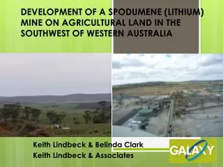
DEVELOPMENT OF A SPODUMENE (LITHIUM) MINE ON AGRICULTURAL LAND IN THE SOUTHWEST OF WESTERN AUSTRALIA. Keith Lindbeck & Belinda Clark Keith Lindbeck & Associates. AUSTRALIA. Australia is approximately the same size as the continental United States of America excluding Alaska.

E N D
DEVELOPMENT OF A SPODUMENE (LITHIUM) MINE ON AGRICULTURAL LAND IN THE SOUTHWEST OF WESTERN AUSTRALIA Keith Lindbeck & Belinda Clark Keith Lindbeck & Associates
AUSTRALIA • Australia is approximately the same size as the continental United States of America excluding Alaska. • Apart from Antarctica, Australia is the driest continent in the world. In total, 70% of the mainland receives less than 500 mm of rain annually, which classes it as arid or semi-arid.
MT CATTLIN SPODUMENE PROJECT • Owned by Galaxy Lithium Australia • Spodumene (Lithium/Tantalite) deposit • Located 540 km east-southeast of Perth, Western Australia. • Two kilometres north of Ravensthorpe town (population approx. 400).
MT CATTLIN SPODUMENE PROJECT • 15 year mine life • Open pit – 1 Mtpa • Three concentrators: • Spodumene (Li2O) -150ktpa • Lithium Carbonate (Li2CO3) - 15 ktpa • Tantalum (Ta2O5) recovered in HMS concentrate plant – 364tpa • Concentrate exported • Tailings Storage Facility • Reverse Osmosis Plant • Power sources – diesel, solar and wind • Processing plant, open pit, waste rock dumps, etc
TENURE • Project area initially owned by rural landholder – a rural landholder has a veto right over any mineral tenement application covering their land. • To avoid tenure issues, Galaxy purchased the property. • Project area located on cleared cropping and grazing land with isolated pockets of degraded native vegetation.
SURFACE HYDROLOGY • Cattlin Creek
HYDROLOGY • The creek water is highly saline, with a salinity similar to seawater (about 30,000 mg/L TDS). There is a relatively small wetland/samphire area associated with the creek to the northeast of the site
VEGETATION AND FLORA • Vegetation subject to grazing – little understorey • 22 weeds species recorded; 3 listed as ‘Declared Weeds. • Bridal Creeper (Asparagus asparagoides) • Saffron Thistle (Carthamnus lanatus) • Cape Tulip (Moraea flaccida)
FAUNA • One fauna species poses potential issue – Malleefowl (Leipoa ocellata) • Nest in mounds: up to 1m height; 3-5m diameter • Can reuse old existing mounds
HERITAGE • Aboriginal • Surveys recorded 4 Archaeological sites, 31 isolated finds • One Registered Aboriginal site (consisting of artefacts) in Unallocated Crown Land • Approval from Department of Indigenous Affairs required (Section 18) • European • Site ‘Hawks Nest Camp site’ located near Cattlin Creek within the project area. The site contains relics of an old mining camp settled in 1899. • No impact to the site
PROJECT APPROVALS Mining Act 1978: • Controls allocation of licences and leases for mining purposes • Mining Lease and Miscellaneous Licence obtained • Manages royalties paid for mineral extraction • Provides for environmental assessment and approval for mining projects via submission of a Mining Proposal (MP) to the Department of Mines and Petroleum (DMP) for assessment and approval by the Director – Environment of DMP. • MP approval obtained • Recent changes to Act require approval of a Mine Closure Plan prior to approval of the MP • Bonds (2 tenements - $1,232,000)
Environmental Protection Act 1986 – Part IV • Under this Act, mining proposals are assessed for approval under Part IV to ensure that that environmental impact assessments are undertaken for those projects that “may have a significant impact on the environment”. • Memorandum of Understanding (MOU) has been signed between the Director-General of the DMP and the Chairman of the EPA. • This MOU sets down guidelines which enable the environmental officers in the DMP to assess whether the proposed project requires referral to the EPA. i.e. mining of >10Mtpa; project located within or <2km of a conservation area or an occupied townsite • Mt Cattlin project was located within 2km of an occupied townsite (Ravensthorpe) • Project referred to the OEPA – decision ‘Not assessed’ i.e. no formal assessment – defer to DMP
Environmental Protection Act 1986– Part V • The Department of Environment and Conservation (DEC) requires a proponent to have a granted Works Approval (‘license to construct’) and Operating Licence to operate a “prescribed premises”. • There are 95 prescribed premises described in the regulations and for the mining industry. • Prescribed premises at Mt Cattlin: Spodumene and Lithium Carbonate Concentrators TSF
Environmental Protection Act 1986– Part V • Part V also administers the State-wide native vegetation clearing approval system. • Clearing permit required for clearing of native vegetation in WA. • There are exemptions (i.e. 10ha/tenement/financial year) – these do not apply in the southwest of WA. • Mt Cattlin required a clearing permit for clearing of up to 15ha of native vegetation. • Despite the degraded nature of the vegetation, as the area fell within an area mapped at a state level as having <30% of its pre-European extent remaining, an offset was required. • Galaxy produced an offset proposal which was later approved involving: • Rehabilitation of the waste dump and TSF to native vegetation • The area proposed to be rehabilitated to native vegetation totals an area of 44 ha: • 15 ha as a direct offset • 29 ha as a contributing offset.
Rights in Water and Irrigation Act1914 • This Act protects the surface and ground waters of WA and means that a proponent must hold a valid licence to construct surface water dams, construct or install bores or wells, to abstract water from bores or wells or from surface dams. • Mt Cattlin obtained a Groundwater Licence for abstraction of 1,095,000kL of water annually (and associated licence for construction of bores). • Groundwater quality varies between 5,000 and 15,000 ppm TDS
Project Approvals • Approval to commence construction received in November 2009. • Mining commenced in March 2010. • Processing commenced in October 2010. • Numerous Mining Proposal addendums have since been submitted for approval to allow expansion of mine infrastructure (e.g. ROM, waste dump).
Proposed Expansion • Proposed expansion of the project east into adjacent Unallocated Crown Land (UCL – public land) in two years. • This requires: • Diversion of Cattlin Creek • Diversion of a public road which splits the deposit • Salvaging and relocation of Aboriginal artefacts - The Section 18 was granted by the Minister for Indigenous Affairs and the artefacts were recently relocated to an undisclosed site where they will not be impacted by the proposed mining expansion.
Current status of operation • Project currently on ‘care and maintenance’ – no mining or processing • Requirement to continue with monitoring and reporting • High Australian dollar and impact on exports.