Download
1 / 32
320 likes | 442 Views
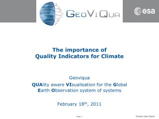
The importance of Quality Indicators for Climate. Geoviqua QUA lity aware VI sualisation for the G lobal E arth O bservation system of systems February 18 th , 2011. Climate Data - from FCDR to ECV. Fundamental Climate Data Records - FCDR

E N D
The importance ofQuality Indicators for Climate Geoviqua QUAlity aware VIsualisation for the Global Earth Observation system of systems February 18th, 2011
Climate Data - from FCDR to ECV • Fundamental Climate Data Records - FCDR • used to denote a long-term data record, involving a series of instruments, with potentially changing measurement approaches • Essential Climate Variable - ECV • The Essential Climate Variables (ECV) are required to support the work of the United Nations Framework Convention on Climate Change (UNFCCC) and the Intergovernmental Panel on Climate Change (IPCC). All ECV are technically and economically feasible for systematic observation. It is these variables for which international exchange is required for both current and historical observations. It is emphasized that the ordering within the table is simply for convenience and is not an indicator of relative priority. Currently, there are 50 ECVs.
Satellite-based ECVs GCOS – 107 Systematic Observation Requirements for Satellite-Based Product for Climate Page 81
The Measurement Chain - the SAR Level 1b Level 2 Calibration Model
Definition of Primary products • CEOS Definitions • Level 0 Reconstructed unprocessed data at full space -time resolution with all available supplemental information to be used in subsequent processing (e.g. ephemeris, health and safety) appended. • Level 1A Reconstructed unprocessed data at full resolution, time - referenced, and annotated with ancillary information, including radiometric and geometric calibration coefficients and geo - referencing parameters (e.g. ephemeris) computed and appended but not applied to the Level 0 data. • Level 1B Radiometrically corrected and calibrated data in physical units at full instrument resolution as acquired. • Level 2 Derived geophysical parameters (e.g. sea surface temperature, leaf area index) at the same resolution and location as Level 1 source data. • Level 3 Data or retrieved geophysical parameters which have been spatially and/or temporally re - sampled (i.e. derived from Level 1 or 2 products), usually with some completeness and consistency. Such re-sampling may include averaging and compositing. • Level 4 Model output or results from analyses of lower level data (i.e. parameters that are not directly measured by the instruments, but are derived from these measurements).
Level 1b products The example of Scatterometer and Radiometers
Scatterometer • In Europe, • ERS-1 - AMI (1991) C-Band fan-beam • ERS-2 - AMI (1995) C-Band fan-beam • Metop - ASCATT (2007) C-Band fan-beam • In US, • Seasat - SASS (1978) Ku-band fan-beam • NSCAT (1996) Ku-band fan-beam • QuikSCAT - SeaWinds (1999) Ku-band scanning • ADEOS-2 - SeaWinds (2003 ) Ku-band scanning
Scatterometer • Scatterometers measure sea surface roughness • The use of a different radar frequency means that the interactions between the sea-surface and the electromagnetic radar pulses are different.
Infrared Radiometers - SST • ATSR-1, ATSR-2, AATSR • 4 channels at wavelengths of: • 1.6µm (visible) • 3.7µm • 11µm • 12µm • Dual view • Self Calibrating • AVHRR • 6 channels at wavelengths of: • 0.58 - 0.68 µm • 0.725 - 1.00 µm • 1.58 - 1.64 µm • 3.55 - 3.93 µm • 10.30 - 11.30 µm • 11.50 - 12.50 µm
Infrared Radiometers - SST • ATSR-1, ATSR-2, AATSR • 4 channels at wavelengths of: • 1.6µm (visible) • 3.7µm • 11µm • 12µm • Dual view • Self Calibrating • ASTER • 14 channels at wavelengths including: • In the Thermal Infrared • 8.125 - 8.45 µm • 8.45 - 8.8 µm • 8.9 - 9.3 µm • 10.3 - 11.0 µm • 11.0 - 11.65 µm
A variety of Sensors • Different sensors implies: • Different Calibration • Different Signal Processing • Different Physic Therefore • Different Level-1b products Therefore • The data merging/fusion can only be done after conversion into geophysical products
Level 2 products The example of Sea Surface Temperature
Sea Surface Temperature The hypothetical vertical profiles of temperature for the upper 10m of the ocean surface in high wind speed conditions or during the night (red) and for low wind speed during the day (black).
Wind speed - some definitions • Wind speed is the speed of wind, the movement of air or other gases in an atmosphere. It is a scalar quantity, the magnitude of the vector of motion. The rate of wind movement in units of distance/time. • is the expected sustained 10-meter sustained wind speed (in knots) for the indicated hour. • The average wind speed taken during an hourly five-minute window, and given in kilometers per hour. • in meters per second. This is measured by an anemometer (Windcap Ultrasonic Windsensor WS425) installed on site at 8m , with an accuracy of 0.135m/s (0.3mph, 0.26 knots) or 3% of the reading, whichever is greater. 10 second samples are averaged over 5 minutes. • is the average velocity at which the air travels over a one-minute period and is measured in nautical miles per hour (NM/H or knots). The display is in miles per hour (mph), with the knots in parentheses. • average speed in miles of kilometres per hour of wind at a given site usually expressed is a maximum or average over the year. • Wind Speed is the current sustained wind, while Wind Gust is the current intermittent burst of wind speed. Wind speed is measured by the weather station's anemometer. The station calculates a 10-minute average wind speed and a dominant 10-minute wind direction as "wind speed." • Wind speed is measured at the West Oahu Air stations at the standard height of 33 feet above ground by a propeller anemometer mounted on a tower. The wind speed reported on the West Oahu Air website pertains to the hourly average and is reported in units of miles per hour (mph). • Wind Speed -- The rate at which air is moving horizontally past a given point. It may be a 2-minute average speed (reported as wind speed) or an instantaneous speed (reported as a peak wind speed, wind gust, or squall).
Wind speed - some definitions • sustained10-meter wind speed for the indicated hour. • average taken during an hourly five-minute window. • 8-meter wind speed, 10 second samples averaged over 5 minutes. • average over a one-minute period. • average speed of wind at a given site usually expressed is a maximum or average over the year. • Wind Speed is the current sustained wind, while Wind Gust is the current intermittent burst of wind speed. • 10-minute average wind speed and a dominant 10-minute wind direction as "wind speed." • 33-feethourly average. • 2-minute average speed or an instantaneous speed. • Altitude - Speed Averaging - Direction Averaging
From Level-2 to ECV The example of A.1 - Surface Vector Wind O.3 – Sea surface temperature
GCOS Requirements for ECVs Product A.1 Surface Vector Wind Target requirements The surface wind field is the primary driver of the ocean circulation, which is responsible for the global transport of important amounts of heat, freshwater and carbon. Surface drag and momentum exchanges, fluxes of sensible heat and moisture also depend on wind speed. The surface wind field is a sensitive measure of the state of the global coupled climate system and is very valuable for climate change detection and climate model evaluation. Over land, wind contributes to the surface heat balance influencing advective and turbulent heat fluxes. • Accuracy: Mean and quadratic statistics to 10% of the mean speed, or ~0.5 ms-1 at 10ー • Spatial and temporal resolution: 10 km horizontal resolution, hourly observing cycle • Stability: ~0.1 ms-1/decade Product O.3 Sea Surface Temperature Target requirements Known patterns of interannual and longer-term climate variability have amplitudes of several degrees C over basin scales. Coastal variability has comparable or larger amplitudes and occurs on scales as small as 1 km over multi-day periods. The diurnal cycle can be of comparable magnitude under certain conditions and can be aliased into lower frequencies if not sampled properly. Global-average warming trends are estimated to be about 0.5°C over 100 years. • Accuracy: 0.25°C • Spatial and temporal resolution: 1 km horizontal resolution, 3-hourly observing cycle • Stability: 0.1°C Source: http://www.wmo.int/pages/prog/gcos/Publications/gcos-107.pdf
The Cube Concept The example of O.3 – Sea surface temperature
25 km 4 km 1 km >1 km O.3 – Sea surface temperature • For one ECV, the various FDCR’s are of different natures in terms of • type of parameters • resolution SST Depth SST Sub-Skin SST fnd SST Skin
25 km 4 km 1 km >1 km O.3 – Sea surface temperature • As example in-situ measurements are covering • All type of parameters • At very low resolution/intermittent observations In-situ SST Depth SST Sub-Skin SST fnd SST Skin
25 km 4 km 1 km >1 km O.3 – Sea surface temperature • In the vertical axes, one can add the type of sensor • First infra-red with their own characteristics SST Depth SST Sub-Skin SST fnd SST Skin Infra-red In-situ
25 km 4 km 1 km >1 km O.3 – Sea surface temperature • In the vertical axes, one can add the type of sensor • First infra-red with their own characteristics • Then the passive microwaves SST Depth SST Sub-Skin SST fnd SST Skin Passive microwaves Infra-red In-situ
25 km 4 km 1 km >1 km O.3 – Sea surface temperature • From there one can build re-gridded products … SST Depth SST Sub-Skin SST fnd SST Skin Re-gridded Passive microwaves Infra-red In-situ
25 km 4 km 1 km >1 km O.3 – Sea surface temperature • … and process merged products SST Depth SST Sub-Skin SST fnd SST Skin Merged Re-gridded Passive microwaves Infra-red In-situ
25 km 4 km 1 km >1 km O.3 – Sea surface temperature • The exact nature of the cube varies with time as new sensors and techniques appear/disappear SST Depth SST Sub-Skin SST fnd SST Skin Merged Re-gridded Passive microwaves Infra-red In-situ Time n Other cubes exist for n+1 etc…
25 km 4 km 1 km >1 km Merging routes across instruments Spatial aggregation O.3 – Sea surface temperature SST Depth SST Sub-Skin SST fnd SST Skin Key Science body: GHRSST CLIVAR GCOS SST / SI WG Key Uers: Short Term, Seasonal, Decadal, Forecasting Systems and climate projection Modelling community Merged Re-gridded Passive microwaves Infra-red In-situ Time n Other cubes exist for n+1 etc…
From the ECV perspective • This type of analysis shall be developed for each ECV to include: • Various sensors type, • Various product type • The temporal evolution of the measurement (sensors) and processing (algorithms) techniques • The merging routes shall take into account these variabilities. • To build a proper ECV, each FCDR shall find its place in this analysis
The importance ofQuality Indicators for Climate From Sensor to Merged products From FCDRs to ECVs
The different steps FCDR (Level 0) Level 2 ECV
The different Steps - Quality Indicators • All these steps shall be completely described to allow the production of the ECVs • Sensor: • Sensor Characteristics • Signal Processing • Error Characterisation at every level • Level-1 B • Definition of the parameters • Calibration • Processing algorithms • Assumptions and Hypothesis • Error characterisation • Level 2 • Definition of the parameters • Validation • Processing algorithms • Assumptions and Hypothesis • Error characterisation • Merging / Fusion • Definition of the parameters • Validation • Processing algorithms • Assumptions and Hypothesis • Error characterisation
Quality Assurance for Climate • Climate Change is a societal challenge, • Quality Assurance is a fundamental element of Climate change. • Examples • Offset Market Growing but Quality Assurance Lags: GAO • The U.S. Government Accountability Office found that, by and large, a lack of information surrounding carbon offsets leads to problems determining additionality and the existence of quality assurance mechanisms. • Environment Canada • Quality assurance/quality control (QA/QC) activities should be an integral part of any inventory development processes as they improve transparency, consistency, comparability, completeness and accuracy of greenhouse gas inventories. • Green House Gases • Lloyd's Register Quality Assurance (LRQA) work with organisations to help them demonstrate their emission reductions and compliance with national requirements. • LRQA offers validation and verification services so that clients can demonstrate their emission reductions and compliance with national requirements and the mechanisms originating from the Kyoto Protocol. • It requires to provide data from a large variety of source and therefore lead to the definition of standards in particular in Products Quality, Quality Control and Cal/Val • In order to have credibility in the production of ECVs, all the processing steps shall be completely described, characterised with an associated error characterisation process. • Quality Indicators (the ensemble of parameters needed to understand and exploit FCDRS and to produce ECVs) are essential element of the whole process.