Download
1 / 20
200 likes | 315 Views
This thesis proposal examines the evolution of storm vulnerability in a Nova Scotia community over time, assessing the impact of development patterns. Utilizing GIS and historical data, the study aims to identify vulnerabilities, analyze damages, and make recommendations for minimizing future risks.

E N D
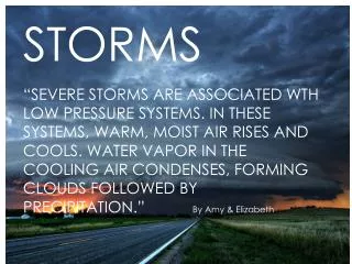
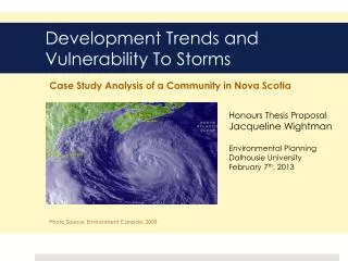
Case Study Analysis of a Community in Nova Scotia Development Trends and Vulnerability To Storms Honours Thesis Proposal Jacqueline Wightman Environmental Planning Dalhousie University February 7th, 2013 Photo Source: Environment Canada. 2009.
Outline • Background • Storms in Nova Scotia • Coastal Development Trends • What is vulnerability? • Research Problem • Goals and Objectives • Method • Expected Findings • Implications of Study
Storms in Nova Scotia Nova Scotia 10 Years of Hurricane Tracks: 1992 - 2001
Storms in Nova Scotia Land-falling Hurricanes 100 Years of Tracks in Nova Scotia Photo Source: Environment Canada, 2012.
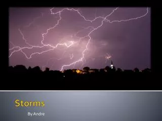
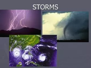
Storms in Nova Scotia • Land-falling hurricanes are not the only problem • Extratropical storm remnants can also do damage Remnants of Hurricane Noel (2007) Damaged property and roads, Caused power outages to homes and businesses in Nova Scotia Photo Source: CBC News Online, 2012.
Storms in Nova Scotia • Winter storms can do a lot of damage Groundhog Day Storm, 1976 Blow to Yarmouth fishing industry Thousands of dollars of damage to this wharf alone Photo Source: Fundy Group Publications LTD, Groundhog ‘76
Storms in Nova Scotia • Climate change will increase storm risk: • Storm surges will reach further inland due to sea level rise • Possibility of more frequent, intense storms
Coastal Development Trends • Number of people on the coast is increasing • More people exposed • Use of coast in the 19th and early 20th century: • infrastructure (wharves, docks, railways, etc.) • Today: • residential, recreational, commercial and institutional uses
What is vulnerability? RISK is the product of • Hazard – How big is the storm? • Exposure – Will the storm hit us? • Vulnerability – Can we withstand it? All of these factors determine the RISK of damages
What is vulnerability? • The amount of destruction is determined by: • Magnitude of the storm • Our location in relation to the storm • Infrastructure and development patterns
Research Problem • How has vulnerability to storms in a community in Nova Scotia evolved over time due to changes in development patterns? • What do these trends imply for future storm risk?
Goals • Goal 1: Conduct a historical case study analysis of the effect of land use change on vulnerability • Goal 2: Determine how the community can minimize its vulnerability to future storms
Objectives • Map development changes over time including type, density, use and form. • Interpret land use change from a vulnerability perspective: • Determine and identify vulnerable land uses at each point in time. • Identify the damages associated with every storm. • Compare past to present vulnerability, and make recommendations based on past trends.
Method • Chose a community that is vulnerable to storms and has undergone significant land use change. • Yarmouth, Nova Scotia • Strongly affected by storms • Data available
Spatial analysis of land use change using GIS: Geo-reference and map historic fire insurance maps Aerial photos Current Zoning maps Method: Land Use Change Over Time Section of 1891 Yarmouth Fire Insurance Map Courtesy of Yarmouth Planning Department
Categorize buildings based on attributes that affect vulnerability: Use Building materials Permanency Investment Interpret change in vulnerability over time due to changes in land use Method: Land Use Change Over Time Section of 1938 Yarmouth Fire Insurance Map Courtesy of Yarmouth Planning Department
Create a list of major storms that hit community: Environment Canada News articles Compare storm damages to land use at the time, make correlations if possible Method: Storm Damage Analysis
Analyze current vulnerability to storms Based on historic trends and current land use maps Identify areas of concern Method: Vulnerability to Future Storms
Expected Findings Historic trends • Vulnerability increases as the coast becomes more developed • More storm damages in areas where development has changed from infrastructure/industrial to residential/commercial/recreational Future storm risk • Development occurring in a way that increases vulnerability Change in hazard? • Fires more of an issue in the 19th century • Flooding a bigger issue today than in the past
Implications of study Understanding the past is key to planning for the future. Past: • The influence of a community’s development on its vulnerability to storms Present: • Trends show an increase in vulnerability, how can we change this? Future: • Climate change • increase in storm extent = more damage potential