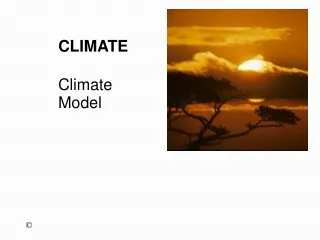
Climate
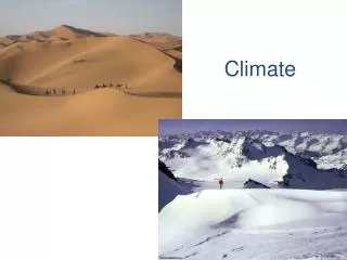
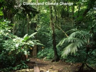
Climate. Climate is the average weather (patterns established over decades) of a location Climate refers to Temperatures throughout the year Precipitation throughout the year Susceptibility to particular weather events such as: Monsoons Tornadoes Hurricanes/typhoons Drought.

Climate
E N D
Presentation Transcript
Climate • Climate is the average weather (patterns established over decades) of a location • Climate refers to • Temperatures throughout the year • Precipitation throughout the year • Susceptibility to particular weather events such as: • Monsoons • Tornadoes • Hurricanes/typhoons • Drought
6 factors determine climate • 1. Latitude • 2. Altitude/Relief • 3. Prevailing winds • 4. Ocean Currents • 5. Distance from the sea • 6. El Nino effect
Latitude – distance from the equator Measures north/south Tropics, polar circles " Fundamentals of Mapping ." Intergovernmental Committee on Survey and Mapping. The Intergovernmental Committee on Surveying and Mapping , n.d. Web. 21 July 2010. <http://www.icsm.gov.au/mapping/coordinates.html>.
Altitude - relief • Higher altitude/colder temperature • Leeside of mountains is dryer • Danoff-Burg, Dr. James A.. "SEE-U Biosphere 2: Module 09." Columbia University in the City of New York. Columbia University, n.d. Web. 21 July 2010. <http://www.columbia.edu/itc/cerc/seeu/bio2/restrict/modules/module09_content.html>.
Prevailing Winds • From water= more humid • Leeside of mountains = drier • From tropics = warmer • From polar regions = colder • The prevaling winds for BC are from the Pacific Ocean bringing moist, warmer air. The Okanagan is dry because of the mountains. • Jackson, Doug. "Aerospaceweb.org | Ask Us - Boeing Stratocruiser Flight Times." Aerospaceweb.org | Reference for Aviation, Space, Design, and Engineering. N.p., n.d. Web. 21 July 2010. <http://www.aerospaceweb.org/question/dynamics/q0057.shtml>.
Ocean Currents • Temperature of current can warm or cool the adjacent land • Direction of wind adds to the effect (i.e. If the wind travels over the ocean first ) • BC’s temperature is warmed somewhat by currents (see map) Walter, Thomas B.. "ocean.currents." DoG, HC - CUNY. N.p., n.d. Web. 21 July 2010. <http://www.geography.hunter.cuny.edu/~tbw/wc.notes/7.circ.atm/ocean_currents.htm>.
Distance from sea – continentality Water changes temperature MUCH more slowly than land, so living close to a huge body of water will “moderate” temperatures (warmer in winter and cooler in summer) Inland (continental) areas face more extreme summers and winters (marine climate and continental climate)
El Nino phenomenon • El Nino refers to unusually warm surface water in the Pacific Ocean. Every few years, on an irregular basis, El Nino occurs. The warmer water changes both rainfall and wind patterns. The phenomenon has been blamed for flooding, droughts, and even the lack of snow for Vancouver’s winter Olympics.
Assignment Based on the 5 factors, guesstimate the climate of the city you are assigned: Toronto, Halifax, Prince Rupert and Winnipeg. • 1. Find the city on a map • 2. Check the latitude and compare to West Kelowna. Is it further north/south? Will the city likely be warmer or colder? • 3. Check the relief. How does the elevation compare to West Kelowna? Is it on the leeside of mountains? How might the relief effect the climate? • 4. Check the prevailing winds. Are they from the north or south? Do they travel from water or land? • 5. Check the ocean currents. Will they be warm or cool or too far away to have much effect? • 6. Check the distance from sea. Will the climate moderated by the ocean? Compare answers with the class.
Climograph • A climograph is a very specific type of graph which indicates a location’s average monthly temperature with a line graph, and average monthly precipitation with a superimposed bar graph. See the example below: "Annual Climatology:." Welcome to the National Drought Mitigation Center website!. National Drough Mitigation Center, n.d. Web. 12 Aug. 2010. <http://www.drought.unl.edu/whatis/iclimographs/VancouverMTMP.htm>.
Individual assignment Casey, Joe. "Kelowna A., BC, Canada: Climate, Global Warming, and Daylight Charts and Data." World Climate. N.p., n.d. Web. 25 Aug. 2010. <http://www.climate-charts.com/Locations/c/CN71203011239700.php>.
Rainfall • Precipitation occurs when humidity in the air condenses • What causes the humidity to condense? • Cooling • What causes cooling? • Meeting a cooler air mass and rising in altitude
3 scenarios1. Frontal rainfall Pidwirny, Michael. "7(r) Air Masses and Frontal Transitional Zones." Geography : Physical Geography. N.p., n.d. Web. 25 Aug. 2010. <http://www.physicalgeography.net/fundamentals/7r.html>.
2. Orographic (or relief) rainfall Rogers, J. David. "SAY, WHAT IS A 100-YEAR FLOOD." Missouri University of Science and Technology. N.p., n.d. Web. 25 Aug. 2010. <http://web.mst.edu/~rogersda/umrcourses/ge301/what%20is%20a%20100%20year%20flood.htm>.
Assignment • Determine the climate of your chosen place • Create a climograph