Download
1 / 41
410 likes | 535 Views
MONITORING TROPICAL FOREST FROM SPACE - THE AMAZON PROJECT. Instituto Nacional de Pesquisas Espaciais - INPE. PRODES Objectives Operational Methodology Results DIGITAL PRODES Objectives Proposed Methodology Results for 231/67 TM scene. MONITORING OF TROPICAL DEFORESTATION.

E N D
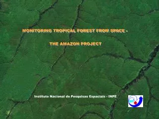
MONITORING TROPICAL FOREST FROM SPACE - THE AMAZON PROJECT Instituto Nacional de Pesquisas Espaciais - INPE
PRODES Objectives Operational Methodology Results DIGITAL PRODES Objectives Proposed Methodology Results for 231/67 TM scene MONITORING OF TROPICAL DEFORESTATION
To estimate the extent of gross deforestation and annual rate of gross deforestation To update the digital database To distribute the increments of deforestation • Into major forest types • Into classes of size Objectives Objectives Project Project
Image Analysis Image Analysis Project Satellite Image (1:250,000) + Overlay Minimum area identified 6.25 ha
Plotting Plotting Increment 97/98 Project
Project ANNUAL RATE GROSS DEFORESTATION (km² / year) * Decade Mean ** Biennium ACRE AMAPÁ AMAZONAS MARANHÃO MATO GROSSO PARÁ RONDÔNIA RORAIMA TOCANTINS AMAZONIA 96/97 358 18 589 409 5271 4139 1986 184 273 13227 97/98 536 30 670 1012 6466 5829 2041 223 576 17383 77/78* 620 60 1510 2450 5140 6990 2340 290 1650 21130 88/89 540 130 1180 1420 5960 5750 1430 630 730 17860 89/90 550 250 520 1100 4020 4890 1670 150 580 13810 90/91 380 410 980 670 2840 3780 1110 420 440 11130 91/92 400 36 799 1135 4674 3787 2265 281 409 13786 92/94** 482 - 370 372 6220 4284 2595 240 333 14896 94/95 1208 9 2114 1745 10391 7845 4730 220 797 29059 95/96 433 - 1023 1061 6543 6135 2432 214 320 18161
Project EXTENT OF GROSS DEFORESTATION (km²) Jan/78 2500 200 1700 63900 20000 56400 4200 100 3200 152200 Apr/88 8900 800 19700 90800 71500 131500 30000 2700 21600 377500 Aug/89 9800 1000 21700 92300 79600 139300 31800 3600 22300 401400 Aug/90 10300 1300 22200 93400 83600 144200 33500 3800 22900 415200 Aug/91 10700 1700 23200 94100 86500 148000 34600 4200 23400 426400 Aug/92 11100 1736 23999 95235 91174 151787 36865 4481 23809 440186 Aug/94 12064 1736 24739 95979 103614 160355 42055 4961 24475 469978 Aug/95 13306 1782 26629 97761 112150 169007 46152 5124 25142 497055 Aug/96 13742 1782 27434 99338 119141 176138 48648 5361 25483 517069 Aug/97 14203 1846 28140 99789 125023 181225 50529 5563 25768 532086 Aug/98 14714 1962 28866 100590 131808 188372 53275 5791 26404 551782 ACRE AMAPÁ AMAZONAS MARANHÃO MATO GROSSO PARÁ RONDÔNIA RORAIMA TOCANTINS BRAZILIAN AMAZONIA (Includes old defortation)
30000 25000 20000 15000 10000 5000 0 80 85 88 98/99*** 97/98 91/92 96/97 77/78 88/89 89/90 90/91 94/95 95/96 92/93** 93/94** O,54 Mean Rate of Gross Deforestation (% / yaer)* 0,30 0,40 0,37 0,37 0,81 0,48 0,51 0,48 0,37 0,47 0,40 Decade Mean Rate Project EVOLUTION OF THE MEAN RATE OF GROSS DEFORESTATION (km² / year) MEAN RATE OF GROSS DEFORESTATION (km² / year) * Relative to the area of forest remains. ** Data from 1993 and 1994 refer to the estimates of the mean rate of gross deforestation for the period 1992 - 1994. *** The mean rate of gross deforestation for 1999 was derived from the analysis of 44 TM-Landsat scenes.
Project Dense Tropical Rain Forest - Distribution of the mean rate of gross deforestation by classes of size MEAN RATE OF GROSS DEFORESTATION (% / year)* * Relative to the annual mean rate in Dense Tropical Rain Forest
Project Deforestation Observed in 1998 Deforestation ’98 Dense Savanna Woodland Amazon White-Sand Woodland Dense Tropical Rain Forest Open Tropical Rain Forest Early Primary Succession Communities Contact Zone Seasonally Deciduous Tropical Forest Non Forest Water
Project Critical Areas Dense Savanna Woodland Amazon White-Sand Woodland Dense Tropical Rain Forest Open Tropical Rain Forest Early Primary Succession Communities Contact Zone Seasonally Deciduous Tropical Forest Non Forest Water Critical Areas ESTIMATIVE 1999 % of the Rate of Gross Deforestation Assotiated with the Critical Areas Mean Rate of GrossDeforestation in the Critical Areas ( km²/ year) Mean Rate of Gross Deforestation ( km² / year) Year 98 13.474 17.383 78 16.926 99 13.120
Aproximated Statistics of Project Project Machine-hours: 10.000 Person-hours: 50.000 Time required: 4 months Mean number of people/day: 70 Cost: R$ 927.000,00
Objectives Proposed Methodology Results for 231/67 TM scene DIGITAL PRODES
MATERIAL AND METHODS Landsat TM Linear Spectral Mixing Model Image Segmentation and Classification SPRING OBJECTIVESTo automate the image interpretation procedure and to build a Database with deforested areas information.
DIMENSIONALITY REDUCTION OF (RGB) TM IMAGE BY GENERATING SHADE FRACTION IMAGE, WHICH ALLOWS THE DISCRIMINATION OF SURFACE TARGETS Burned areas Primary forest DRAINAGE DISCRIMINATION Regrowth Typical deforestation
IMAGE SEGMENTATION AND CLASSIFICATION OF SHADE FRACTION IMAGE SIMILARITY (8) AND AREA (16) THRESHOLD VALUES (MINIMUM MAPPED AREA = 5.76 ha)
THE CLASSIFICATION EDITION DONE BY PHOTOINTERPRETER IN THE COMPUTER SCREEN THE OVERLAP OF VECTOR DATA ALLOW TO EDIT OR TO ELIMINATE POLYGONS #AGREGADO-97 ASSURES AND MAINTAINS THE COHERENCE WITH THE HISTORICAL DATA OF ANALOGICAL PRODES
DIGITAL PRODES: ACRE, RONDÔNIA, MATO GROSSO, AND PARÁ ( APPROXIMATELY 80% OF DEFORESTATION ) 110 LANDSAT TM IMAGES ACQUIRED IN 1997
# EXAMPLE OF FINAL REPRESENTATION PROPOSED FOR THE DIGITAL PRODES PROJECT
MAPPING BURNED AREAS Burned areas over old deforestationa ( 84%) Burned areas Burned areas Burned areas over recent deforestation 16%) • Burning occurred over recent deforested areas (orange color, 186 km2) • were discriminated from those occurred over old deforested areas • (red color, 964 km2) mapped using 1998 TM image.
MAPPING REGROWTH AREAS CLASSIFICATION OF SEVEN REGROWTH CLASSES Regrowth
D E T E R SYSTEM OF DEFORESTATION DETECTION IN A REAL TIME Based on the application of PRODES Digital methodology over MODIS images
RELATION BETWEEN DETER X PRODES PRODES 2004 ESTIMATIVA LANDSAT/CBERS/.... PRODES 2003 ESTIMATIVA LANDSAT-TM5 DETER 2004 DETECÇÃO MODIS/WFI
THE HISTORICAL DATA OF PRODES DIGITAL 2000 NEED TO BE COMPLETED AND OVERLAYED OVER MODIS IMAGES
AREA EXTENSION OF PRODES DIGITAL OVER MODIS IMAGE (COMPOSITE 12 - 27 AUGUST 2003)
DETAIL OF AREA EXTENSION PRODES DIGITAL OVER MODIS IMAGE (COMPOSITE 12 - 27 AUGUST 2003)
PROJETO DETER EXAMPLE OF DEFORESTATION DETECTION “APRIL / MAY”
MODIS COMPOSITE 22 APRIL - 07 MAY 2004 R(MIR) G(NIR) B(Red)
DETAIL - MODIS COMPOSITE- 22 APRIL - 07 MAY 2004 Rio Xingu SOIL FRACTION VEGETATION FRACTION SHADE FRACTION
CLASSIFICATION OF MODIS IMAGE (COMPOSITE 22 APRIL - 07 MAY 2004) AREA EXTENSION UP TO_AUGUST 2003 + INCREMENT UP TO 07 MAIO
NEW AREA EXTENSION UP TO 07 MAY 2004 OVER MODIS IMAGE (22 APRIL - 07 MAY)
AREA EXTENSION UP TO 07 MAY 2004 OVER MODIS IMAGE 21 MAY 2004