Download
1 / 19
190 likes | 282 Views
REMOTE SENSING METHODS FOR INVESTIGATING OUTGOING INFRARED RADIATION OF RECENT LARGE REGIONAL FAULTS AND ITS TERRESTRIAL HEAT FLOW AND GEOCHEMICAL HALOES. N.V.Vilor , L. D.Andru - laitis, O. V.Zarubina, B. S.Danilov, and A. V.Klyuchevsky

E N D
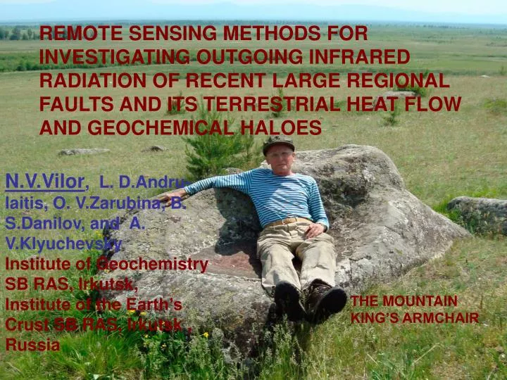
REMOTE SENSING METHODS FOR INVESTIGATING OUTGOING INFRARED RADIATION OF RECENT LARGE REGIONAL FAULTS AND ITS TERRESTRIAL HEAT FLOW AND GEOCHEMICAL HALOES N.V.Vilor, L. D.Andru-laitis, O. V.Zarubina, B. S.Danilov, and A. V.Klyuchevsky Institute of Geochemistry SB RAS, Irkutsk, Institute of the Earth’s Crust SB RAS, Irkutsk , Russia THE MOUNTAIN KING’S ARMCHAIR
Purpose • Determinationof intensity of outgoing IR radiation flow of large seismoactive regional faults, which are expose by surface heat flows by remote sensing method and correlation this flow with transfer of mobile chemical elements and its geochemical flows • Items • the remote sensing method of mapping of distribution of intensity of outgoing IR radiation flow for different geodynamic situation • the investigation of nature of surface outgoing IR radiation flow • the investigation of distribution of mobile chemical elements into surface formations of regional faults • the calculation of its geochemical flows by using the conception of geochemical barriers
satellitesNOAA, TERRA, AQUA Brightness of the outgoing electro-magnetic radiation in the IR band mea-sured by satellites The area of computing the geometric factor L The outgoing electro-magnetic radiation in IR heat band F–surfaceheatflow(mW/m2)–theeffective surface radiation of the geostructure F The flow was formed inside the radiating layer of the ground F = Fgr + Fc + F phc + Fd The area of subsurface heat-mass transfer via heat-carriers Fd The subsurface heat flow from the upper part of the earth’s crust. THE SCHEME OF THE ORIGIN OF THE SURFACE INFRARED RADIATION OF THE LARGE REGIONAL FAULTS
Geodynamical situations of manifestation of outgoing surfaceIR radiation flowof large seismoactive regional fault
Distribution of outgoing surface IR radiation in the BRZ. 1 – 5 the largest rft depressions: 1- Baikal, 2- Hovsgol, 3 - Tunka, 4 – Barguzin, 5 – Upper Angara, 6 - Darkhat B Rift situation. Outgoing surface IR flow large tectonic depressions BRZ. A. Tunka depression. B. Bargoozin depression A
The temporal maps of regional permeability along large faults BRZ for 1976 – 1994 years A Upper Angara B Tunka C Bargoozin The low length wave of geometric component of plots of outgoing surface IR flows of BRZ’largest faults
А Мангейм Frankfurt Strasburg C Страсбург Fraidurg B Outgoing surface IR flows map of Western Europa part with Rhine graben. A, B, C – large regional faults (after Gorni V.I. 2007) The structural map of Rhine graben. thermal water springs(after Friedrichsen,1981 famous water spring
The structural map of Afar B The correlation of the depth of bedding of Moho surface and outgoing IR flow The IR flow The outgoing surface IR flow map of Afar depression and mouth of Eastern African rift The depth of bedding of Moho surface, km
B C A The displacement geodynamic situation. IR radiation distribution on western part of USA(A) and structural maps of San-Andreas transform fault (B) and Big Basin province (C) (after R.L.Cook andJ.A.Thomson, 1970)
IR radiation anomalies of the surface of large faults of San Andreas system (1-3) and on faults of Big Basin province (4-6) F –fault’s tracks F F F 1 2 3 IR radia-tion temperatu-re, K F F F 6 5 4 Points of dimention
Collision situation.Structural (C) and IR radiation flow intensity (D) maps of Copetdag structural arc (after Tronin, 2010) A C South-Turkmen main fault D Kura-Bugaz gulf B Kara-Kum desert South-Turkmen fault Caspian Sea Aladag-Binalud displacement Structural (A) and IR radiation flow intensity (B) maps of the main bord er fault of Himalayas (after Ganser A.1967, Tronin,Saraf, 2010)
The Tarim platform The new map of Moho surface for Chinese territory by Baranov, @Earth Physics, N1, 2009 Ramp situation These boundaries are located on the slopes of the uplifted block of the upper crust, which corres-ponds to the massif of the Tarim platform.
Thenorthen boundery IR flux Faults desert The border zone range IR flux The southern boundary faults Brightness of the contrast outgoing surface IRflow for theTarim platform and its framing (January 2001, night) Basin’s upluft Border zone desert range The distribution of IR flux intensity across Tarim platform The distance, km
IR flow The calcula-tion of quasista-tionary IR flow Mazartag structure months Kuruk-tag structure The derivative of IR flow The minimum of derivative Kalpin-tag structure
The transition to the values of brigthness measured for the surface IR flow can be made with the use of the following relation F = L · G (Gossorg, 1980) (1), were F - surface IR flow, L - brightness IR flow, G - geometric factor, which writes G = π ·S · sin2 α = 6.8704 (m2. ster). Hence the surface IR flow F computed by (1) makes: F = 6.8704 L (mW). Values of F are added for the components, which form its balance. The addends of such a balance include: Fgr – heat flow of the active ground layer (the result of heat inertia), Fc – heat effect of the surface condensation or crystallization of water vapor, F pch – heat effect of the process of oxidation of gases coming from the ground in the upper part of the active layer, Fd – component of the deepheat flow. Hence, we have: F = Fgr + Fc + F pch + Fd The sub-surface endogenic flow Fd is the sum of influences of the conductive and the convective components upon the radiating layer. The difference between the value of the near-surface endogenic flowFdand the near-surface conductive componentFcnd computed represents the share of the convective component Fcnv .Fcnv = Fd –Fcnd The calculated surface heat flowof large regional faults of BRZ The calculated surface heat flow of large regional faults of Tarim basin and it folded frame
The set of geochemical samples on large seismoactive regional fault’s trakcs of BRZ A. Border regional zone of Siberian platform and Tunka fault, B. Bargoozin depration A B Depth, cm Plots of volatile chemical ore element’s concentrationdistribution into surface formations of Bargoozine regional fault The concentration is g / t
Geochemical indicators,associated with surface outgoing IR flow of large seismoactive faults of BRZ
Surface ionization level of near ground air for Tunka fault track П, geochim. flow = [С comp : (S ∙ t)] ∙10 6 = kg/km2 ∙ year. fault rim zone depression Geochemical flows of large seismoactive regional faults of BRZ Cordomorphous cloud above Tunka fault track fault track
Thank's a lot for Your attention Ionospheric perturbations above large seismoactive fault, associated with Wenchuan Mw=8.0 earthquake on 12 May 2008 in Sichuan, China (after Xiao-Li Ding et al., Urumqi, 2009)