Download
1 / 17
240 likes | 680 Views
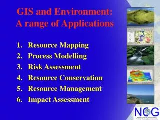
Resource Mapping Process Modelling Risk Assessment Resource Conservation Resource Management Impact Assessment. GIS and Environment: A range of Applications. Resource Mapping - Geology. An example of resource mapping using GIS…

E N D
Resource Mapping Process Modelling Risk Assessment Resource Conservation Resource Management Impact Assessment GIS and Environment:A range of Applications
Resource Mapping - Geology • An example of resource mapping using GIS… • Geological Survey of Ireland online data reference service. • Solid geology. • Linear structural features • Linear Stratigraphical features. • GSi boreholes. • OSi background mapping • Groundwater vulnerability mapping online. • Advisory for government departments & agencies on groundwater issues Source: http://www.gsi.ie
Resource Mapping - Landform D. A. C. B. Digital Terrain Model (DTM) data Satellite and aerial survey-derived data on topography is used in a wide variety of applications including: A. DTM - Image draping, visibility assessment B.SLOPE - Roads design, Hydrological modelling C. ASPECT - Agricultural, Biodiversity assessments D. HILLSHADE - Landform visualisation DTM Source: NASA Shuttle Radar Topography Mission. http://srtm.usgs.gov/
Resource Mapping - LIDAR A. Environmental change analysis A. LIDAR DTM model rendered to 3D in ArcGIS and draped with B. 1860 six-inch mapping and C. 2002 digital aerial photography to assess stream course changes over time. B. C. LIDAR Data Source: UK Environment Agency
Resource Mapping - Landcover E.U. Ireland CORINE Landcover 2000 project CORINE 2000 is a satellite-derived GIS dataset that classifies landcover resources of member states. Source http://terrestrial.eionet.eu.int/CLC2000 Legend
Resource Mapping – Marine Irish National Seabed Survey A multibeam sonar survey of Ireland's 525,000 km2 territorial seabed area, providing water depth data and knowledge of the nature of the seabed and its overlying sediment. Magneticand gravity techniques are helping to evaluate the nature and structure of the deeper geology http://www.gsiseabed.ie/
Process Modelling – Hydrology Hydrological modelling in GIS. Catchment delineation based on Digital Terrain Models (DTM's), Stream delineation based on runoff models on DTM’s, Definition of hydrological management zones for planning purposes. examples from diverse sources
Process Modelling / Risk Assessment LANDSLIDES Modelling Landslide susceptibility. Use of A. DTM to compute B. slope maps to C. infer water flows D. outlining slope / flow accumulation E. highlighting risk areas, which are F. Tested against observed landslide data. A. B. D. C. F. E. Source: http://www.krisweb.com/watershd/slope.htm
Process Modelling / Risk Assessment FLOODING Flood modelling / risk assessment. UK Environment Agency Flood risk GIS A. Web Access GIS B. Web GIS portal C. Postcode / name search ‘York’ D. Actual flood for ‘York’ E. Factory flooded F. Street flooded A. B. D. C. E. F. Source: http://maps.environment-agency.gov.uk/wiyby/mapController
Resource Conservation (NPWS) Data B. A. C. E. D. National Parks and Wildlife Service (NPWS) GIS data Conservation areas protected by legislation Data available online for: A. National Parks, B. Special Areas of Conservation (SAC’s). C. Special Protection Areas (SPA’s), D. Natural Heritage Areas (NHA’s), E. Nature Reserves. Data source: NPWS. http://www.heritagedata.ie/en/index.html
Resource Conservation – Habitats • Biodiversity mapping – web GIS, India. • Web GIS, diverse biodiversitydata dissemination data. • Spatial and non-spatial • querying for plant species. • Queryable sample data. • Queryable Red book species data. • Outputs include, vegetation, fragmentation, disturbance and biological richness maps. Source: http://www.biospec.org
Resource Conservation – Mammals A. B. Habitat suitability A. Overlay model of combined human constraints. B.Distance to water assessment. C.Combined model of human–elephant conflict. C. Source: http://www.esri.com/news/arcnews/spring05articles/helping-elephants.html
Resource Conservation – GPS A. B. D. C. Animal Tracking A. Brown Bear -Sweden B. Wolves - Finland C. Red Deer - Czech Rep. D. Whitetail Eagle – Germany E. Lynx - Germany E. Source: http://www.environmental-studies.de/
Resource Management - Planning Environmental Management GIS. Rhode island State Env. Mgmt. dept. Online access to GIS data for State planners, Environmental Managers and the public. Data provided includes: A. Administative areas. B. Groundwater zones. C. Landcover / land-use. D. Recreation. Custom printable maps possible in combination with roads, waterbodies, topography and aerial photography. A. B. D. C. Source: http://www.dem.ri.gov/maps/index.htm#GV
Resource Management – Rivers EPA Water Quality monitoring data reporting in GIS The Environmental Protection Agency Regular assessments of river water quality. Assessment based on the species diversity count data. Web GIS used as public access reporting tool. Sourcehttp://www.epa.ie/rivermap/data/rivmaptop.html
Impact Assessment - EIA Environmental Impact Assessment Road EIS Cantabria Spain. 80 km motorway. Several routes considered. Common environmental concerns: Traffic increase, noise, air, water pollution visual impact, ecosystems impacts, public health. GIS suitability modelling DTM, Slope, Geology, Regolith, Geotechnical. GIS impact assessment, Landcover, flood Hazard, traffic loads, Population centres. DTM Slope Geol Regol. Geot. Cover. Flood Pop. Road
Impact Assessment - Pollution Groundwater contamination assessment. MTBE (additive for petrol) frequently detected groundwater contaminant. Santa Monica, California, MTBE detected in groundwater. Three of five wells providing 40% water needs for city population shut down. Temecula city, California GIS modelling study. MTBE distribution pattern and trend determined. Kriging to generate 2D maps of potential distribution of MTBE in groundwater. Generation of Probability map (of concentration exceeding recommended levels). Modelling provided an aid for regulators.