Download
1 / 37
410 likes | 664 Views
Case Study: UK Floods Cockermouth , Cumbria. LO: To explain the causes and effects of the flood and explain the management strategies that have been used on the river Derwent. 19 th November 2009. SPECIFICATION TARGET: 2.2b the effects of river flooding on people and the environment.

E N D
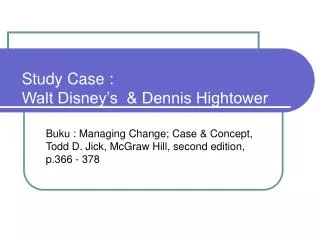
Case Study: UK Floods Cockermouth, Cumbria LO: To explain the causes and effects of the flood and explain the management strategies that have been used on the river Derwent 19th November 2009
SPECIFICATION TARGET: 2.2b the effects of river flooding on people and the environment.
What was Cockermouth like? A small market town With a population of 7,877
The causes of the 2009 flood in the River Derwent, Cumbria The causes of the 2009 flood in the River Derwent, Cumbria Use the following presentation to help you complete annotation onto the outline diagram in your notes. Physical causes are shown in blue, human causes in red. Colour code your annotation accordingly.
The various locations mentioned in your notes. Cumbrian Hills Keswick R. Derwent R. Cocker Cockermouth North Workington
1. Physical Causes Cumbrian Hills Keswick R. Derwent R. Cocker Cockermouth North Workington
1. Warm, very moist air, blowing from the SW, meets Cumbrian mountains & is forced to rise. North
2. It cools & condenses, producing cloud & rain – a lot of rain. In fact, 400mm of rain falls, breaking the previous record for highest 24 hour total in the UK of 316mm. North
Record rainfall 316mm in 24 hrs!
3. There is too much rain to infiltrate into the ground, and so it flows by overland flow to the streams, causing their discharge to rise very quickly. These feed quickly into the main rivers, the Derwent & the Cocker, increasing their discharge. North
3. There is too much rain to infiltrate into the ground, and so it flows by overland flow to the streams, causing their discharge to rise very quickly. These feed quickly into the main rivers, the Derwent & the Cocker, increasing their discharge. North
Example of the extreme overland flow produced by the record-breaking heavy rain that fell. Example of the extreme overland flow produced by the record-breaking heavy rain that fell.
4. At the confluence of the R. Derwent and R. Cocker, their discharges combine. This water then flows down towards Workington, causing flooding there. North
2. Human Causes Cumbrian Hills Keswick R. Derwent R. Cocker Cockermouth North Workington
1. Urbanisation – the towns such as Cockermouth and Keswick have increased the amount of impermeable surfaces which means that the water gets to the river more quickly, increasing discharge.
Notice how the water flows over the surface of the road. Similar effects occurred in urban areas as the water could not infiltrate into the tarmac. Notice how the water flows over the surface of the road. Similar effects occurred in urban areas as the water could not infiltrate into the tarmac.
2. Blocked sewers – inadequate sewer capacity and blockages caused sewers to back up and caused flooding incidents, for example in Elliot Park, Keswick.
What else helped to cause the Cumbrian Floods? • The ground was already saturated, so the additional rain flowed as surface run-off straight into the river • The steep slopes of the Cumbrian Mountains helped the water to run very rapidly into the rivers • The rivers Derwent and Cocker were already swollen with previous rainfall • Cockermouth is at the confluence of the Derwent and Cocker (i.e. they meet there)
For a specific area explain the causes of a flood (6) • The River Derwent flows through Cockermouth and is located in Cumbria, England and suffered flooding in 2009 and 2012. In 2009, floods were caused by excessive relief rainfall due to the area being mountainous – over 500mm of rain was received in a month, with 315mm falling in just 48hours in some areas. Cockermouth is located at the confluence of two rivers, and is downstream from hilly relief. As a result, when the rivers were overflowing due to high rainfall there was very little infiltration and a lot of surface runoff so Cockermouth received double the usual discharge and the rivers burst their banks. The floods were also caused by human factors such as urbanisation and building on floodplains which increased the amount of impermeable soils and led to more surface runoff.
Flooding, River Derwent in North Yorkshire Colour code to show causes, location detail & effects 4 bridges destroyed Roads and home were flooded up to 1 and a half meters In Malton, rubbish blocked the channel so the water backed up, making the flood worse than it could have been 1 police officer killed Melting snow on the North York Moors contributed to surface runoff Deforestation means the water gets to the ground straightaway, instead of being intercepted. The River Derwent burst it banks New buildings on the flood plain increased impermeability and reduced infiltration Sewage from flooded drains mixed with the flood waters to make a health hazard The population is about 100,000 The main roads A169 and A166 had to be closed. The rail link between York and Scarbourgh was cut and the replacement bus could not get to the town of Milton Pickering was flooded first, and town further down the river flooded a few days later. Steep slopes near the source of the River Derwent means increased runoff The main towns are Pickering, Norton, Malton, Pockington, Helmsley and Stanford Bridge It was the worse flooding the residents had seen in 70 years Between 28 Feb and 11 Mar there had been over 500mm of rain
For a specific area of river explain the flood management strategies that have been used (6)
Effects • http://www.youtube.com/watch?feature=player_embedded&v=iN5faen6s5g • http://www.youtube.com/watch?feature=player_embedded&v=AyvNxypJZNo • http://www.youtube.com/watch?v=UCxr0JfLEv0#t=38
The effects of the flood • ·Over 1300 homes were flooded and contaminated with sewage • · A number of people had to be evacuated, including 50 by helicopter, when the flooding cut off Cockermouth town centre • · Many businesses were flooded causing long-term difficulties for the local economy • · People were told that they were unlikely to be able to move back into flood-damaged homes for at least a year. The cost of putting right the damage was an average of £28,000 per house • · Insurance companies estimated that the final cost of the flood could reach £100 million • · Four bridges collapsed and 12 were closed because of flood damage. In Workington, all the bridges were destroyed or so badly damaged that they were declared unsafe – cutting the town in two. People faced a huge round trip to get from one side of the town to the other, using safe bridges • · One man died– PC Bill Barker
Information GCSE Case study Revision AQA_A Table 1: Properties flooded by district and use. CUMBRIA Allerdale Barrow Carlisle Copeland Eden South Lakes Residential 1,794 1,299 0 15 22 74 384 Commercial 445 422 0 0 0 5 18 www.cumbriaobservatory.org.uk/elibrary/Content/Internet/536/671/4674/4026717419.pdf Cumbria Floods 19th Nov 2009 (M.E.D.C. case study) Of the 1,721 properties flooded in the Allerdale borough - 917 were in Cockermouth (pictured). Of these 691 were residential properties. http://news.bbc.co.uk/1/hi/england/cumbria/8398538.stm The Cumbrian town of WORKINGTON was divided when floods destroyed its river crossings, killing a police officer, it has been re-united by a temporary footbridge. Workington's Barker Crossing, built by the Army, is named after Pc Bill Barker who died when Northside Bridge was washed away during last month's floods. The 170ft (52m) bridge across the River Derwent took a week to build. Schoolchildren were first to use the new crossing, to avoid a very long bus trip to school. It took Cockermouth residents, on average, six months to move back into their homes and even ONE YEAR LATER about 30 houses remained unready for their owners to return. GCSE questions may be about long term change or triggers that cause an event; plus immediate or long term consequences for groups; plus the possible responses to disaster.
The total cost Total damage cost: £276.5m • Business and local economy: £129.2m • Property: £98.3m • Roads and bridges: £34m • Health and welfare: £12.9m
For a chosen stretch of river explain the impacts of the flood (6)
Research a Flood case study in an MEDC – UK floods Causes: 1. 2. Effects – remember to quote specific detail and locations Flood Location (shade) Human responses: give specific detail
Worksheet GCSE Case study Revision AQA_A During the previous week- 39mm (1.52in) fell on Monday - that is, during the 24 hours beginning at 9am on Monday - 61mm (2.39in) on Tuesday - 143mm (5.61in) on Wednesday - 247mm (9.71in) on Thursday. The prolonged steady downpour which triggered the flooding began at 2000 on Wednesday and ended, 34 hours later, at 0600 on Friday. In that relatively brief time, it deposited a total of 378mm (14.87in). It takes eight months for that much rain to fall in London. Major rainfall events in the UK, that trigger serious flooding, fall into several different categories, defined by intensity, longevity, & geographical area. Skills questions Cumbria Floods 19th Nov 2009 (M.E.D.C. case study) TASK – Describe the location of Cockermouth, Cumbria. You may wish to refer to direction & distance. Use BOTH human and physical features. TASK – annotate this picture. You are on a committee of town planners and environment agency - How would you prevent future flood damage. ……………………………. …………………………..…. …………………………….. Cockermouth is close to …………………………….. ……………………..……… …………………………….. …………………………….. …………………………….. Flowing west towards the …………………………….. ……………………………. …………………………….. …………………………….. …………………………….. River Derwent (A597 bridge) at Workington http://news.bbc.co.uk/local/cumbria/hi/people_and_places/nature/newsid_8370000/8370332.stm TASK – Read the paragraph about the rainfall that caused the 2009 floods. Draw a graph of the week’s precipitation. What do the words prolonged, average, evaporation and saturated mean? STOP – Did you read the question? It says stop the damage NOT stop all future flooding! Have you thought about cost V benefits?
Worksheet 2 GCSE Case study Revision AQA_A C River Derwent hydrograph 19-11-09 Red = flood event Nov’09 Black = mean annual maximum D B cumecs www.ceh.ac.uk/news/news_archive/2010_news_item_47a.html#fig3 A Time (Number of 15min intervals) Skills questions Cumbria Floods 19th Nov 2009 (M.E.D.C. case study) X • TASK – Look at the sources. • Why is Nov 2009 So unusual even in rainy Cumbria? • Which letter (A,B,C,D) is camera viewpoint? • What types of property have been flooded at X castle X
STAFF NOTES GCSE Case study Revision AQA_A Slideshow – sch comp won’t set up account to download LINK http://funkygeography.blogspot.com/2009/11/cumbria-floods.html Weather information http://www.metoffice.gov.uk/about-us/who/how/case-studies Flood hyrdographs http://www.ceh.ac.uk/news/news_archive/2010_news_item_47a.html http://news.bbc.co.uk/local/cumbria/hi/people_and_places/nature/newsid_8368000/8368580.stm