Download
1 / 31
310 likes | 477 Views
Impact of Climate change in Australia & South America. Paula Williams & Susanne Olsen.

E N D
Impact of Climate change in Australia & South America Paula Williams & Susanne Olsen
During major warm events, El Niño warming extends over much of the tropical Pacific and becomes clearly linked to the intensity of the Southern Oscillation. While ENSO effects are basically in phase between the Pacific and Indian Oceans, ENSO effects in the Atlantic Ocean lag behind those in the Pacific by 12 to 18 months. Many of the countries most affected by ENSO are developing countries that are largely dependent upon their agricultural and fishery sectors for food supply, employment, and foreign exchange. New capabilities to predict the onset of ENSO events can have global socio-economic impacts. While ENSO is a natural part of the Earth's climate, an important concern is whether its intensity or frequency may change as a result of global warming. .
El Niño-Southern Oscillation (ENSO; commonly referred to as simply El Niño) is a global coupled ocean-atmosphere phenomenon. The Pacific ocean signatures, El Niño and La Niña are important temperature fluctuations in surface waters of the tropical Eastern Pacific Ocean. The name El Niño, from the Spanish for "the little boy", refers to the Christ child, because the phenomenon is usually noticed around Christmastime in the Pacific Ocean off the west coast of South America. La Niña, similarly, means "the little girl". These effects were first described in 1923 by Sir Gilbert Thomas Walker from whom the Walker circulation, an important aspect of the Pacific ENSO phenomenon, takes its name. The atmospheric signature, the Southern Oscillation (SO) reflects the monthly or seasonal fluctuations in the air pressure difference between Tahiti and Darwin, Australia. The most recent occurrence of El Niño started in September 2006 and lasted until early 2007. From June 2007 on, data indicated a weak La Niña event, strengthening in early 2008 and weakening in late 2008, with a forecast return to neutral conditions in 2009.
Australia Temperature Australian average temperatures have increased 0.9°C since 1950, with significant regional variations. The frequency of hot days and nights has increased and the frequency of cold days and nights has declined. Rainfall Since 1950, most of eastern and south-western Australia has experienced substantial rainfall declines. Across New South Wales and Queensland these rainfall trends partly reflect a very wet period around the 1950s, though recent years have been unusually dry. In contrast, north-west Australia has become wetter over this period, mostly during summer. From 1950 to 2005, extreme daily rainfall intensity and frequency has increased in north western and central Australia and over the western tablelands of New South Wales, but decreased in the south-east and south-west and along the central east coast. Oceans Global sea levels rose by about 17 cm during the 20th century, and by around 10 cm from 1920-2000 at the Australian coastal sites monitored. Substantial warming has also occurred in the three oceans surrounding Australia, particularly off the south-east coast and in the Indian Ocean.
Outlook The latest rainfall outlook issued by the Bureau of Meteorology shows no strong bias towards either wetter or drier conditions across the Murray-Darling Basin for the next 3 months (see Figure 6). The Southern Oscillation index has weakened to +9, and most climate models are currently predicting that the El Nino - Southern Oscillation (ENSO) will remain neutral for the next few months. Further information can be obtained from www.bom.gov.au/climate/ahead
Extreme weather conditions Within 800kms from the coastline a mean warming of temperature of 0.1-1.3 degrees is likely by 2020 Decreased annual rainfall is also expected over southern Australia The frequency of tropical cyclones (Cat 3-4-5) on the east coast will increase by 22%. Cyclone Hamish which hit the Queensland coast in early March 2009 was a Category 5. This occurred just days after severe floodings. Droughts are expected to increase by 20% over most of Australia by 2030. NSW has been drought declared for nearly 5 years. Earthquakes have been experienced in Victoria 6 March & 18 March 2009, registered as 4.6 and also occurring a few weeks after the Victorian fires hit the nearby regions. A rare earthquake is also erupting undersea near Tonga (19 March 2009). It is believed to be a cluster of up to 36 volcanoes http://www.climatechange.gov.au/science/hottopics/pubs/topic5.pdf
Fires and El Niño Since serious fires in Australia usually follow long dry periods, many of the worst fires in eastern Australia accompany El Niño-Southern Oscillation events. For instance, the disastrous Ash Wednesday fires in southeastern Australia followed failure of winter and spring rains during the strong El Niño event of 1982. There is also some evidence that El Niño summers have a higher incidence of extreme temperatures (over 38°C). Over southeastern Australia, weather conditions considered dangerous enough to warrant a fire weather warning, and/or fire ban, overwhelmingly occur when the Southern Oscillation Index is negative. But not all the time. Some major fires have occurred in La Niña events: the fires of January 1939 followed a rare La Niña spring drought in southeastern Australia (in a cruel twist of irony, floods at the end of February washed out many of those made homeless by the fires!). And more recently, disastrous bushfires in Victoria’s Dandenong Ranges in January 1997 accompanied a weak La Niña event. Fire Season worst March 2009 Victorian fires http://www.smh.com.au/news/national/bushfires-ravage-victoria/2009/02/09/1234027894314.html The times of peak fire danger over Australia. Note the tendency for summer/autumn to be the danger period in the southern States, and winter/spring in the north Relationship between the Southern Oscillation Index (SOI) and extreme fire danger days in Victoria. Dangerous conditions, with serious bushfires, are much more likely in southeastern Australia during the summers of El Niño years (negative SOI), than La Niña summers (positive SOI). (Courtesy of Harvey Stern and Mark Williams, Bureau of Meteorology)
Floods QLD and Nth NSW Fires in South at the same time In the future, it means more droughts in the dry south and more flooding in the tropical north. The Great Barrier Reef, the world's largest coral reef system rich in sealife and sensitive to small temperature changes, is in trouble. http://www.treasurer.gov.au/DisplayDocs.aspx?doc=transcripts/2009/021.htm&pageID=004&min=wms&Year=2009&DocType=2
Murray-Darling Basin The Murray-Darling Basin is one of Australia's largest drainage divisions and covers one seventh of the continent. It is ranked fifteenth in the world in terms of length and twenty first in terms of area. The Murray-Darling Basin includes the three largest rivers in Australia; the Murray River, the Darling River and the Murrumbidgee River. The Murray-Darling Basin is very important for its biodiversity and for rural communities as well as Australia's economy. Three million Australians inside and outside the Murray-Darling Basin are directly dependent on its water. About 85 per cent of all irrigation in Australia takes place in the Murray-Darling Basin, which supports an agricultural industry worth more than $9 billion per annum. The long-term productivity and sustainability of the Murray-Darling Basin is under threat from over allocated water resources, salinity and climate change. At the 3 July 2008 meeting of the Council of Australian Governments (COAG), the Prime Minister, Premiers of New South Wales, Victoria, South Australia and Queensland and the Chief Minister of the Australian Capital Territory signed an Intergovernmental Agreement on Murray-Darling Basin Reform. The Murray-Darling Basin Authority (MDBA) has been established by the newly elected Labor Government to improve the way water is managed in the Murray-Darling Basin Flooding is a natural part of our catchment processes. The flooding in Queensland in early March 2009 has contributed to some improved water flows into the Darling River
Water conservation The National Water Initiative (NWI) is Australia's enduring blueprint for water reform. Through it, governments across Australia have agreed on actions to achieve a more cohesive national approach to the way Australia manages, measures, plans for, prices and trades water. It represents a shared commitment by governments to increase the efficiency of Australia's water use, leading to greater certainty for investment and productivity, for rural and urban communities, and for the environment. The overall objective of the National Water Initiative is to achieve a nationally compatible market, regulatory and planning based system of managing surface and groundwater resources for rural and urban use that optimizes economic, social and environmental outcomes. National Water Initiative objectives: http://www.nwc.gov.au/www/html/672-objectives.asp?intSiteID=1 Climate change is estimated to cause the largest and most likely reduction in flow, accounting for almost half of the estimated reduction in water volumes. State and local governments provide incentives for households to be waterwise by providing rebates on installation of water tanks and using a water efficient washing machine. New homes or renovations/ extensions to existing homes must pass a BASIX rating of 5. Introduced by the NSW Government, BASIX, the Building Sustainability Index, ensures homes are designed to use less potable water and be responsible for fewer greenhouse gas emissions by setting energy and water reduction targets for house and units. BASIX is one of the most robust sustainable planning measures in Australia, delivering equitable and effective water and greenhouse gas reductions across NSW.The new regulations incorporate all aspects of the building ie insulation, cooling, water efficiency, electrical efficiency in lighting, as well as garden landscaping to ensure native plants are grown that are heat tolerant and require minimal water.http://www.basix.nsw.gov.au/information/about.jsp
http://www.bom.gov.au/inside/services_policy/public/sigwxsum/sigwmenu.shtmlhttp://www.bom.gov.au/inside/services_policy/public/sigwxsum/sigwmenu.shtml Monthly significant reports in weather trends during February 2009 when Australia experienced the Floods in Queensland and Fires in Victoria
Great Barrier Reef Increasingly frequent El Niño events superimposed on a rising trend in temperatures will impede the recovery of coral cover from previous bleaching events. Report states:.“ …We are at risk of seeing the most pristine coral reef system degrade over the next few decades, with macroalgae (seaweed) taking over from the coral, and drastic changes to fish populations and biodiversity generally.’ Photograph courtesy of the Great Barrier Reef Marine Park Authority
Drought The Australian Government is supporting drought affected farmers, rural communities and agriculture dependent small businesses through income support, interest rate subsidies and free counseling. The health of populations is an important element of adaptive capacity to ensure they can continue to contribute as a valuable member of their local community. Climate variability impacts the environment as well as human nutrition due to water scarcity, salination of agricultural lands, destruction of crops, disruption of food logistics and increased burden of plant infectious diseases or pests. The effect on health includes death, malnutrition (under nutrition or protein-energy malnutrition), infectious disease and respiratory diseases. Drought diminishes dietary diversity and reduces overall food consumption. Increase in temperatures can increase the incidence of food poisoning such as salmonellosis It can also affect the livelihoods of many farmers triggering population movements, particularly from rural to country areas. This has been evident in the far west region of NSW. Short-term increase in risk of infectious disease outbreaks can occur from stagnation and contamination of drainage canals and small rivers. Droughts are also responsible for a rise in dust storms causing respiratory problems
Healthcare in rural and remote areas A National health impact assessment of climate change will affect Australia in the following ways: An increase in heatwave and bushfire related deaths (Victorian bushfire Feb/ March 2009 – resulted in 220 deaths) Drowning from floods - people swept away by heavy currents or trapped. Diarrhoeal disease in indigenous communities (commonly seen in communities along the Darling River near Broken Hill NSW) Potential change in the geographical range of dengue fever new outbreak of dengue fever in Bourke NSW March 2009; as some of the flood waters from Queensland flow down the Darling River Bacteria present in garden soil in tropical and wet areas such as the Northern Territory and Queensland causing melioidosis (February 2009) Likely increase in environmental refugees from Pacific Islands The Royal Flying Doctor Service provides primary health care clinics to remote communities in the far west of NSW, aswell as emergency call outs. In other states it provides an emergency service. In the past 5 years during the drought in NSW there has been a high incidence of suicide amongst male farmers in theBroken Hill and surrounding area. Mental health issues has been on the rise and often the pride of the men and theirisolated locations, means that they do not seek help. This has affected many families and the local communities. Access to safe water in rural and remote communities is a priority due to poor supplies from lack of rainfalls filling upthe water supply systems – rivers, dams and household water tanks. Health impacts from the recent bushfires included burns, smoke inhalation, injuries – strains and sprains and death. Toxic gases released into the atmosphere from burning building materials impact on acute and chronic illnesses of therespiratory system.
Wildlife survival Environmental adaptation is crucial for the survival of all living species. Migratory patterns are often affected and movements to areas of either a warmer or cooler climate to obtain food is not uncommon. Birdlife variety can change from year to year. As Queensland's flood damage bill hit $210 million, thousands of people in the north remained isolated and tens of thousands of cattle were thought to be starving to death. The Australian Feb 2009 Death of farming animals – sheep and cattle from natural disasters impacts the local and export economy for the country. Extreme natural disasters impacts the economy of this country by 87% Sam the Koala was rescued by a volunteer firefighter David Tree during the recent Victorian bushfires which passed through the Strezlecki Ranges on 1 February 2009. 3rd degree burns were sustained on both paws. Sam is making a wonderful recovery which can be followed daily on her website. http://www.samthekoala.com.au/
Australia's Global Climate Observing Systems (2001) - a detailed national report on systematic observation of climate submitted to the UN Framework Convention on Climate Change. The report contains information about Australia's meteorological and atmospheric observations, oceanographic observations, terrestrial observations and space-based observations. Download the report (9Mb)
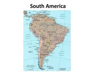
South America Temperature During El Nino the Sth Atlantic sea surface temperature rose as did high rainfall and humidity affecting crops and prevalence of vector-borne disease Rainfall Vulnerability of to flooding events is high in almost 70% of the area represented by Latin American countries Oceans Low lying coasts in Latin American countries are among the most vulnerable to climate variability and extreme hydrometeorological events rain, windstorms sub and tropical cyclones
South America • By mid-century, increases in temperature and associated decreases in soil water are projected to lead to gradual replacement of tropical forest by savanna in eastern Amazonia. Semi-arid vegetation will tend to be replaced by arid-land vegetation. • There is a risk of significant biodiversity loss through species extinction in many areas of tropical Latin America. • Productivity of some important crops is projected to decrease and livestock productivity to decline, with adverse consequences for food security. In temperate zones, soybean yields are projected to increase. Overall, the number of people at risk of hunger is projected to increase (TS; medium confidence). • Changes in precipitation patterns and the disappearance of glaciers are projected to significantly affect water availability for human consumption, agriculture and energy generation
HotOutlook The Amazon Basin contains the largest contiguous extent of tropical forest on Earth, almost 5.8 million km2 . It harbours perhaps 20% of the planet’s plant and animal species. There is abundance of water resources and the Amazon River accounts for 18% of the freshwater input to the global oceans
Amazonia a ‘hotspot’ of the Earth system Over the past 30 years almost 600,000 km2 have been deforested in Brazil alone (INPE-MMA, 2005a) due to the rapid development of Amazonia, making the region one of the ‘hotspots’ of global environmental change on the planet. Field studies carried out over the last 20 years clearly show local changes in water, energy, carbon and nutrient cycling, and in atmospheric composition, caused by deforestation, logging, forest fragmentation and biomass burning. The continuation of current trends shows that over 30%of the forest may be gone by 2050 In the last decade, research by the Large Scale Biosphere-Atmosphere (LBA) Experiment in Amazonia is uncovering novel features of the complex interaction between vegetated land surfaces and the atmosphere on many spatial and temporal scales. The LBA Experiment is producing new knowledge on the physical, chemical and biological functioning of Amazonia, its role for our planet, and the impacts on that functioning due to changes in climate and land use (http://lba.cptec.inpe.br/lba/site/).
Projected temperature (°C) and precipitation (%) changes for broad sub-regions of Central and South America based on Ruosteenoja et al. (2003). Ranges of values encompass estimates from seven GCMs and the four main SRES scenarios.
Adaptation: practices, options and constraints Agriculture and forestry Some adaptation measures aiming to reduce climate change impacts have been proposed in the agricultural sector. For example, in Ecuador, options such as agro-ecological zoning and appropriate sowing and harvesting seasons, the introduction of higher-yielding varieties, installation of irrigation systems, adequate use of fertilizers, and implementation of a system for controlling pests and disease were proposed (NC-Ecuador, 2000). In Guyana several adjustments relating to crop variety (thermal and moisture requirements and shorter-maturing varieties), soil management, land allocation to increase cultivable area, using new sources of water (recycling of wastewater), harvesting efficiency, and purchases to supplement production (fertilizers and machinery) were identified (NCGuyana, 2002).
Adaptation capacity of the South American highlands’ pre-Colombian communities Figure 13.4. Nasca (southern coast of Peru) system of water cropping for underground aqueducts and feeding the phreatic layers Under such limitations, from today’s Mexico to northern Chile and Argentina, the pre-Colombian civilisations developed the necessary capacity to adapt to the local environmental conditions. Such capacity involved their ability to solve some hydraulic problems and foresee climate variations and seasonal rain periods. On the engineering side, their developments included rainwater cropping, filtration and storage; the construction of surface and underground irrigation channels, including devices to measure the quantity of water stored (Figure 13.4) (Treacy, 1994; Wright and Valencia Zegarra, 2000; Caran and Nelly, 2006). They also were able to interconnect river basins from the Pacific and Atlantic watersheds, in the Cumbe valley and in Cajamarca (Burger, 1992).
Future impacts and vulnerability to climate change and variability in Latin America: people and coastal systems. South American climate issues Buenos Aires -13/2/2009
Future Impacts in Health Issues Human migration resulting from drought, environmental degradation and economic reasons may spread disease in unexpected ways, and new breeding sites for vectors may arise due to increasing poverty in urban areas and deforestation and environmental degradation in rural areas (Sims and Reid, 2006). Recent studies warn of the possible re-emergence of Chagas’disease in Venezuela (Feliciangeli et al., 2003; Ramírez et al.,2005) and Argentina (PNC, 2005), and a wider vector distribution in Peru (Cáceres et al., 2002). Some models project a dispersal potential for Chagas’ vector species into new areas (Costa et al., 2002). A national assessment of Brazilian regions demonstrated that the north-east is the most vulnerable to the health effects of changing climate due to its poor social indicators, the high level of endemic infectious diseases, and the periodic droughts that affect this semi-arid region (Confalonieri et al., 2005)
Polarise synergies to Sth America and Australia • Cyclones - Hamish Category 5 • Droughts - New South Wales • Coral reefs dying disease parasites • Crops wheat suffering?? • Fires Victoria • Coastal sea rise - more king tides • Coastal surface temperature increasing • Flooding Qld • Monsoonal rain WA • Earthquakes Melbourne (nz) • Increase vector borne diseases Ross River, Denghue Fever Malaria , Leishmanias sandfly
Polarise synergies to Sth America and Australia El Nino vs La Nina
SUMMARY Australia “The terrible events of the past couple of weeks (in Australia) are, without doubt, partly the result of global warming and the greenhouse effect," said Neville Nicholls, an expert on climate change and wildfires at Australia's Monash University.” At present Australia is going through the El Nino phase of ENSO while South America is experiencing La Nina South America Increasing global temperature will cause sea levels to rise and will change the amount and pattern of precipitation, likely including an expanse of the subtropical desert regions, and potential failure of climate systems such as monsoons. Other likely effects include Arctic shrinkage and resulting Arctic methane release, shrinkage of the Amazon rainforest (already very damaged by deforestation from logging and farming), increases in the intensity of extreme weather events, changes in agricultural yields, modifications of trade routes, glacier retreat, species extinctions and changes in the ranges of disease vectors. Political and public debate continues regarding the appropriate response to global warming Globally The Earth’s temperature has fluctuated naturally over millions of years. However, carbon dioxide levels are at unusually high levels, 30 per cent higher than at any time in the past 420,000 years, and model simulations confirm that global warming during the past 50 years was mainly caused by human activities. The future rate of temperature change may be unprecedented in human history, and would affect a much larger population than in the past. The Earth’s surface has warmed over the past 100 years by about 0.6°C, with the 10 warmest years all occurring since 1990. Other evidence of global warming includes more heatwaves, warming of the oceans and lower atmosphere, less snow, and glacial retreat. All reliable estimates of Northern Hemisphere temperatures over the past 1000 to 2000 years confirm that the 20th century has been unusually warm.
References • Climate Change and Water. IPCC Technical Report Paper VI. Intergovernmental Panel on Climate Change. • Chapter 8 - Human Health, Leading Authors: Ulisses Confalonieri, Bettina Menne • Chapter 11 - Australia & New Zealand, Chapt 13 - Latin America Leading Authors: Kelvin Hennessy, Blair Fitzharris • Chapt 13 – Graciela Magrin, Carlos Gay • Australian Government. Bureau of Meteorology www.bom.gov.au • South America: Tenacious Drought Puzzles Climate Experts by Marcela Valente* - Tierramérica (buenos aires) Friday, February 13, 2009 Inter Press Service • Australian Government. Department of the Environment and Heritage Australian Greenhouse Office Hot Topics in climate science http://www.climatechange.gov.au/science/hottopics/pubs/topic5.pdf • 31 bushfires raging in Victoria as death toll continues to grow. The Sydney Morning Herald. February 9, 2009 - 11:03AM http://www.smh.com.au/news/national/bushfires-ravage-victoria/2009/02/09/1234027894314.html • The Treasurer of the Commonwealth of Australia The Hon Wayne Swan MP personal websitehttp://www.treasurer.gov.au/DisplayDocs.aspx?doc=transcripts/2009/021.htm&pageID=004&min=wms&Year=2009&DocType=2 • The Murray-Darling Basin Authority http://www.mdba.gov.au/ • National Water Initiative http://www.nwc.gov.au/www/html/672-objectives.asp?intSiteID=1 • NSW Government Department of Planninghttp://www.basix.nsw.gov.au/information/about.jsp • Sam the Koala personal website http://www.samthekoala.com.au/ • Australia's Global Climate Observing Systems (2001) http://www.bom.gov.au/climate/how/gcos01.shtml • LBA Programa de Grande Escala da Biostera- Atmosfer na Amazonia http://lba.cptec.inpe.br/lba/site