Download
1 / 57
570 likes | 665 Views
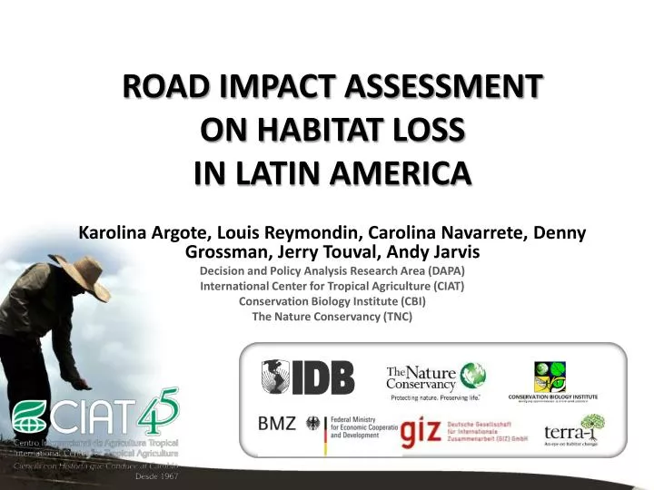
ROAD IMPACT ASSESSMENT ON HABITAT LOSS IN LATIN AMERICA. Karolina Argote, Louis Reymondin, Carolina Navarrete, Denny Grossman, Jerry Touval, Andy Jarvis Decision and Policy Analysis Research Area (DAPA) International Center for Tropical Agriculture (CIAT) Conservation Biology Institute (CBI)

E N D
ROAD IMPACT ASSESSMENT ON HABITAT LOSS IN LATIN AMERICA Karolina Argote, Louis Reymondin, Carolina Navarrete, Denny Grossman, Jerry Touval, Andy Jarvis Decision and Policy Analysis Research Area (DAPA) International Center for Tropical Agriculture (CIAT) Conservation Biology Institute (CBI) The Nature Conservancy (TNC)
Project outcomes This project presents a habitat change monitoring methodology that can be used to identify environmental impacts of road construction, and support improved design of future projects that would minimize negative environmental impacts. The project has also helped understand the nature of environmental impacts of road infrastructure projects in distinct contexts across Latin America, demonstrating the importance of policy and ecosystem specific safeguards.
Objectives of the project • Evaluate the environmental impacts of road infrastructure in the past through monitoring of natural habitat loss pre- and post- construction for 5 road projects across Latin America • Demonstrate how this can be integrated into a decision support tool – DATABASIN • Identify entry points by which ex ante assessment can provide improved safeguards
Content • Methodologies 1.1. Terra-I – Habitat Change Monitoring 2. Road Impact Results 2.1. The BR-364 highway in Brazil. 2.2. The IIRSA projects in Peru. 2.3. The Pan-American Highway in Panama. 2.4. The Santa Cruz – Puerto Suarez corridor in Bolivia. 2.5. The Trans-Chaco Highway in Paraguay. • Methodology of the Future Deforestation Scenarios and Results • Carbon-Conservation Interface • Conclusions and Recommendations Photo by Alvaro Gaviria in Cartagena del Chaira ParquesNacionalesNaturales de Colombia
1.1. Methodologies:Terra-i Methodology • Terra-i is a system that monitoring the habitat change in Latin America • using Neural Network and satellite data • Wetherefore try tolearnhoweach pixel (site) respondstoclimate, and anyanomolycorrespondstohumanimpact. • Neural-network, is a bio-inspired technology which emulates the basic mechanism of a brain. • It allows … • To find a pattern in noisy dataset • To apply these patterns to new dataset INPUTS: Past NDVI (MODIS MOD13Q1) PreviousRainfall(TRMM) OUTPUT: 16 daypredicted NDVI
1.1. Methodologies: Terra-i TheBottom-Line • 250m resolution • Latin American coverage (currently) • Satellite data tomonitorithehabitatevery 16 days • Identification of habitatchangeevents • Habitatloss data online tovisualize and download. www.terra-i.org
1.1. Methodologies: Interpreting the graphs When did the habitat loss happen within each buffer? Area of habitat lost Geographic footprint of the road Buffer distance from the road (km)
BR-364 Highway, Brazil Date Acre Segment: Construction 2002 to 2010 Rondonia Segment: Construction 1985 to 1997
2.1. Road Impact Results: BR-364 Highway, Brazil Study Area • Section 2: a corridor of 515km which connects the town of Rio Branco in the state of Acre and Porto Velho in the state of Rondônia.
2.1. Road Impact Results: BR-364 Highway, Brazil Study Area • The road Cruzeiro do Sul – Porto Velho was analyzed into two different sections. Section 1: a corridor of 623km Cruzeiro do Sul - Rio Branco in the state of Acre, Brazil. • This section passes through a large biological corridor of the state of Acre which has been regulated by 39 protected areas connected to each other.
2.1. Road Impact Results: BR-364 Highway, Brazil Road impact • Comparing the two segments one can see a huge difference in the deforestation rates and in how it is the spatially distributed. Much higher deforestation rates, and much BIGGER footprint >50km due to secondary roads etc. More localised footprint, and and lower overall deforestation levels. Nevertheless, increase in last 2 years.
2.1. Road Impact Results: BR-364 Highway, Brazil Protected Areas BomFuturo and Jaciparanáare the two protected areas most affected by deforestation in Rondônia and are located next to the analyzed road, within a buffer area of 20km. Actually, the deforestation rate in BomFuturo has been of 10,188 hectares per year (adding up to 76,406 hectares converted in 7.5 years) whereas it has been of 6,337 hectares per year in Rio Jaciparaná (adding up to 47525 hectares converted in 7.5 years).
2.1. Road Impact Results: BR-364 Highway, Brazil Conclusions • Section 1: Acre. Habitat loss of 19,542 hectares was recorded per year in average in a buffer area of 50km of the Cruzeiro do Sul -Rio Branco Segment • Section 2: Rondonia. Habitat loss of 79,783 hectares per year within a same buffer size around the Rio Branco -Porto Velho Segment. • Much higher in the segment Rio Branco-Porto Velho (in Rondonia) than in Cruzeiro do Sul-Rio Branco (In Acre) likely due to the conservation policies implemented in Acre state. Note fewer secondary roads, and greater protection from National Parks in segment 1.
IIRSA Project, Peru Date Construction: 1998 to 2007
2.2. Road Impact Results: IIRSA Projects, Peru Study Area • The analyzed roads have a total length of 1584km and go through all Peru from the Pacific coast to the Acre state in Brazil. The road was split into three different sections for the analysis: • Section 1:752km. Paita on the Pacific coast (Piura) to Tarapoto. • Section 2: 381km. Tarapoto - Huanuco (where it passes 2km away from Tingo Maria National Park). • Section 3: 451km. Tingo Maria (Huanuco) - Cruzeiro do Sul (Acre, Brazil). Section 1 Andean Section 2 Piedemonte Section 3 Amazon
2.2. Road Impact Results: IIRSA Projects, Peru Road Impact • Section 1 (Paita-Tarapoto) : accumulated loss of 40,794 hectares (5,439 Ha/yr). Significant increase in deforestation in past 3-4 years Most habitat loss in first 10km (45%)
2.2. Road Impact Results: IIRSA Projects, Peru Road Impact • Section 2 (Tarapoto-Tingo Maria) : accumulated loss of 30,763 Ha (4,102 Ha/yr). Most impacted areas are located in a buffer of 30km from the road. Significant increase in deforestation in past 3-4 years Most habitat loss in first 30km (88%)
2.2. Road Impact Results: IIRSA Projects, Peru Road Impact • Section 3 (Tingo Maria-Cruzeiro): accumulated loss of 58,900 hectares (7,853 Ha/year). Most impacted areas are located in a buffer of 30km from the road. No apparent increase in deforestation during or after road construction Most habitat loss in first 30km (81%)
2.2. Road Impact Results: IIRSA Projects, Peru Conclusions Section 1: Andes. Footprint more localised (<10km), 25% increase in habitat loss post-project versus pre-project. Section 2: Piedemonte. Larger footprint (10-20km), and > doubling of deforestation after road finalization. Section 3: Tingo Mario-Cruzeiro. High baseline levels of deforestation in the region, but no increase since road project (major sections of road still not complete).
Pan-American Highway, Panama Date Construction: 1985 to 1990
2.3. Road Impact Results: Pan-American Highway, Panamá Study Area The Pan-American Highway is located in the Darien province in Panama at the eastern end of the country and its length is approximately 262km, in a 30km of buffer around the road are located more than 10 protected areas with important ecological functions.
2.3. Road Impact Results: Pan-American Highway, Panamá Habitat Change Monitoring • MAIN INPUTS • For generated deforestation maps before 2000: • A dataset of land cover produced by the Forest Information System Project, the National Environmental Authority (ANAM) for 1992 and 2000. • For generated deforestation maps between 2004 and 2010: Terra-I dataset. • Methodology • Reclassify the Land Cover Maps of 1992 and 2000 using ArcGIS software in Vegetation and non vegetation maps. • Generated the deforestation map of 1992-2000. • Applied the Terra-I Methodology to monitoring the habitat change between 2004 to 2010. • Analyze the road impact in buffers areas in 10, 20, 30, 40 and 50km of the road.
2.3. Road Impact Results: Pan-American Highway, Panamá Road impact The habitat loss is greater the closest it’s to the road. Vast majority of habitat change occurred in the 1990’s directly after road construction. Deforestation 2004-2011 < 10% of 1990’s levels.
2.3. Road Impact Results: Pan-American Highway, Panamá Conclusions • Between 1992 and 2000 there was an alarming loss of 7% of the total national forest cover in Panama which is equivalent to 497,306 hectares. This deforestation is localized mostly in the provinces of Panama and Darien and close to the road. • The impact occurs mainly in the direct influence area of the road (0 to 10km). • The Darien province lost 24% of its forests, and Panama 23%. Most of this deforestation occurred in Mixed Cative forest in order to create new cropland areas.
Santa Cruz-Puerto Suarez, Bolivia Date Construction: 2000 to 2011
2.4. Road Impact Results: Santa Cruz-Puerto Suarez Corridor, Bolivia Study Area • The corridor Santa Cruz-Puerto Suarez is located in the South East of Bolivia. Its length is approximately 636km and connects the towns of Santa Cruz de la Sierra and Puerto Suarez located on the border with the state of MatoGrosso do Sul in Brazil. In the area one can see four easily distinguishable types of ecoregions: Pantanal, Dry Chaco, Chiquitano Dry Forest and Cerrado
2.4. Road Impact Results: Santa Cruz-Puerto Suarez Corridor, Bolivia
2.4. Road Impact Results: Santa Cruz-Puerto Suarez Corridor, Bolivia Road Impact • Road still under construction. Some direct impacts especially close to Santa Cruz. • Major indirect impacts of fires originating from “slash and burn” practices, especially in 2010.
2.4. Road Impact Results: Santa Cruz-Puerto Suarez Corridor, Bolivia Conclusions • Too early to say what direct impacts are until road fully connects Bolivia with Brazil • Nevertheless, clear indirect impact through fires originating from slash and burn activity, especially in the region of Santa Cruz
Trans-Chaco Highway, Paraguay Date Construction: 2002 to 2006
2.5. Road Impact Results: The Trans-Chaco Highway, Paraguay Study Area • The trans-Chaco highway length approximately 736km, extending from the boundaries between Bolivia and Paraguay near the military post Mayor InfanteRivarola in the department of Boqueron until it intersects with the 9th Road which runs through the Dry Chaco in Boqueron continuing through the department of Presidente Hayes across the humid Chaco region up to the Asuncion metropolitan area in the Central Department.
2.5. Road Impact Results: The Trans-Chaco Highway, Paraguay Habitat Change Monitoring • MAIN INPUTS • For generated deforestation maps between 2000 and 2004: • Datasetfrom the high spatial resolution satellite Landsat 4 Thematic Mapper in the Dry Chaco ecoregion. • For generated deforestation maps between 2004 and 2010: Terra-I dataset. • Methodology • Classify the Landsat-4 satellite images using the k-Means Algorithm . • Generated the deforestation map of 2000-2004. • Applied the Terra-I Methodology to monitoring the habitat change between 2004 to 2011. • Analyze the road impact in buffers areas in 10, 20, 30, 40 and 50km of the road.
2.5. Road Impact Results: The Trans-Chaco Highway, Paraguay Road Impact • Total of 650,000 Hectares lost in 50km buffer since 2004 • Massive increase since 2007 (project completion) • Large footprint, covering >50km from road
2.5. Road Impact Results: The Trans-Chaco Highway, Paraguay Conclusions • Very high levels of deforestation pre- and post- road construction • But > 300% increase in deforestation rates since road finished, with a footprint that likely goes beyond 50km buffer
Methodologies: Future Deforestation Scenarios • INPUTS • The distance to the nearest road, to the nearest river, to the nearest city (> 1000 people) • The elevation • The base map (what was already deforested before the analysis with terra-I (from human classification of the terra-i clusters)) • The detection from the terra-I model. This methodology is still under development, nevertheless its implementation as proof of concept in Brazil generated good results in areas with clear patterns of deforestation. Steps… • Train neural network to recognize pixels that are likely to be deforested • Create maps of potential deforestation • Select random pixels from the potential maps • Repeat 2 and 3 Currently, the tool only takes into account topographic variables, but the idea is in the future is to include others inputs such as administrative information (protected areas, country…), social information (small farmers, industrial exploitation, community managed forest…) and ecosystems in order to improve the estimation.
3. Future Deforestation Scenarios: Applied in BR-364 Road, Brasil • Applied • The study area was the area around the road Rio Branco-Porto Velho, in Brazil from the 1st of January 2004 to the 10th of June 2011. • Constant rate to 10’000 hectares per 16 days period (the average rate recorded by Terra-i in this area) • Sampled 10’000 pixels to train the neural network. (7000 unchanged and 3000 deforested) • INPUTS • The distance to the nearest road, to the nearest river, to the nearest city (> 1000 people) • The elevation • The base map (what was already deforested before the analysis with terra-I (from human classification of the terra-i clusters)) • The detection from the terra-I model. This first implementation of this methodology gave encouraging results as by comparing this result with the actual detected deforestation one can see that the general patterns resulting from the simulation are convincing and quite similar to the real events. However, various improvements could be instigated.
3. Future Deforestation Scenarios: Applied in BR-364 Road, Brasil PROOF OF CONCEPT Potential deforestation at T=150 Potential deforestation at T=0 Base map Predicted deforestation Actual deforestation (Terra-i)
4. Carbon-Conservation Interface Methodology