Download
1 / 10
100 likes | 393 Views
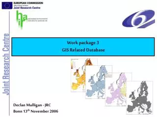
Work package 3 GIS Related Database. Osmate – Spring. Declan Mulligan - JRC Bonn 13 th November 2006. Objectives and Description. Objectives :

E N D
Work package 3 GIS Related Database Osmate – Spring Declan Mulligan - JRC Bonn 13th November 2006
Objectives and Description • Objectives: • Establishment of consistent databases on land use and environmental and climatic conditions, which are necessary for the calculation of Predicted Environmental Concentration throughout member states to allow seamless transfer of data into other packages used in modelling and indicator development • Description of work: • Establishment of the availability and current format of data relevant to the HAIR project • Establish format and requirements of data for use by other work packages • Design database to hold available data in appropriate format for use by other modules • Deliver example database for the regional, national and international scale
Database format • Projection: Lambert-Azimuthal Equal-Area projection (ETRS_1989_LAEA) Equal area grid suitable for generalising data, statistical mapping and analytical work where an equal area of cells is important. • INSPIREframework for spatial data reporting: COM(2004) 516, 23.7.2004 Extent EU25 + EFTA +CC2 • Data availability and format • GIS Shapefiles • Tabular: dbf files • Available on ftp site
Base Grids • Two grids created to contain data required by the other modules • 10 km x 10 km Grid HAIRNET10K (450 rows x 450 columns) • 25 km x 25 km Grid HAIRNET25K (180 rows x 180 columns) • Each cell given a unique identifier DEM and 10 km grid
Crop data • Data: Crop Area (ha) • Source: EUROSTAT Farm structure survey (FSS) for 2000 • FSS 2000 for EU15 • a2crops for NM10 • Xacrops for CC2 • Crop data for 608 regions corrected and linked to GISCO NUTS* 2 and 3 polygons (combined in some regions) *NUTS - nomenclature des unites territoriales statistiques
Soil Data • Data: Topsoil parameters • Source: European Soil Bureau Network (ESBN) – JRC • Topsoil data calculated for each 10 km and 25 km grid cells • Data included: • Organic carbon (%) • Clay, sand & silt (content %) • Depth to rock (cm) • Packing density (g/cm3) • Base saturation • Hydrological data
Elevation and slope • Source: (CCM) Catchment characterisation and modelling • Digital Elevation Model (DEM) • Scale: 250 m x 250 m • Derived from mosaic • Slope derived from DEM • Digital river network
Meteorological data • Data: Long-term average Temperature and Precipitation • Source: (MARS) The Monitoring Agriculture and Regional Information Systems • Original data: MARS 50 km Grid (projection LAEA 9/48 not 10/58) • Monthly and annual values derived • New 50 km x 50 km grid created • Data linked to 10 km and 25 km grids
Conclusion • This work package provided: • An assessment of data availability across member states and suitability for incorporation into the HAIR system • An assessment of system requirements as defined by other work packages • Specification for the database • A harmonised database populated with pan-European data available to all HAIR project partners
Thank You Declan Mulligan - JRC Bonn 13th November 2006