Download
1 / 37
370 likes | 1k Views
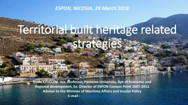
ESPON, NICOSIA, 28 March 2018. Territorial built heritage related strategies. Stella KYVELOU, Ass. Professor, Panteion University, Dpt of Economic and Regional development, Ex. Director of ESPON Contact Point 2007-2013 Adviser to the Minister of Maritime Affairs and Insular Policy

E N D
ESPON, NICOSIA, 28 March 2018 Territorial built heritage related strategies Stella KYVELOU, Ass. Professor, Panteion University, Dpt of Economic and Regional development, Ex. Director of ESPON Contact Point 2007-2013 Adviser to the Minister of Maritime Affairs and Insular Policy E-mail : kyvelou@panteion.gr
Preamble : Culture viewed by the Cohesion policy • Culture is at the core of Europe's rich heritage and history and has an important role in enhancing the attractiveness of places and strengthening the unique identity of a specific location. • Culture and creativity can be important drivers and enablers of innovation as well as an important source for entrepreneurship. • Culture is a key driver for increasing tourism revenue, with cultural tourism being one of the largest and fastest growing tourism segments worldwide. • Culture also has an important role to play in promoting social inclusion.
Key definitions and structure of presentation 1. A renewed consideration of cultural heritage ? 2. Cultural heritage as territorial asset 3. Approaches of cultural heritage management 4. Spatial planning approaches 5. Built heritage in Greece 5.1 Case study 1 5.2 Case study 2 6. Conclusions 7. Key challenges and Policy recommendations
Cultural heritage, an invaluable territorial asset • Cultural heritage constitutes an invaluable asset from a historical, cultural, social and economic points of view. • Therefore, it should be treasured and wisely managed in order to avoid loss of place identity, cultural and social degradation, loss of leisure and tourism opportunities, and so on.. • Cultural heritage is a territorial asset, being part of the territorial capital of a city or region • Directly linked with CH, Cultural Tourism is gaining ground : it accounts for 40% of all European tourism; 4 out of 10 tourists choose their destination based on its cultural offering (EC, 2018).
Spatial planning approaches • Spatial planning approaches are equally important, to achieve appropriate protection and enhancement of cultural heritage • According to Kozlowski and Vas-Bowen*, buffer zone planning (BZP) is considered to be the key approach to fill the gap between conservation and wise management of the cultural heritage. • Besides, lessons learnt from natural heritage areas confirm that buffer zone planning (BZP) is an ideal method for implementing gradual protection in the surrounding area of a protected space, without hampering any types of activities and development outside its bounds. • * Kozlowski J. and Vass-Bowen N. (1997), “Buffering external threats to heritage conservation areas: a planners perspective”, in Landscape and Urban Planning, Vol 37 (3-4), pp. 245 – 267.
The Hellenic context (1) • In Greece, protection zoning for the monumental and cultural heritage has long been addressed, both by the Ministry of Culture and by the Ministry for the Environment. • On the part of the Ministry of Culture, the most recent legislation (L.3028 of 2002) on the country’s cultural heritage launches two types of protection zones: Protection Zone A and Protection Zone B. • Protection Zone A is a zone of absolute protection- It usually includes exclusively and strictly the location of the monument or archaeological site, in which all kinds of interventions and constructions are prohibited. • Protection Zone B works as a Buffer Zone, extending to such a distance as to include areas that interact with the monument and its surrounding landscape (so that special planning regulations are applied).
The Hellenic context (2) • On behalf of the Ministry for the Environment, environmental and spatial planning legislation also provides for special zoning for the protection of the built and monumental heritage of the country, although in an indirect way. • Special Protection Areas (ΠΕΠ), is a special zone that can be used in Local Spatial Plans (Urban Plans, etc), in order to implement very strict building regulations and, thus, achieve protection of the cultural, natural and agricultural landscapes. • In the past : Zone for Building Activity Control (ZOE), outdated and no longer used. • Sites of Outstanding Natural Beauty (ΤΙΦΚ), is another special zone, suitable for the protection of built and monumental heritage in rural areas, that was conceptualized in the 1950’s (L.1469) by the Ministry of Culture, but then transferred in the recent past (in 2011) to the Ministry for the Environment, that now has absolute jurisdiction over such zones.
3 case-studies CASE STUDY 1. The adventure of the settlements of less than 2,000 residents CASE STUDY 2. Evolutionary resilience applied to the Arkochori traditional village CASE STUDY 3. The Aegean Archipelago built cultural heritage
CASE STUDY 1 : Settlements of less that 2000 inhabitants in Greece A vast number of small settlements is spread over the Greek territory, despite the fact that almost 2/3 of the Greek population live in 8 urban areas with over half of which live in Athens. Hellenic Statistical Authority, 2001
Settlements of lessthan 2000 inhabitants Approximately 13,000 settlements of less than 2,000 residents • 12.000presentno special architectural interest • 865are characterized astraditional with a special framework of protection • 110 are abandoned. 12
2 Decrees for Settlements of lessthan 2000 inhabitants • Presidential Decreesregulate development inthesesettlements. • The1stone was established in 1985 (24.4/FEK181D/1985),wasimmediatelyimplemented and thenmodified in 2011.a/ Definestheirboundaries b/ Sets general building regulations • Τhe2ndwas established in 1985 and referstotheirurbanplans (specify building blocks, transport networks etc.) andwas partlyapplied. • * urban planning regulations follow the building regulations • Another important decree (19/10/FEK594D/1978),which specifiestheprotectionoftraditionalsettlements, hasbeenputintoforcesince 1978. • 400 settlementsacrossthecountrywerecharacterisedastraditional in 1978 and this numberwasdoubledby 2012. 13
1st Decree for Settlements of lessthan 2000 inhabitants Refersto: • Theclassificationofsettlementsincategories • ThedefinitionofUrbanandMorphologicalRulesof BuildingandArchitecture (buildingsystem, height, etc) 14
1st Decree for Settlements of lessthan 2000 inhabitants For the classification of settlementsin categories, architecturalstylereportsweredrawnupatPrefecturallevel, referringto the character/style of eachsettlement. Nowadays there are approximately 4,500 Prefectural decisions for thesesmallsettlementswhich define only theirboundaries and set building regulations but do not include the urban planning provisions. 15
1st Decree for Settlements of lessthan 2000 inhabitants The architecturalstylereports, refertothe external characteristics and elements of the buildings, especially the house, such as: • The colors of theirfacades • The openbalconies and theirposition on the facades of the building • Other external elements (i.e.stairs) withregardtotheirconstructionmaterials. 16
The Council of the State (Supreme Administrative Court of Greece)for the Settlementsoflessthan 2000 inhabitants 2important decisions N.1828/2008has ruled thatitisnotfeasibletobuildhousesinsettlementsthataresimply defined, iewithout a plan. N.3661/2005has ruled that the definitionofsettlementswith a populationoflessthan 2000 inhabitantsisgeneralurbanplanningarrangement andmustbedeterminedby a Presidential Decreeandnotby a Prefecturaldecision, nevertheless it hasn't been established yet. The approvalby a PD isrequiredforpublicutilitiesin a defined settlement. Theabsenceofurbanplanningis a keyinhibitortothesustainabilityanddevelopementofthe settlements. 17
Ministry of Environment and Energy : MorphologicalRules in Building and Architecture (MRBA) for the settlements of <2000 inhabitants 2011 theMinistryoftheEnvironmentandEnergy(MEE) decidedtheenforcementofMorphologicalRulesinBuildingandArchitecture (MRBA) forthesettlementsof <2000 inhabitants. • Thewholeprogrammeconcerned the allocation of 48 studiesfor every Regional Unit coveringtheentireterritory(except for the Regionsof Attica and Thessaloniki). • Thisprogrammewasmostly fundedbyEuropean Structural funds(ESPA) and a smallpart came from the Hellenic GreenFund.
MorphologicalRules in Building and Architecture (MRBA) for the settlements of <2000 inhabitants The aim of the Ministry of the Environment and Energy (MEE) was the establishment of a General BuildingFrameworkfor Small Settlements • coveringall the regionalunits of the country • aimingtocontributeeffectivelyto the integration of the spatialplanning and to the upgrading of the environmental, architectural, urban and historicalphysiognomy of the settlements. Key purposeof theMinistry of the Environment and Energy (MEE) was toreplace the 3existing General PresidentialDecrees(PD19.10/FEK594D/1978, PD2.3/FEK138D/1981and PD24.4/FEK181D/1985) by a newGeneral BuildingFrameworkand form the basis for furtherdrafting of newbuildingcodesbyeach Regionalunit. 19
MorphologicalRules in Building and Architecture (MRBA) for the settlements of <2000 inhabitants 2014 TheMinistry of the Environment and Energy (MEE)in collaborationwith the Panhellenic Association of Architects (SADAS-PEA) and the academiaof the Facultiesof Architectureorganizeda conference in which the generalguidelines for the preparation of the studiesfor every Regional Unit wereset. At this conference it was discussed that spatial planning at the local level is still at an early stage and should be completed. 20
A Researchon the Implementation of plans at local level (Vezyriannidou, 2014) Local Spatial Plans of L.4269/14(or General Urban Plans of L.2508/97) regulate the territorial region of the municipality, seeking the comprehensive integrated planning of urban, suburban and rural areas for the next 15-20 years, through a combination of development, environmental and social criteria. FINDINGS 1997– 2014: In a total of 910 municipalities (the Region ofAttica not included), General Development Plans 16% (144) were approved 31% (285) areongoingwhereas 53% (479) of themunicipalitieshave no G.U.Ps/SHOOAP.
MorphologicalRules in Building and Architecture (MRBA) for the settlements of <2000 inhabitants In2016, theMinistryoftheEnvironmentandEnergy (MEE)received 29 assigned studiesforthe 29 RegionalUnits (RU) ofthe 48 totalRUsofthecountry, excludingAtticaandThessaloniki. In 2016, the Municipalities and otherstakeholderswereasked toexpresstheirviewsbeforepromotingtheinstitutionalizationofthe Presidential Decrees for the Regional Units. *the views of the stakeholders were requested after the studies werecompleted and delivered and not during the preparation phase. This has resulted in a series of problems.
MorphologicalRules in Building and Architecture (MRBA) for the settlements of <2000 inhabitants The main problems werein the areas of : • Land uses • Streamswithinsettlements • Forestlandwithinsettlements • Overlapppingof competences of the authorities ie: thecases of the settlementsthathave“doubleprotection”frameworks,bothby the Ministry of Culture and the Ministry of the Environment and Energy (MEE). Despite the initialintention in 2011, the Ministryof the Environment and Energy (MEE) has neither proceededto the establishmentof the new general institutionalframeworkfor the whole of the small-scalesettlementsnor has it set rules for each of the regional unitsuntiltoday. Although the first 28 studieshave beencompletedsince 2016, they have not been established yet, nor have the other20 studies been assigned.
Conclusions from case study 1 In order for the morphologicalrules of building and architectureto become a realTOOL for the sustainable development of the small settlements, it would be necessary to : • Integrate spatial planningatalllevelswiththe ultimategoal of sustainabledevelopment of the settlements. • Α General BuildingFramework should guide the drafting of newbuildingcodesbyeach Regionalunit. • The establishment ofrulesadapted to regional characteristics should be community-based that is involve the Municipalitieswhichhave the primaryresponsibility for the operation of the small settlements and the implementation of the townplanninglegislation.
CASE STUDY 2 : a mountainous old traditional settlement : the ArkochoriSource : ECHOPOLIS 2018 Proceedings • Furthermore each “ikrari” was divided in several sub areas the “basnes” according to the male members of the family. • The management of 16 “ikraria” as a whole entity, was based on a co-operative model. • The main activities developed were livestock farming, cheese making, logging, trade and to a very small extent agricultural activity. • The community worked on a cooperative basis and commonly managed the valuable natural resources like water and timber. • This common management and sharing practices created a peculiar and strong sense of community and bonding to the place and impacted the spatial and functional form of the settlement. • Located at an altitude of 600m and relatively close to the city of Naoussa (8km) • It was founded in 1630 and is one of the oldest settlements in the area of Mount Vermio. • 350 registered residents (2011 census count), but only 20 of them live permanently in the settlement • In 1910 the greater area of Arkochori (1600 hectares) was bought by 16 Greek families from the Ottoman ruler. • The area was divided into 16 subareas, called “ikraria”. • Each “ikrari” belonged to one (extended) family and a designated leader, usually the first/oldest male member of the family, was responsible for the management and exploitation of the land.
The Arkochori traditional villageSource : ECHOPOLIS 2018 Proceedings
The Arkochori traditional villageSource : ECHOPOLIS 2018 Proceedings
A resilient development strategy for the settlement of Arkochori: Vision & Goals VISION: “Reinvent the nature of the settlement with emphasis on preserving and enhancing its traditional character, aiming at economic, social and environmental resilience".
Building resilience in the Arkochori village GOAL 1: Establishment of a community-based enterprise system GOAL 2 : Introduce diversity and redundancy of economic activities Promote diverse activities with a wide variety of objectives that is related to the agricultural sector. These could include organic farming and organic certified products, livestock farming, place-branding products, etc. Agritourismactivities based on a place-sharing concept where the visitors become short term inhabitants of “ikraria” participating in related employment, training and educational activities. • Establishment of a co-operative scheme based on the concept of “ikraria” and local human resources. • Promotion of small-scale enterprises based on the family model and the mentality of “ikraria”. The enterprises retain a certain degree of autonomy when at the same time they preserve interdependent relations with other place-based (or not) enterprises.
Building resilience in the Arkochori Village GOAL 3 Protect and enhance built environment GOAL 4 Community building Promote Community building though place based economic and social activities. This goal builds upon the existing strong relations of “ikraria” and the strong connections created by the common cultural and religious activities. Measures include: Organize the local economy, cultural and social activities though a participatory process in all stages of planning ensuring social legitimacy of all decisions, plans and actions. Ensure that actions and activities are inclusive and refer to the variety of people and their capabilities. The notion is that each person has different kind of assets that are equally valuable and key elements in facing a shock to the system. • The settlement of Arkochori presents distinct aesthetical, architectural and urban features that is worth preserving. Measures include: • protect the morphological characteristics of the buildings. • preserve the morphology of the settlement and its urban tissue, manage future expansions or land development and avoid possible land use conflicts due to new uses in the settlement. • Increase connectivity within the settlement and enhance the links to other growth poles.
Conclusions from case study 2 Evolutionary resilience ( Davoudi, 2012) offers a new and probably more appropriate framework to describe the nature and processes of agglomerations because of their complex, non-linear, and self-organising qualities. The spatial strategy for achieving resilient development in Arkochori is inspired by its unique community-based organizational structure and builds upon older patterns, by adding novel elements that mutate and evolve the initial structural and functional organization of the settlement.
Setting the new context for spatial planning: Evolutionary Resilience Davoudi (2012) introduced the term “evolutionary resilience” as more appropriate to describe the nature and processes within cities. Complexity Evolutionary resilience recognizes three qualities of urban ecosystems Non-linearity Self-organization In this perspective resilience of urban ecosystems is not just their ability to return to its normal or previous state of equilibrium but rather to “change, adapt, and, crucially, TRANSORM in response to stresses and strains” Davoudi, S., et al. (2012). Resilience: a bridging concept or a dead end? Planning theory & practice, Vol. 13, No.2, Taylor & Francis, pp.299-333
CASE STUDY 3 : The Aegean Archipelagowith its many islands • South Aegean Region is represented by the insular landscape of the Aegean, which led to the formation of its distinctive place identity, either as a global touristic destination or the wild insular beauty of the Aegean or/and the maritime borders of Greece to the East. • The main challenges faced in relation to CT lie upon the low level of cultural heritage accessibility (both tangible and intangible), translated into limited exploitation of underwater/maritime cultural heritage, the absence of a decentralized governance model, as well as the overlap of work responsibilities in CT planning and the absence of specialized structures and monitoring mechanisms. • We will use TIA process application to support identifying and mapping the cultural identity of the Aegean which is defined by the quality of its natural and cultural resources, its inexhaustible natural and cultural capital and the strong cultural impact the area has had over the centuries, thus promoting the Aegean archipelago as an “imaginary museum of global scope”.
CASE STUDY 3 : The Aegean Archipelagowith its many islands • More specifically we selected two case studies included in the area of the insular and cross border South Aegean Region, thus setting out to investigate cultural tourism in • a. the micro insular space of the Regional Unit of Cyclades (1st case study) and • b. in a large island of the Regional Unit of Dodecanese (2nd case study). Focus will be put on “maritime cultural heritage” (M.C.H.) and “underwater cultural heritage” (U.C.H.) due to the regional specificities. • Identification of culturally significant areas. • Analysis and assessment of cultural ecosystem services using Public Participation GIS • Based on nexus methodology approach, evaluation of the contribution of cultural heritage significance areas to the tourism added value and development. • Highlighting of the current governance models with particular reference to governance issues (the role of European, national, regional and local authorities, the role of public and private sector, the participation of other type of stakeholders, top down or bottom up approaches, public and private tourism investments, etc).
Conclusions and recommendations • Focusing on the new approaches and planning strategies for urban ecosystems it seems that we need to reinvent planning practices and tools. • Planning should take on a new role that reject the traditional top-down regulatory approach and embrace the idea that cities and territories are NOT in an equilibrium state or evolve in LINEAR fashion but are complex, nonlinear and self-organising systems. • Therefore, spatial planning could set the framework for successful implementation of the proposed strategy while protecting and preserving existing built heritage through appropriate spatial strategies.
Thank you for your attention ! Lab Coordinates Director Stella Kyvelou, Architect-Planner, Manager in European environmental policy. Ass.Professor, Deputy Head of the Dpt of Economic and Regional development E-mail : kyvelou@panteion.gr • Laboratory of Strategic and Maritime Spatial Planning and Sustainable Development Lab, ex.ESPONContact Point 2007-2013 • Panteion University of Social and Political Sciences