Download
1 / 21
210 likes | 463 Views
Global Land Surveys. Mid-Decadal Global Land Survey Data Gap study Towards Decadal Global Land Survey . Garik Gutman Land-Cover/Land Use Change Program, Manager Landsat Program Scientist NASA HQ, Washington, DC. Global Land Surveys (GLS).

E N D
Global Land Surveys • Mid-Decadal Global Land Survey • Data Gap study • Towards Decadal Global Land Survey Garik Gutman Land-Cover/Land Use Change Program, Manager Landsat Program Scientist NASA HQ, Washington, DC
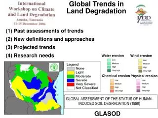
Global Land Surveys (GLS) • Recent Integrated Global Observations of Land (IGOL) theme report calls for the generation of maps documenting global land cover at resolutions between 10m and 30m at least every five years • Despite 35 years of Landsat observations, there has not been a unified global analysis of land cover trends nor has there been a global assessment of land-cover change at Landsat-like resolution => • Periodic Global Land Surveys and assessments of land cover/land-cover change are needed
GEOSS Task AG-06-04 • Task • Initiate an international assessment effort on forests and forest changes utilizing ongoing land cover mapping projects (e.g. GLOBCOVER). • Ensure application of standardized classifications and harmonization of existing datasets • Deliverables • Uptodate user needs assessment for forest/land cover observations for forestry at regional and global scales • Launch and progress for GEOSS implementation project on international forest assessments • Availability and adoption of land characterization standards and updated land cover data.
Available Data • In the beginning of this decade NASA funded development of data sets based on global Landsat observations • These GLS data sets provided global, orthorectified, typically cloud-free Landsat imagery centered on the years 1975, 1990, and 2000. • These data sets provide a consistent set of observations to assess land-cover changes at a decadal scale. • They are freely available via the Internet from the United States Geological Survey (USGS) EROS Center (see http://earthexplorer@usgs.gov)
Mid-Decadal Global Land Survey GLS2005 • Develop a global orthorectified dataset from Landsat or Landsat-like observations based on measurements during 2004-2006 • Use Landsat-7 composites as primary source, Landsat-5 ground stations data to complement, ASTER to fill the remaining gaps, EO-1/ALI over islands • USGS leads Phase I – data compilation (completed) • NASA leads Phase II – data processing at USGS (started) • Phase III – LCLUC products by community • Workshop in February in Annapolis • ROSES-2007 LCLUC solicitation
Phase I: Putting the Pieces Together Kudos to Steve Covington et al. USGS
M.C. Escher, 1960: Circle Limit IV (Heaven and Hell) Priority Matters • Which Landsat has priority for the GLS2005 ? L7 L5 L7 L5 • Final decision: • First priority: L-7 • Second: L-5 • ALI+ASTER fill in
Landsat-7 Coverage Using Composites • Good composites ~ 60% • No suitable pairs ~ 20% • Rest – depending on criteria
Coverage GLS2005 Coverage: More islands and reefs Full coverage of Arctic Inc. Antarctic continent 2005
Progress • Scene selection for North America and Africa are currently ongoing, next - Northern Eurasia (All done automatically - system LASSI) • GLS1975, -1990, and -2000 are being reprocessed using SRTM digital elevation models and improved geodetic control • This will be the state-of-the-art geodetic control set for GLS2005, reprocessing GLS2000 (Geocover) and Landsat-based map products in the next decade
Timeline • Release Schedule for GLS2005 • Feb 15, 2008: North America, Landsat-7 • June 30, 2008: Rest of Globe, Landsat-7 • Dec 31, 2008: Rest of Globe, Landsat-5 • Reprocessed GLS2000 • July 2008
Landsat Data Gap Initiative • Landsat-7 data are only partially useful - there are gaps • Composites of cloud-free image pairs produce about 60% global coverage • Mechanical problems may affect satellite longevity. • Landsat-5 is old and experiences mechanical and electrical problems • The next Landsat (LDCM) ~ 2011-2012 • Objective is to identify, assess, and recommend alternative data sources that can best provide recurring global land observations, sufficiently consistent in terms of acquisition extent, frequency, and quality, as that of the Landsat Program.
Systems Considered • IRS ResourceSat – 1, 2 (India) • CBERS – 2, 2A, 3, 4 (China & Brazil) • RapidEye – 1, 2, 3, 4, 5 (Germany) • DMC – Algeria, Nigeria, UK, China • Terra/ASTER (METI & NASA) • High-resolution U.S. commercial systems • IKONOS, QuickBrid, OrbView-3 • SPOT – 4, 5 (France) • ALOS (JAXA) • EO-1/ALI (NASA & USGS)
Implementation • The Landsat Program is unique • Single source of systematic, global land observations • Alternate sources can reduce the impact of a Landsat data gap • Preliminary analysis • India’s ResourceSat and China/Brazil’s Earth Resources Satellite (CBERS) are the leading candidates for reducing the impact of a Landsat data gap • Data characterization and cross-calibration • Prototype for International cooperation under GEOSS/CEOS: • Implementation plan correlates with the IEOS/Global Land Observing System initiative
Reduction to Two Sensors • India’s ResourceSat-1 (launched 2003) • High Resolution Linear Imaging Self-Scanner (LISS-IV) – 5.8m VNIR SWIR • Medium Resolution Linear Imaging Self-Scanner (LISS-III) - 23m - VNIR SWIR • Advanced Wide Field Sensor (AWiFS) -56m – VNIR SWIR • Follow-on planned • China-Brazil’s CBERS-2 (launched 2003) • HRCCD (High Resolution CCD Camera) – 20m VNIR • IRMSS (Infrared Multispectral Scanner) – 80m SWIR, 160m TIR • WFI (Wide-Field Imager) – 260m VNIR • No identical sensor slated for the CBERS-2B in 2007 • CBERS-3 (2009) a good candidate
Summary of Evaluation • ResourceSat: able to provide data in near-term • AWiFS weaknesses • Courser resolution than Landsat resolution • Lacking bands (Landsat 1, 6 or 7) • AWiFS strengths: • 740 km swath, 5 day repeat, radiometric resolution (10 bits), cost, timeliness, availability, generally high quality, SWIR band • CBERS-2: issues • IRMSS and WFI power supply failed in April, 2005 • Complete failure early in 2007 eliminated CCD • Lack of information on data formats, processing, and operational modes, instrument operability • Look to CBERS 2B
Milestones • USGS/INPE Agreement for CBERS downlink - U.S. coverage • Cross calibration/validation activities • USGS/ISRO Agreement for RESOURCESAT calibration and science data
Technical challenges • Receiving and archiving • Different formats, storage media, metadata • Cataloguing data acquired along different orbits with varying scene sizes and swath widths • Analysis/Applications • Mosaicing and co-registering data from multiple sources with different spatial resolutions, registration accuracy, and scene sizes • Differentiating land-cover change from multiple sources • Developing new methodologies and algorithms incorporating data from multiple sources
Towards a Decadal Global Land Survey for 2010 • LDCM is planned for 2011: data available in 2012 • A Decadal Survey to be centered on 2010 +/- 2 years, i.e. 2012 may be already the last year for the observational period • One/both Landsats may still be “alive”: high-risk • Possible scenarios: • Either L-5 or L-7 is dead • Both are dead
Preparing for Land Surface Imaging Constellation • A 2010 Data set presents an opportunity for a truly international initiative • The Data Gap study will not generate the GLS2010 • Sources other than IRS or CBERS • Additional receiving stations may be needed • GEOSS/CEOS is the proper framework • The Challenge will be the data system
谢谢 Thank you! спасибо