Download
1 / 15
150 likes | 302 Views
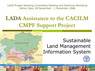
LADA Project Steering Committee Meeting and Technical Workshop Rome, Italy, 28 November - 1 December 2006. LADA Assistance to the CACILM CMPF Support Project. Sustainable Land Management Information System. CACILM – Central Asian Countries Initiative for Land Management. Partnership between

E N D
LADA Project Steering Committee Meeting and Technical Workshop Rome, Italy, 28 November - 1 December 2006 LADA Assistance to the CACILM CMPF Support Project SustainableLand Management Information System
CACILM – Central Asian Countries Initiative for Land Management • Partnership between • Kazakhstan, Kyrgyz Republic, Tajikistan, Turkmenistan, Usbekistan, and the • International donor community • GEF, GM, ADB, IFAD, World Bank, UNEP, UNDP, ICARDA, CIDA (Canada), GTZ (Germany), SDC (Switzerland) • Other partners • FAO, IDB, UNCCD Secretariat
CACILM – Central Asian Countries Initiative for Land Management • Goal The restoration, maintenance, and enhancement of the productive functions of land in Central Asia, leading to improved economic and social well-being of those who depend on these resources while preserving the ecological functions of the land. • Total timeframe of CACILM : 10 years • 1st Phase funded: US$ 20 million (OP-15)over the next 3 years
CACILM – Central Asian Countries Initiative for Land Management • National Programming Framework(NPF) with a common set of nine programme areas: • capacity building for strengthening the enabling environment • capacity building for integrated land use planning and management • sustainable agriculture in rainfed lands • sustainable agriculture in irrigated lands • sustainable forest and woodland management • sustainable pastureland management • integrated resource management • protected area management and biodiversity conservation • remediation in the region of the former Aral Sea
CACILM – Central Asian Countries Initiative for Land Management • Multicountry Programme Framework(CMPF) to capture added value and synergy: • Capacity building for mainstreaming sustainable land management and ensuring that it is integrated into planning and management • Development of a sustainable land management information system • Sustainable land management research • Knowledge management and information dissemination
CACILM – Central Asian Countries Initiative for Land Management • CACILM Task Force identified the need for a CMPF Support Project • to ensure a common basis to reach the objectives of CACILM • to use a comprehensive and integrated approach to SLM across all CAC for implementation of the national programmes under the NPFs • to improve the capacity of institutions in CAC to adopt integrated land use planning and management • to take into consideration current international efforts towards the harmonization of land data and information management
CACILM – Central Asian Countries Initiative for Land Management • Multicountry Activities of the CACILM Support Project US$ 3.025 million over 2.5 years • Sustainable Land Management Information System (SLMIS) FAO • Knowledge Management Plan and Information Dissemination Programme ADB • Sustainable Land Management Research Programme ICARDA
Sustainable Land Management Information System • SLMIS Phases and Components • Inception Phase • Presentation of LADA methodology to a wide range of stakeholders at national and local level. • Nomination of SLMIS National Coodinators • Inception workshop at national level – creation of SLMIS technical task force • Multicountry workshop with SLMIS task forces from all CACs • Development of workplan
Sustainable Land Management Information System • SLMIS Phases and Components • Capacity Building for Land Degradation Assessment • LADA Training Programmes to promote • awareness of land degradation problems • assessment, monitoring and rehabilitation techniques • Training of trainers and curriculum development organized by FAO and its partners • Toolbox for land degradation assessment • Indicators
Sustainable Land Management Information System • SLMIS Phases and Components • Design • Preparation of System Design Document • Monitoring and Data Collection • Information Technology Component • Compilation of National Land Degradation Information • Data Sharing and relation to LADA Project • FAO’s LADA Virtual Centre serves as core system and platform for interaction
Sustainable Land Management Information System • SLMIS Phases and Components • Development and Testing • Data Collection with enhanced focus on indicators • Development and testing of prototype • Preparation of documentation and on-line user manuals • Deployment • Specification of data sharing arrangements • Roles and responsibilities of administrators • Operation, maintenance, quality control • Reporting on key land degradation indicators at national, sub-regional and global level • Implementation of Specific Applications • Hot Spot and Bright Spot Analysis of NDVI Trends
Sustainable Land Management Information System • Linkage of SLMIS with Performance Monitoring System • To ensure systematical tracking of important SLM indicators in the NPF and CACILM logical frameworks
Sustainable Land Management Information System In conclusion, FAO’s assistance to CACILM will • provide an overview of land degradation and its causes (mapping and documents) • establish a baseline for monitoring and evaluation • harmonize mechanisms for data collection and analysis at regional, national and local level • provide a platform for storing and sharing information at different levels • take into consideration current international efforts towards the harmonization of land data and information management • improve the capacity of institutions in CAC to adopt integrated land use planning and management • document best practices, useful for mitigation measures and rehabilitation projects. • identify priority areas for conservation, rehabilitation action, investments, and related technology choices • contribute to the effective use of (donor) funds