Download
1 / 37
390 likes | 749 Views
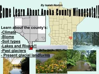
By Isaiah Norton. Come Learn About Anoka County Minnesota!!. Learn about the county’s: -Climate -Biome -Soil types -Lakes and Rivers!! -Past glaciers - Present glacial landforms. Climate of Anoka County.

E N D
By Isaiah Norton Come Learn About Anoka County Minnesota!! Learn about the county’s: -Climate -Biome -Soil types -Lakes and Rivers!! -Past glaciers - Present glacial landforms
Climate of Anoka County The Climate of Anoka county according to the Koppen-Geiger system of climate classification is DFB which is part of the Moist continental climate.
Climates in Anoka County • D= Snow Climate • F= Sufficient precipitation in all months • B= Dry Climates
Precipitation for Anoka county Minnesota. (2009) Lots of rain!!
Biomes!! Different Biome Regions What is a Biome? A biome is major biotic community characterized by the dominant forms of plant life and the prevailing climate Anoka County is in the Deciduous forest area.
Soils of Anoka County Udalfs sub group The Dominant Soil type in this region are Udalfs which is a sub group of Alifsols.
Alifsols Alfisol soils are characterized by an argillic horizon produced by illuviation.
Udalfs The area of extreme southeast Minnesota that is dominated by udalfs on ridges contains fertile udolls in the valley floor. In the north udalfs are now covered by large aspen forests. Some of the largest white and red pine were found on these soils.
2. 1.
4. 3.
5. 6.
Ordovician bedrock -Limestone -Shale -Dolostone -Sandstone
Cambrian Bedrock GlauconiticSanstone Quartzose Sandstone
ANOKA COUNTY LAKES Anoka County Lakes! -There are 77 named lakes in Anoka County. Thirty-eight of these lakes are considered of notable significance General Lake Characteristics -Generally, all lakes within Anoka County are considered shallow lakes. The average maximum depth of recreational and developed lakes is 16 feet, although East Twin, our deepest water body, is 68 feet deep. -The biggest of these lakes is Coon Lake, at 1259 acres. The majority of Anoka lakes are smaller and shallower, with a median size of 55 acres. http://www.anokanaturalresources.com/water/lakes/index.htm
Coon Lake is Anoka county’s biggest lake! East twin is the deepest lake in Anoka county
-Anoka County has several major waterways, a number of smaller streams, and a multitude of ditches. The Mississippi River borders the county on the southwest. -The Rum River is located throughout most of Anoka County, it runs from north to south through the western part of the county.
Sunrise River -Mississippi River -Rum River Anoka County Rivers!!
Water Sheds of Anoka County!! A watershed is an area of land that catches water from precipitation and snowmelt. The water then drains to a common waterway, such as, a stream, lake, aquifer, or wetland. Anoka County is part of the Mississippi/ gulf watershed
The Des monies lobe from the Wisconsin Glacier Minnesota was inhabited by Two Major Glaciers in its history The Superior lobe form the Wisconsin glacier
Quaternary geology of Anoka county Minnesota Anoka county is covered mostly by till with is formed under glaciers The Glaciers Left behind soil in Anoka county called till!
Glacial Lakes in Anoka County!! These lakes were left by glaciers receding through Minnesota.
The Anoka Sand plain covers almost all of Anoka county (The Plain covers the till left behind by the glaciers). This sand was left when glacial lakes and rivers drained at the end of the ice age.
Eskers!! Esker—Sinuous ridge of sand and gravel deposited in an ice-walled channel of a glacial meltwater stream. The fluvial sediment may be covered by 10 feet (3 m) or more of till.
Eskers!! You can see eskers and glacial troughs in the north west corner of Anoka county! !
Glacial Troughs!! Deep, broad, irregular troughs Deep, broad, irregular troughs—Locally contain long lakes or chains of lakes. Interpreted to reflect valleys cut by meltwater flowing beneath Superior lobe ice that were partially buried by subsequent glacial events.
The End. Thanks for coming to Anoka County Minnesota!!
Slide 1) http://www.nps.gov/miss/naturescience/images/prairestcena.jpg http://www.nps.gov/miss/planyourvisit/images/manominPark.jpg http://www.anokacountyparks.com/images/photos/camp_salie.jpg http://www.anokacountyparks.com/images/photos/sec_rumcent.jpg Slide 2) http://upload.wikimedia.org/wikipedia/commons/7/7c/Americas_Koppen_Map.png Slide 3) http://www.freefoto.com/images/16/08/16_08_25---Snow-Scene_web.jpg http://www.ncrs.fs.fed.us/pubs/gtr/other/gtr-nc178/images/fig13.jpg http://babajidesalu.files.wordpress.com/2009/07/rain24-hours.jpg Slide 4) http://www.ci.lino-lakes.mn.us/vertical/Sites/%7BA233BB09-8316-4E17-A27A-C25E01027DA7%7D/uploads/%7B4C6CA35C-7DD8-4C82-ADAC-33DAEF772DCF%7D.JPG Slide 5) http://farm3.static.flickr.com/2083/1816626705_e09b2c0e68.jpg http://z.about.com/d/forestry/1/0/c/A/biome1999a.gif Slide 6) http://dacnet.nic.in/aislus%20ranchi/images/map_alfisols_big.jpg BIBLIOGRAPHY
BIBLIOGRAPHY CONT. • Slide 7) • http://www.geo.msu.edu/soilprofiles/Ultic%20Hapludalf.JPG • http://soils.usda.gov/technical/classification/orders/images/alfisol.jpg • Slide 8) • http://www.co.rice.mn.us/parks/photos/Wilderness-LimestoneBluff1.jpg • http://www.geology.ar.gov/images/powell%20outcrop.JPG • http://energytechstocks.com/wp/wp-content/uploads/2007/11/shale-rock330.jpg • http://media.photobucket.com/image/Sandstone%20rock%20in%20Minnesota/CraigCreekRider/Blue%20Ridge%20Parkway%20Area/Spec%20Mines%20Dody%202Loops/100_7017.jpg • Slide 9) • http://pubs.usgs.gov/ha/ha730/ch_j/jpeg/J103.jpeg • http://clasticdetritus.files.wordpress.com/2008/03/fff45.jpg • Slides 10) 11) 12) 13) • http://www.anokanaturalresources.com/soil/gen_soils_map.htm • Slide 14) • http://www.anokanaturalresources.com/water/precipitation/2009_chart.htm • Slide 16) • http://www.minnesotaslakes.com/LakePages_TC/899993-R1-09-8A.JPG • http://www.anokanaturalresources.com/water/lakes/index.htm
Slide 17) http://www.anokanaturalresources.com/water/lakes/lakes_map.htm Slide 18) http://www.anokanaturalresources.com/water/streams/index.htm http://media.photobucket.com/image/Rivers%20in%20Minnesota/2008EarthHealing/Dalheimer%20Racist%20Indian%20names/RumRiver1.jpg Slide 19) 20) http://www.anokanaturalresources.com/water/streams/index.htm http://www.anokanaturalresources.com/water/streams/chem_mon/typo_crk.htm Slide 21) http://www.watershedactivities.com/projects/fall/media/watershed-diagram-2.jpg Slide 22) http://www.alaska-in-pictures.com/data/media/16/college-fjord-tidal-glaciers_1176.jpg Slide 23) http://www.anokanaturalresources.com/soil/geo_his_sandplain.htm Slide 25) http://www.extension.umn.edu/distribution/naturalresources/images/6574f01.gif Slide 26)http://images.google.com/imgres?imgurl=http://www.anokanaturalresources.com/soil/soil_images/glacier1.jpg&imgrefurl=http://www.anokanaturalresources.com/soil/geo_his_sandplain.htm&usg=__tGTL3YQMqz9r6Mx5ETloG9TRFNU=&h=245&w=221&sz=9&hl=en&start=8&um=1&itbs=1&tbnid=pkWoNahwkXM2cM:&tbnh=110&tbnw=99&prev=/images%3Fq%3DGlacial%2Bhistory%2Bof%2BAnoka%2Bcounty%26um%3D1%26hl%3Den%26client%3Dfirefox-a%26sa%3DN%26rls%3Dorg.mozilla:en-US:official%26channel%3Ds%26tbs%3Disch:1 BIBLIOGRAPHY CONT.
BIBLIOGRAPHY CONT. • Slide 27) • http://www.pricoldclimate.org/files/u42/helenallisonshot.jpg • Slide 28) • http://www.anokanaturalresources.com/soil/geo_his_sandplain.htm • Slide 29) • http://home.kabelfoon.nl/~trogon/Scand2003/SwedenFinland/ZwedenEsker.jpg • Slide 30) • Quaternary Map of Anoka County Minnesota • Slide 31) • Quaternary Map of Anoka County Minnesota