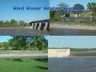
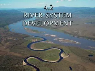
4.2 RIVER SYSTeM DEVELOPMENT
4.2 RIVER SYSTeM DEVELOPMENT. River System Introduction. As runoff moves across the land surface, it erodes rock and soil eventually forming a narrow ditch, called a gully . Eventually, it will form a permanent stream.

4.2 RIVER SYSTeM DEVELOPMENT
E N D
Presentation Transcript
River System Introduction • As runoff moves across the land surface, it erodes rock and soil eventually forming a narrow ditch, called a gully. • Eventually, it will form a permanent stream. • A river systemis a network of streams and rivers draining an area of its runoff. • Made up of tributaries, which are streams flowing into lakes or into larger streams. • Braided streams have channels running in various ways
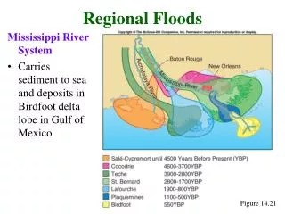
Watersheds • River systems are divided into regions called watersheds, or drainage basins, which are areas of land drained by a water system. • The largest watershed in the United States is the Mississippi River watershed. • Watersheds are separated from each other by areas of higher elevation called a divide.
Stream Channels • As a stream forms, it erodes soil and rock to make a channel, which is the path a stream follows. • The parts of a stream channel include: • Bank • Bed Bank StreamChannel Bed
Stream Channels • When a river winds back and forth, it develops bends known as meanders. Meanders
Stream Channels • The beginning of a stream is known as the head of the stream, or the headwaters. • The place where a stream empties itself into a larger body of water is known as the mouth of the stream. Lake Itasca, MN headwaters of the Mississippi River. Gulf of Mexico the mouth of the Mississippi River.
Channel Erosion • Erosion is the process by which soil and sediment are transported from one location to another. • The Colorado River has eroded the Grand Canyon. • About 10 MYA, it was as flat as a pancake! • In the process of headward erosion, channels lengthen and branch out at the upper ends where runoff enters the streams. • In the process of stream piracy, a stream from one watershed is “captured” by a stream from another watershed with a higher rate of erosion.
Channel Erosion • A stream’s ability to erode its channel is influenced by three factors: • Stream Load • Discharge • Gradient
Stream Load • The materials other than water carried by a stream are called the stream load. • The dissolved loadis mineral matter transported in liquid solution. • The suspended loadconsists of particles of fine sand and silt. • The speed of the water keeps these particles suspended, so they don’t sink to the bottom. • The bed loadis made of larger, coarser materials such as coarse sand, gravel, and pebbles.
Discharge • The volume of water moved by a stream in a given time period is called discharge. • The faster a stream flows, the greater its discharge and the more materials it can carry in its load. • Its erosive energy/speed is also greater in this case. Discharge (m3/s) = cross-sectional area (width x depth) x velocity Q = A V
Gradient • Gradient is the change in elevation of a stream over a certain distance. • High gradient = more erosive energy to erode rock and soil. • Low gradient = less energy for erosion to occur.
Stream Features • As a stream begins to meander, the overall velocity of the stream decreases, causing streams to erode and cut more into their banks. • The point where velocity increases on the outside of a meander and begins to cut into its bank, is known as acutbank. • The point where velocity decreases on the inside of a meander and begins to deposit material, is known as a point bar.
Cutbanks and Point Bars Cutbank Point Bar
Stages of a River • Over time, a stream transports rock and soil downstream making the channel wider and deeper. • When a stream becomes longer and wider, it is classified as a river.
Stages of a River • In the early 1900’s, William Morris Davis developed a model showing the stages of river development. • He believed all rivers evolve from a youthful stage to an old-age stage and do so by eroding in the same way with the same rate of erosion. • Today, scientists use many of his terms to describe a rivers general features. • Stages include: • Youthful • Mature • Old-Age • *Rejuvenated
Youthful • Usually flow quickly down steep gradients. • More erosion generated from the velocity. • Normally erode deeper rather than wider. • Very few tributaries. • Associated with rapids and waterfalls. • V-shaped valley begins formation.
Mature • Flow is not as fast as youthful rivers due to a lower gradient. • Erodes wider rather than deeper. • Fewer falls and rapids. • Fed by many tributaries. • Greater discharge than a youthful river.
Old-Age • Very low gradient creating little erosive energy. • Instead of widening and deepening its banks, the river deposits rock and soil in and along its channel. • Characterized by wide, flat flood plains, or valleys with many meanders. • Fewer tributaries than a mature river because the smaller tributaries have joined together. • Oxbow lakes are common features.
Oxbow Lakes • An oxbow lakeis a crescent, U-shaped lake lying alongside a winding river. • Created over time as erosion and deposits of soil change the river’s course.
Rejuvenated • Found where the land is raised by tectonic activity. • This rising land causes the river’s gradient to become steeper, and the river flows quicker. • Cuts deeper into the valley floor. • Step-like formations, called terraces, often form on both sides of a stream valley as a result of rejuvenation.
Rejuvenated Rivers Terraces
Stream and River Deposits • After rivers erode rock and soil, they drop, or deposit, their load in water or on land. • Deposition in water • Placer Deposits • Deltas • Deposition on land • Alluvial Fans • Floodplains • Deposition is the process in which material is laid down or dropped. • Rock and soil deposited by streams are called sediment. Rivers and streams deposit sediment where the speed of the water current decreases.
Placer Deposits • A heavy concentration of minerals at places in a river where the current slows down are known as placer deposits. Some placer deposits contain gold (Au). During the CA “Gold Rush”, miners panned for gold in the placer deposits of rivers.
Deltas • A fan-shaped deposit of sediment at the mouth of a stream or river is known as a delta. • Form as current slows down. • Usually on a flat surface and is made of mostly mud. • Create a growing coastline. • Consistent of a diverse plant and animal life. Nile River delta in Egypt Mississippi River delta in the Gulf of Mexico
Alluvial Fans • When a fast-moving mountain stream flows onto a flat plain, the stream velocity decreases and sediment is deposited. • A fan-shaped deposit of sediment by a stream when the slope of the land decreases sharply is known as an alluvial fan. • Similar to deltas, but they are on land rather than water.
Floodplains • The volume of water in nearly all streams varies depending on the amount of rainfall and snowmelt in the watershed. • A dramatic increased in volume can cause a stream to overflow its banks and to wash over the valley floor. • An area along a river forming from sediment deposition when the river overflows its banks is called a floodplain. • Each flood adds another layer of sediment.
Floodplains • Rich farming area because the periodic flooding brings new soil to the land. • Provide convenient access to the river for shipping, fishing, and transportation. • However, flooding can also cause damage to the land. • Farms can be destroyed and towns can be evacuated.
Flooding Dangers • The great Mississippi River flooded in 1993. • Caused damage to 9 states estimated $15 billion in damage. • Many people lost their lives as well.
Controlling Floods • One type of barrier that can be built to help control flooding and store water is called a dam, which redirects the flow of water. • The water can be used in irrigation for farming, local drinking water, and electricity generation.
Controlling Floods • Overflow from a river can also be controlled by a levee, which is a natural or artificial barrier on the banks of a river or stream. • Natural Levee: deposits of sand, mud, and other materials resulting from previous overflow. • Artificial Levee: man-made barriers created from types of building materials and engineered to be erosion-resistant.