Download
1 / 19
190 likes | 288 Views
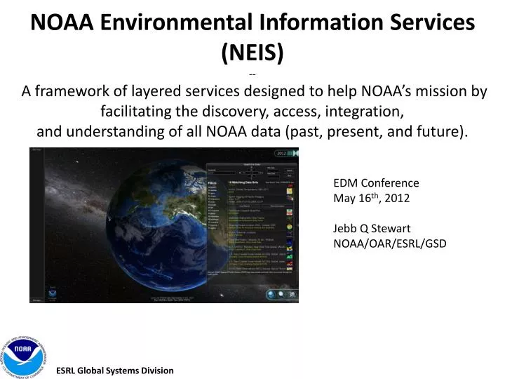
NOAA Environmental Information Services (NEIS) -- A framework of layered services designed to help NOAA’s mission by facilitating the discovery, access, integration, and understanding of all NOAA data (past, present, and future). . EDM Conference May 16 th , 2012 Jebb Q Stewart

E N D
NOAA Environmental Information Services(NEIS)-- A framework of layered services designed to help NOAA’s mission by facilitating the discovery, access, integration,and understanding of all NOAA data (past, present, and future). EDM ConferenceMay 16th, 2012 Jebb Q Stewart NOAA/OAR/ESRL/GSD
NEIS Background • GSD Director Discretionary Funds (DDF) Proposal • NEIS Requirement • Fast access to any data, any time, right now, on any platform. • NEIS Group Objectives • Build upon NEIS work in the past • Assess GSD capabilities pertinent to the concept of NEIS. • Evaluate existing, developmental technology, and solutions relevant to concept. • Evaluate envisioned needs of primary users. • Provide recommendation of how to best use GSD resources to contribute to a National capability. ESRL Global Systems Division
Lots of Great Technology Exists. xkcd.com • THREDDS LAS ERDDAP • Google Earth NASA World Wind GeoPortal • MERMAid REVERB iRODS • Grads Data Server OGC Services • More…
NEIS Concept Take advantage of existing technology where we can to quickly find and access to data 100 of years in the past to 100 years in the future, from the top of the atmosphere to the bottom of the ocean in a single application. Framework provides capability to answer questions that require data from different data sources.
NEIS in NOAA GEOSS GCMD geo. data.gov Other Catalogs NOAA GeoPlatform NEIS TerraViz NOAA Data Catalog NEIS CORE Proposed Services Local Catalog Geoportal Server Local WAF Geoportal Server data access service Data and ServicesShared Hosting Options (NOAA Cloud, Fed GeoPlatform) service data dataset dataset dataset
What is TerraViz? • What is TerraViz? • A system developed from the ground up by GSD based on Unity3D. • There are no licensing restrictions in distributing the TerraViz executable. • Unity3D is a well supported commercial game and data visualization engine with 750,000 active users • Unity/C# is designed for 3D development, making it easy to create multiple views, create 3D meshes representing environmental objects, etc. • Develop once, then will run under Windows, Mac, web browsers, iPhones, iPads, Android devices, and even game systems (Wii, Xbox 360, etc.) • We can modify the user interface and add any feature we need. • TerraViz Handles millions of polygons and performs quickly • TerraViz is one possible visualization tool built to develop, test, and showcase NEIS framework. ESRL Global Systems Division
Why not Google Earth? • Google Earth, works great for certain applications and static products, however: • Handles ~10,000 polygons before slowing to a crawl. • Closed system (Google Earth source code not available) so we can’t add needed features. • Google Earth plug-in works on Windows and Mac 32-bit browsers only (won’t run on iPhones, iPads, or Android devices.) • Developing GE plug-in user interfaces in browser-dependent Javascript is tedious. • Very Limited integrated data discovery or browsing, most uses require a separate application. • Limited animation/data interaction support. • Limited support for non-static data (ie Time Series)
NEIS - Finding and Discovering Data NEIS Need: A way to programmatically discover and find data. • NEIS is using Apache Solr to index ISO metadata records from metadata catalogs (currently geoportal) and related service endpoints. • Solr provides temporal and geospatial filtering. • Using facets on keywords, service name to fine tune searches.
Finding and Discovering Data Challenges • Challenges: • Having information readily available on data and services for searching. • Harvesting versus Aggregated searching • Metadata ISO records are not the only source of information. Some information is needed from service endpoints. • Inability to access data programmatically due to lack of service information in Metadata ISO record. • Recommendations: • Metadata records must contain service endpoints of where to programmatically access data. • Helpful metadata on time information includes dataset start time, periodicity (daily, monthly, yearly), a list of outages, and an end time if dataset is no longer produced.
Metadata Challenges – Tags and Keywords • Challenges: • Metadata keywords inconsistent • Lack of meaningful tags(eastward, longitude). • Keyword repetition – same keywords are used on several data sets. • Semantics, Hierarchy, Taxonomy, Ontology, Relationships – All difficult to infer. • Examples: • “Sea Surface Temperature” “SST” “Sea” “Surface” “Temperature” • “NOAA” vs “National Oceanic Atmospheric Administration”, “Wind” and “Winds” • Ocean -> Ocean Circulation -> Ocean Currents • Recommendations: • GCMD Keywords: http://gcmd.nasa.gov/Resources/valids/archives/keyword_list.html • NASA JPL SWEET Ontology http://sweet.jpl.nasa.gov/ • Allow user defined keywords (Crowdsourcing)
Data Access and Display Challenges • Challenges: • Lack of adherence to specifications and consistency behind standards. • Generation of graphical representations of data. How do I stylize point information? What color palette is the best for this data? • Server uptime and data availability. Indexed ISO records say data is available for time but server may be down during access. • Examples: • ncWMS, the WMS behind THREDDS, uses a default data range when applying a color palette to create an image, often resulting in an empty image. • Recommendations: • Metadata uniformity helps improve user experience – need best practices, examples, and/or automated ways to produce information. • Dashboard system to give feedback to data providers. • Improving WMS experience, color palette is dynamically applied to entire range of data requested or use predefine color table that fits entire data.
Other Considerations • How do we encouraging good data stewardship? • Metadata is vital for applications such as this. • Recommendations: • Showcase of what is possible with good metadata. • Provide Best Practices/Examples of what is good. • Provide tools to help automate process of creating metadata. • Provide feedback to data providers on metadata (rubrics, other information). • Show what metadata was provided by similar data sets. • Helpful information in metadata record: • Links to data services • Short names • Timespan/Periodicity/Spatial Information • Preview/Thumbnail
Dashboard Concept • Suggest metadata enhancements to improve data integration. • Monitor for problems discussed above. • Provide information on standards adherence (ex. OGC). • Monitor data for changes (changes of fields, service endpoints, units, uptime, outages.) ESRL Global Systems Division
Next Steps • Improving search and discovery of data: • Better understanding of semantics and relationships. • Crowdsourcing tagging. • Suggested data sets, like Netflix or Amazon. • Scenario based searching: • Fisherman / Hurricane / Education/ Climate. • Learn what is used in these profiles and score higher for future searches. • Improving data access and integration: • Using additional data access methods (ERDDAP, more OGC.) • Cross service Server Side Processing / Analytics. ESRL Global Systems Division
Looking to the Future • NEIS is looking towards the future for data visualization and interaction through integrating and leveraging new and emerging technologies to meet NEIS goal ‘any data, any location, any platform, now’ • Perform processing within cloud environment and with high speed connectivity to data sources, taking advantage of large processing power within clouds. • Send graphics and server side processed/rendered/streamed data to GUI, improving bandwidth utilization. • Take advantage of fast networking to make remote requests and processing appear like local application. • Similar to how the new Amazon Silk Browser works. ESRL Global Systems Division
Questions? Jebb.Q.Stewart@noaa.gov http://www.esrl.noaa.gov/neis