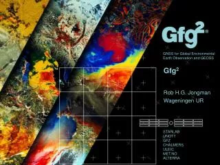
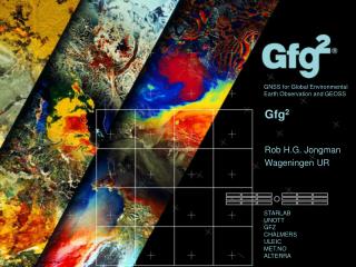
Gfg 2
Gfg 2. Rob H.G. Jongman Wageningen UR. What is Gfg 2 ?. The EU acknowledged the need to better assess the scientific value of GNSS beyond their classical positioning services Gfg 2 - GNSS for Global Environmental Earth Observation (GEEO) and GEOSS

Gfg 2
E N D
Presentation Transcript
Gfg2 Rob H.G. Jongman Wageningen UR
What is Gfg2? • The EU acknowledged the need to better assess the scientific value of GNSS beyond their classical positioning services • Gfg2 - GNSS for Global EnvironmentalEarthObservation (GEEO) and GEOSS • Gfg2 is a three year coordination action funded by the 7th Framework Program of the European Commission under the Environment theme (2010) • Mission: to better asses the value of GNSS for Global Environmental Earth Observation (GEEO) and GEOSS
The team coordinator
Experts Board • Carmen Aguilera, European GNSS SupervisoryAuthority (GSA) • Christopher Buck, EuropeanSpace Agency (ESA) • Jacob Christensen, RUAG Space AB • James Garrison, PurdueUniversity USA • Manuel Hernandez, UniversitatPolitecnica de Catalunya (UPC), Spain • Norbert Jakowski, German Aerospace Center (DLR) Germany • Frank Kelly, King’sCollege London, UK • Paul Poli, European Centre for Medium-RangeWeatherForecast (ECMWF) • Chuang Shi, Wuhan University, China
Use of GNSS signals • Most current applications receive and process GNSS (GPS) signals directly • timing and position • GNSS – Radio Occultation (GNSS-RO), based on delays of the signals when traveling through the atmosphere • e.g. temperature, humidity • GNSS – Reflectometry (GNSS-R), based on the reflection of the signals from different surfaces • e.g. soil moisture, surface roughness, …
GNSS use in positioning • Use in field tools for bird/mammal counting and tracking (GPS) • Digital elevation modelling (wetlands) • Designing and coordinating European biodiversity field monitoring
GNSS Radio Occultation (GNSS-RO) • measurements of phase path delay • key atmospheric/climate parameters • e.g., refractivityN, • geopotential heightZ, • temperatureT, humidityq
Radio Signals( 20 cm) Transmitter GPS GALILEO Receiver Satellites in LEO:eg. GPS/MET, CHAMP, GRACE, MetOp, Oceansat-2 adapted from Andrea Steiner, 13 Oct 2011
OngoingActivities • Determining existing and future GNSS-GEEO activities and needs on positioning, for mass-market or scientific work; • Explore novel applications of GNSS for GEEO and GEOSS with specific attention to the needs of Earth and Ocean observation systems; • Consolidate a GNSS community of experts for GEEO; • Organisation of Summer schools, worshops and industry events (TEDx Barcelona 2013); • Develop a road map for further R&D.
Essential Climate Variables (ECVs) • What can be measured using GNSS?
Become a Community Member! GNSS for Global Environmental Earth Observation (GEEO) and GEOSS http://www.linkedin.com/groups/GNSS-Global-Environmental-Earth-Observation-3787047 www.gfg2.eu gfg2Project
2013 Events • Roadmap second workshop (Leicester, UK), 10-13 April • Second Summer school, Potsdam, July 1-4 • TEDx Barcelona, October (exact date to be determined) • Those interested in this initiative please contact: gfg2@starlab.es
Forfurtherquestions: Anna Puig Gfg2projectcoordinator Gfg2@starlab.es