Download
1 / 19
190 likes | 376 Views
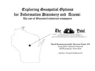
Exploring G eospatial Options for Information Discovery and Access: The case of Wisconsin’s historical newspapers. Mark Rozmarynowski, Stevens Point, WI Geog 596A, Capstone Proposal MGIS program, Penn State Advisor : Deryck Holdsworth. Wisconsin’s newspapers A short history….

E N D
Exploring Geospatial Options for Information Discovery and Access:The case of Wisconsin’s historical newspapers Mark Rozmarynowski, Stevens Point, WI Geog 596A, Capstone Proposal MGIS program, Penn State Advisor: Deryck Holdsworth
Wisconsin’s newspapersA short history… Map sources: Wisconsin Cartographer’s Guild, Wikipedia, Great Lakes Inter-tribal Council, Inc.
Wisconsin’s newspapersA short history… Fur trade era (1650 to 1850) Territorial Era (1787-1848) 19th Century Immigration and Statehood (1848-1899) Map source: Wisconsin Cartographer’s Guild
Guide to Wisconsin Newspapers, 1833-1957Compiled by Donald E. Oehlerts State Historical Society of Wisconsin: Madison, WI (1958). “Wherever people settled – on lakes, at railroad junctions, or on rivers – the editor, his type, and his green eye shade were not far behind.”
Project background: As many as 250,000 papers published in America since Publick Occurrences, Both Foreign and Domestick (Boston,1690). ~3,500 newspaper titles published in Wisconsin since Green Bay Intelligencer published in 1833. No single collection (in-print or online) includes all of this historical content. Researchers navigate a variety of tools to help them discover titles for a given time-period. No single option for access to this information. “Local newspaper,” implies a spatial aspect to these publications, both in content and readership. GIS may help facilitate the research process.
Popular online historical newspaper collections: subscription-based
The Library of Congress: Chronicling America & US Newspaper Directory 1,352 newspapers digitized as of 04/26/2014, Including about 7,597,817 pages. Of 152,524 newspaper titles, < 1% digitized. Above: search result for Stevens Point, WI
Left: OCLC WorldCat.org catalog record and holdings information for Wisconsin Pinery (Note - OCLC# 11718514) Below: UWSP Library Catalog MARC bibliographic record (Note – line 035 includes OCLC#)
Stanford’s Rural West Initiative: “Journalism’s Voyage West”
Wisconsin’s Historical Newspapers Capstone proposal: GIS facilitated discovery and access Primary goals: Comprehensive list of local titles and related information. An accurate timeline of local publications. Visualize geographical distribution, changes over time. Prototype for further research and development. To share this information with colleagues. Primary Objectives: A spatially-enhanced database of newspaper data. A web-service that allows interaction with this data. Dynamic linking to external info on sources/collections.
Methodology Creation of an attribute database. Joining data to shapefiles of point locations using geographic coordinates. Preparation of a series of maps using ArcGIS. Customizing display, symbology, legends, etc. Exporting maps as shapefiles to load into ARGIS Online. Publishing map series using ESRI’s StoryMaps “tabbed viewer” application. Adding summary text including major historical developments. Customizing appearance of the Story Map application. Customizing the functionality using javascript code, such as mouse-over, mouse-clicks, hyperlinks, etc. • Right: pilot study, ESRI’s Story Maps. • Attribute data downloaded from LOC’s US Newspaper Directory. • Locations derived from USGS Geographic Name Information System. • Historical county boundaries data from the Newberry Library. • Map created using ESRI ArcMap 10.1, basemap by ESRI.
Identifying unique titles can be a challenge due to name changes, publisher/editor changes, mergers, and acquisitions…the genealogy of newspapers is complicated. 1863 ? 1870 1878 1872 1885 1895 1921 1981 1999
Discovering titles: sources often provide different information: • Sources may list different titles, spellings, or exclude initial articles • Some include/exclude alternate or variant titles • Estimated dates of publication vary, based on info available • Certain works may not be included as “newspapers”
A newspaper timeline for Stevens Point, WI in the late 19th century: • Many weekly papers founded in the Stevens Point area (only one daily). • Many folded in a short time. • Others changed ownership, editors, names, etc. • At most, 6 newspapers were published simultaneously in a given year • At least 2 titles in print after the 1850’s.
At least 26 possible attributes, data availability varies by source, and terminology often differs. Of these, title, location, dates of publication, and frequency are likely most used by researchers.
Holdings are often scattered in multiple locations, making access problematic.
Wisconsin’s Historical Newspapers Project Timeline: ~10 weeks Research and document data sources. Create database of attribute information on area titles. Geolocating titles at the “populated place” level, join attribute data. Mapping date for selected historical periods. Customize symbology, visualizing attributes. Incorporate relevant historical geographic detail. Publish to a web service (ie. ESRI’s StoryMaps). Select and add summary textual information. Adding interactivity, linking to external sources. Documenting the process used, decisions made, and lessons learned.
References --. (1987). Project & resource update: In support of scholarly research. U.S. Newspaper project rolls on. American Libraries. Retrieved from www.jstor.com. Chang, D., Clark, K., Ge, Y., McGhee, G., Qin, Y., & J. Wang. (2012). Data visualization: Journalism’s voyage west. Retrieved from https://www.stanford.edu/group/ruralwest/cgi-bin/drupal/visualizations/us_newspapers Danky, J.P. & M.E. Hady (Ed’s). (1994). Newspapers in the State Historical Society of Wisconsin: A bibliography with holdings. Volume 1, Wisconsin Newspapers.New York, NY: Norman Ross. Harvey, R. (1979). The Wisconsin Newspaper Association: a history, 1853 to 1979. Madison, WI: Wisconsin Newspaper Association. Knowles, A.K. (2008). Placing history: How maps, spatial data, and GIS are changing historical scholarship. Redlands, CA: ESRI Press. Library of Congress. (2013). Chronicling America: Historic American newspapers. Retrieved from http://chroniclingamerica.loc.gov/ Long, J. (2010). Atlas of historical county boundaries. Retrieved from http://publications.newberry.org/ahcbp/index.html Nesbit, R.C. (1973). Wisconsin: A history. Madison, WI: University of Wisconsin Press. OCLC Developer Network. (2014). WorldCatSeach API. Retrieved from http://www.oclc.org/developer/develop/web-services/worldcat-search-api.en.html Oehlerts, D. (1958). Guide to Wisconsin Newspapers, 1833-1957. Madison, WI: State Historical Society of Wisconsin. Owens, J.B. (2008). Historical Studies, GIS for. In K.K. Kemp (Ed.), Encyclopedia of geographic information science (pp. 220-221). Los Angeles, CA: SAGE. Perret, M.E. (1992). Portage County, of place and time: a historical geography of Portage County, Wisconsin. Stevens Point, WI: Cornerstone Press. Sweeney, M. & L. Hawkins. (2007). The National Digital Newspaper Program: Building on a firm foundation. Serials Review, 33. Retrieved from http://www.sciencedirect.com/science/article/pii/S0098791307000676 U.S. Geological Survey (2013), 19810501, U.S. Geographic Names Information System (GNIS). Reston, VA: U.S. Geological Survey. Retrieved from http://geonames.usgs.gov Wisconsin Cartographers’ Guild. (1998). Wisconsin’s past and present: a historical atlas. Madison, WI: University of Wisconsin Press. Wisconsin Historical Society. (2014). Short history of Wisconsin. Retrieved from https://www.wisconsinhistory.org/topics/shorthistory/ Yarasavage, N., Butterhof, R., & C. Ehrman. (2012). National Digital Newspaper Program: a case study in sharing, linking, and using data. Poster session presented at JCDL '12 12th ACM/IEEE-CS Joint Conference on Digital Libraries. Washington, DC, USA — June 10 - 14, 2012. Retrieved from http://www.loc.gov/ndnp/guidelines/docs/JCDL2012_ndnp.pdf