EDITOR DE MAPAS
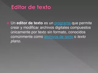
EDITOR DE MAPAS. INTRODUCCIÓN. El editor de mapas permite crear capas para ser visualizadas, descargadas y modificadas de acuerdo a requerimiento de cada usuario. INSTALACIÓN.


EDITOR DE MAPAS
E N D
Presentation Transcript
INTRODUCCIÓN • El editor de mapas permite crear capas para ser visualizadas, descargadas y modificadas de acuerdo a requerimiento de cada usuario.
INSTALACIÓN • Para la instalación se debe tener en cuenta que el archivo aideucuenca debe ir dentro de la carpeta Tomcat, junto a la de apache_tomcat, en la cual se realizan las primeras modificaciones en el archivo de configuración.
Instalación Proj4 • Para que el editor de mapas, pueda funcionar correctamente se requiere la carga de la librería Proj4, el cual contiene las proyecciones cartográficas originales, que se encuentran siendo como tipos estándar. • Esta librería puede ser descargada tanto para Windows como para Windows, desde el siguiente link. http://trac.osgeo.org/proj/
Archivo de Configuración • Para que el editor de mapas, funcione, se tiene que realizar modificaciones en el archivo: configuration_editor.jsp ubicado en /home/Tomcat/apache-tomcat-6.0.32/webapps/ideucuenca/edicion/ En el cual se requiere determinar cuáles son las rutas de edición, de aplicación entre otras.
Configuracion_editor.jsp String RUTAEDICION="/home/Tomcat/aideucuenca/"; String RUTAMAP = "/home/Tomcat/aideucuenca/"; String RUTAAPLICACION="http://localhost:8085/ideucuenca/edicion/"; String RUTAFICHEROSERVERS = "/home/Tomcat/apache-tomcat-6.0.32/webapps/ideucuenca/servers/"; String RUTATXT = "/home/Tomcat/apache-tomcat-6.0.32/webapps/ideucuenca/edicion/txt/"; String RUTADESC = "/home/tomcat/tomcatd/webapps/ideucuenca/edicion/tmp/";
Configuracion_editor.jsp String RUTAIMG = "/home/Tomcat/apache-tomcat-6.0.32/webapps/ideucuenca/edicion/images/"; String RUTASRV = "http://localhost:8080/cgi-bin/mapserv?map="+RUTAEDICION; String RUTACSS = "/home/Tomcat/apache-tomcat-6.0.32/webapps/ideucuenca/edicion/css/"; String coords[]={"-81.304375","-4.8882981455","-75.008507525","1.4075752"}; String SRSEPSG="EPSG:4326"; String CODIGO="ideucuenca"; String TABLA="USUARIOS";
ING. LENIN OMAR LARA CASTRO ADMINISTRADOR IDE RED UTN TELF: 2953461 ext. 7072 geoportal@utn.edu.ec